
National Register of Historic Places listings in Madison County, Virginia facts for kids

This is a list of the National Register of Historic Places listings in Madison County, Virginia.
This is intended to be a complete list of the properties and districts on the National Register of Historic Places in Madison County, Virginia, United States. The locations of National Register properties and districts for which the latitude and longitude coordinates are included below, may be seen in an online map.
There are 21 properties and districts listed on the National Register in the county, including 2 National Historic Landmarks.
Current listings
| Name on the Register | Image | Date listed | Location | City or town | Description | |
|---|---|---|---|---|---|---|
| 1 | Belle Plaine |
(#16000532) |
2488 S. U.S. Route 15 38°19′01″N 78°07′13″W / 38.316944°N 78.120278°W |
Locust Dale | ||
| 2 | Big Meadows Site |
|
(#85003172) |
Address Restricted |
Luray | |
| 3 | Brampton |
(#85003350) |
VA 671 38°17′54″N 78°06′43″W / 38.298472°N 78.111944°W |
Orange | ||
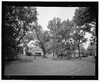
| 4 | Camp Hoover |
 |
(#88001825) |
Shenandoah National Park 38°29′28″N 78°25′13″W / 38.491111°N 78.420278°W |
Graves Mill | |
| 5 | Cliff Kill Site |
(#85003153) |
Address Restricted |
Luray | ||
| 6 | George T. Corbin Cabin |
 |
(#88003067) |
1.5 mi. off Skyline Dr. at jct. of Corbin Cabin Trail and Nicholson Hollow Trail 38°36′07″N 78°20′41″W / 38.601944°N 78.344722°W |
Nethers | |
| 7 | Gentle Site |
(#85003174) |
Address Restricted |
Luray | ||
| 8 | Graves Mill |
(#06000754) |
29 Graves Rd. 38°25′27″N 78°22′09″W / 38.424167°N 78.369167°W |
Wolftown | ||
| 9 | Greenway |
(#88002385) |
US 15 38°17′09″N 78°08′31″W / 38.285972°N 78.141944°W |
Madison Mills | ||
| 10 | Hebron Lutheran Church |
 |
(#71000986) |
1 mi. NE of Madison off U.S. 29 38°24′26″N 78°14′50″W / 38.407361°N 78.247222°W |
Madison | |
| 11 | Hoffman Round Barn |
(#09000242) |
4864 Wolftown-Hood Rd. 38°20′46″N 78°19′56″W / 38.346111°N 78.332222°W |
Wolftown | ||
| 12 | The Homeplace |
(#99000959) |
US 29, jct. with VA 603 38°24′14″N 78°13′17″W / 38.403889°N 78.221389°W |
Madison | ||
| 13 | James City Historic District |
 |
(#01000691) |
US 29 38°26′05″N 78°08′16″W / 38.434722°N 78.137778°W |
Madison | |
| 14 | Locust Hill |
(#02000590) |
Jct. of US 15, Virginia 634, and VA 614 38°20′09″N 78°07′36″W / 38.335833°N 78.126667°W |
Locust Dale | ||
| 15 | Madison County Courthouse |
,_Madison,_Virginia.jpg) |
(#69000258) |
U.S. 29 38°22′49″N 78°15′29″W / 38.380278°N 78.258056°W |
Madison | |
| 16 | Madison County Courthouse Historic District |
_Historic_District_-_Masonic_Hall.JPG) |
(#84003549) |
Main St. 38°22′39″N 78°15′36″W / 38.377500°N 78.260000°W |
Madison | |
| 17 | The Residence |
(#79003052) |
Woodberry Forest School 38°17′33″N 78°07′08″W / 38.292500°N 78.118889°W |
Woodberry Forest | ||
| 18 | Robertson Mountain Site |
 |
(#85003173) |
Address Restricted |
Luray | |
| 19 | Skyline Drive Historic District |
 |
(#97000375) |
Shenandoah National Park, from the N entrance station at Front Royal to the S entrance station at Rockfish Gap 38°32′36″N 78°23′36″W / 38.543333°N 78.393333°W |
Luray | |
| 20 | Woodbourne |
(#99000727) |
VA 657, 1.5 miles W. of Jct. US Alt. 29 and VA 657 38°22′50″N 78°16′41″W / 38.380556°N 78.278056°W |
Madison |

All content from Kiddle encyclopedia articles (including the article images and facts) can be freely used under Attribution-ShareAlike license, unless stated otherwise. Cite this article:
National Register of Historic Places listings in Madison County, Virginia Facts for Kids. Kiddle Encyclopedia.