National Register of Historic Places listings in Marion County, Ohio facts for kids
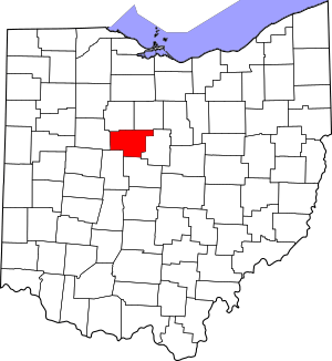
This is a list of the National Register of Historic Places listings in Marion County, Ohio.
This is intended to be a complete list of the properties and districts on the National Register of Historic Places in Marion County, Ohio, United States. The locations of National Register properties and districts for which the latitude and longitude coordinates are included below, may be seen in an online map.
There are 18 properties and districts listed on the National Register in the county, including 1 National Historic Landmark.
Current listings
| Name on the Register | Image | Date listed | Location | City or town | Description | |
|---|---|---|---|---|---|---|
| 1 | Bretz Farm |
(#80003155) |
197 Morral-Kirkpatrick Rd., east of Morral 40°41′16″N 83°09′20″W / 40.687778°N 83.155556°W |
Grand Prairie Township | ||
| 2 | Caledonia Bowstring Bridge |
(#78002131) |
North of Caledonia 40°38′33″N 82°57′55″W / 40.64245°N 82.96539°W |
Claridon Township | ||
| 3 | Harding Tomb |
(#76001485) |
Marion Cemetery 40°34′23″N 83°07′23″W / 40.573056°N 83.123056°W |
Marion | ||
| 4 | Warren G. Harding House |
(#66000618) |
380 Mount Vernon Ave. 40°35′11″N 83°07′19″W / 40.586389°N 83.121944°W |
Marion | ||
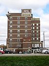
| 5 | Hotel Harding |
(#80003154) |
267 W. Center St. 40°35′17″N 83°08′00″W / 40.588056°N 83.133333°W |
Marion | ||
| 6 | George W. King Mansion-Etowah |
(#95001331) |
429 Mount Vernon Ave. 40°35′06″N 83°07′14″W / 40.585°N 83.120556°W |
Marion | ||
| 7 | Marion Cemetery Receiving Vault |
(#95001415) |
620 Delaware Ave. 40°34′34″N 83°07′20″W / 40.576111°N 83.122222°W |
Marion | ||
| 8 | Marion County Courthouse |
(#74001572) |
100 N. Main St. 40°35′20″N 83°07′42″W / 40.5889°N 83.1283°W |
Marion | ||
| 9 | Marion County Telephone Company Building |
(#07000298) |
197 S. Main St. 40°35′12″N 83°07′45″W / 40.586667°N 83.129167°W |
Marion | ||
| 10 | Marion Township Sub-District No. 8 School |
(#07000027) |
2473 State Route 4 N., north of Marion 40°38′13″N 83°07′35″W / 40.636806°N 83.126389°W |
Marion Township | ||
| 11 | Old US Post Office |
(#90001777) |
169 E. Church St. 40°35′14″N 83°07′32″W / 40.587222°N 83.125556°W |
Marion | ||
| 12 | Palace Theatre |
(#76001486) |
272 W. Center St. 40°35′19″N 83°08′01″W / 40.588611°N 83.133611°W |
Marion | ||
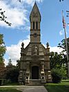
| 13 | Soldiers' and Sailors' Memorial Chapel |
(#95000169) |
Eastern side of State Route 423 within Marion Cemetery 40°34′40″N 83°07′28″W / 40.577639°N 83.124444°W |
Marion | ||
| 14 | Wyatt's Tavern-Fort Morrow Site |
(#78002132) |
Along the Olentangy River, 1 mile (1.6 km) north of Norton 40°26′39″N 83°04′15″W / 40.4442°N 83.0708°W |
Waldo Township |

All content from Kiddle encyclopedia articles (including the article images and facts) can be freely used under Attribution-ShareAlike license, unless stated otherwise. Cite this article:
National Register of Historic Places listings in Marion County, Ohio Facts for Kids. Kiddle Encyclopedia.


