National Register of Historic Places listings in McCook County, South Dakota facts for kids
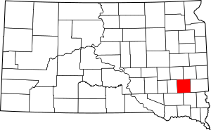
This is a list of the National Register of Historic Places listings in McCook County, South Dakota.
This is intended to be a complete list of the properties and districts on the National Register of Historic Places in McCook County, South Dakota, United States. The locations of National Register properties and districts for which the latitude and longitude coordinates are included below, may be seen in a map.
There are 11 properties and districts listed on the National Register in the county.
Current listings
| Name on the Register | Image | Date listed | Location | City or town | Description | |
|---|---|---|---|---|---|---|
| 1 | Archeological Site No. 39MK12 |
(#93000796) |
Address Restricted |
Bridgewater | ||
| 2 | Downtown Salem Historic District |
(#03001527) |
140, 200, and 201 N. Main 43°43′31″N 97°23′24″W / 43.725278°N 97.39°W |
Salem | ||
| 3 | First Presbyterian Church |
(#13000917) |
351 N. Poplar 43°33′05″N 97°30′04″W / 43.551503°N 97.501174°W |
Bridgewater | ||
| 4 | Henry Kuhle House |
(#08000053) |
321 E. Washington 43°43′51″N 97°23′06″W / 43.730833°N 97.385°W |
Salem | ||
| 5 | McCook County Courthouse |
(#92001862) |
Essex Ave. between Nebraska and Main 43°43′41″N 97°23′15″W / 43.728056°N 97.3875°W |
Salem | ||
| 6 | Ortman Hotel |
(#97000144) |
201 W. Main St. 43°35′52″N 97°17′28″W / 43.597778°N 97.291111°W |
Canistota | ||
| 7 | St. Mary's Catholic Church |
(#85001354) |
Vermont and Idaho Sts. 43°43′36″N 97°23′22″W / 43.726667°N 97.389444°W |
Salem | ||
| 8 | Salem Rest Stop Tipi-Eastbound |
(#14001181) |
Mi. 362.2 on I-90 43°39′57″N 97°25′20″W / 43.665789°N 97.422219°W |
Salem vicinity | ||
| 9 | Salem Rest Stop Tipi-Westbound |
(#14001182) |
Mi. 362.7 on I-90 43°40′02″N 97°24′54″W / 43.667357°N 97.414876°W |
Salem vicinity | ||
| 10 | South Dakota Dept. of Transportation Bridge No. 44-212-090 |
(#93001302) |
Local road over the East Fork of the Vermillion River 43°42′59″N 97°11′14″W / 43.716389°N 97.187222°W |
Montrose | ||
| 11 | Stark Round Barn |
(#01000637) |
Southern side of 247th St, 0.1 miles east of the former Chicago and Northwestern railroad line 43°48′14″N 97°27′04″W / 43.803889°N 97.451111°W |
Unityville |

All content from Kiddle encyclopedia articles (including the article images and facts) can be freely used under Attribution-ShareAlike license, unless stated otherwise. Cite this article:
National Register of Historic Places listings in McCook County, South Dakota Facts for Kids. Kiddle Encyclopedia.


