National Register of Historic Places listings in New Kent County, Virginia facts for kids
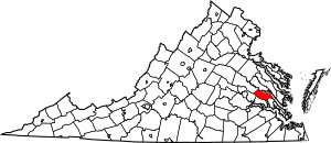
This is a list of the National Register of Historic Places listings in New Kent County, Virginia.
This is intended to be a complete list of the properties and districts on the National Register of Historic Places in New Kent County, Virginia, United States. The locations of National Register properties and districts for which the latitude and longitude coordinates are included below, may be seen in an online map.
There are 16 properties and districts listed on the National Register in the county, including 2 National Historic Landmarks.
Current listings
| Name on the Register | Image | Date listed | Location | City or town | Description | |
|---|---|---|---|---|---|---|
| 1 | Cedar Grove |
(#79003058) |
Northwest of Providence Forge on VA 609 37°29′06″N 77°06′55″W / 37.485000°N 77.115278°W |
Providence Forge | ||
| 2 | Criss Cross |
(#73002043) |
Southwest of New Kent off VA 608 37°30′10″N 77°01′47″W / 37.502778°N 77.029722°W |
New Kent | ||
| 3 | Crump's Mill and Millpond |
(#99001199) |
9065 Crump's Mill Rd. 37°32′24″N 77°05′22″W / 37.540000°N 77.089444°W |
Quinton | ||
| 4 | Emmaus Baptist Church |
(#93000506) |
VA 106 west side, 0.4 miles (0.64 km) south of I-64 37°29′57″N 77°05′32″W / 37.499167°N 77.092222°W |
Providence Forge | ||
| 5 | Foster's Castle |
(#73002044) |
Northeast of Tunstall off VA 608 37°35′38″N 77°04′34″W / 37.593889°N 77.076111°W |
Tunstall | ||
| 6 | Hampstead |
(#70000812) |
1 mile (1.6 km) northwest of the junction of Rtes. 606 and 607 37°36′25″N 77°07′43″W / 37.606944°N 77.128611°W |
Tunstall | ||
| 7 | Marl Hill |
(#90001832) |
VA 642 east of the junction with VA 609 37°32′23″N 77°03′03″W / 37.539722°N 77.050833°W |
Talleysville | ||
| 8 | Moysonec |
(#75002026) |
Address Restricted |
Toano | ||
| 9 | New Kent School; George W. Watkins School |
(#01001046) |
New Kent: 11825 New Kent Hwy; Watkins: 6501 New Kent Hwy. 37°31′45″N 76°58′40″W / 37.529167°N 76.977778°W |
New Kent and Quinton | Pair of schools that represent widespread token desegregation of southern schools in the decade after the 1954 Brown v. Board of Education U.S. Supreme Court decision. Focus of 1968 Green v. County School Board, which was effective in bringing about real desegregation. | |
| 10 | Olivet Presbyterian Church |
(#78003034) |
2.7 miles (4.3 km) northwest of Providence Forge on VA 618 37°28′49″N 77°03′48″W / 37.480278°N 77.063472°W |
Providence Forge | ||
| 11 | Spring Hill |
(#02001448) |
11221 Carriage Rd. 37°26′05″N 76°59′44″W / 37.434722°N 76.995556°W |
Providence Forge | ||
| 12 | St. Peter's Church |
(#69000263) |
County Road 642 37°32′26″N 77°03′23″W / 37.540417°N 77.056389°W |
New Kent | designated a National Historic Landmark March 2, 2012 (as St. Peter's Parish Church) |

All content from Kiddle encyclopedia articles (including the article images and facts) can be freely used under Attribution-ShareAlike license, unless stated otherwise. Cite this article:
National Register of Historic Places listings in New Kent County, Virginia Facts for Kids. Kiddle Encyclopedia.


