National Register of Historic Places listings in Newton County, Georgia facts for kids
This is a list of properties and districts in Newton County, Georgia that are listed on the National Register of Historic Places (NRHP).
Current listings
| Name on the Register | Image | Date listed | Location | City or town | Description | |
|---|---|---|---|---|---|---|
| 1 | Brick Store |
(#09000186) |
U.S. Route 278 at Old Social Circle Road 33°36′07″N 83°44′42″W / 33.601806°N 83.745°W |
Covington | ||
| 2 | Burge Farm |
(#00000467) |
Roughly bounded by GA 142, Cook Rd., Morehouse Rd. and Sewell Rd. 33°32′34″N 83°43′13″W / 33.542778°N 83.720278°W |
Newborn | ||
| 3 | Covington Historic District |
(#98000969) |
Roughly Covington City S of US 278 33°35′41″N 83°51′12″W / 33.594722°N 83.853333°W |
Covington | ||
| 4 | Covington Mills and Mill Village Historic District |
(#00000370) |
Roughly bounded by Wheat, Collins and Lott Sts. and, to the north, the Covington Mills pond and Creek 33°36′19″N 83°50′50″W / 33.605278°N 83.847222°W |
Covington | ||
| 5 | Floyd Street Historic District |
(#74000699) |
Floyd St. from Elm to W of Sockwell St. 33°35′48″N 83°51′20″W / 33.596667°N 83.855556°W |
Covington | ||
| 6 | Newborn Historic District |
(#98000970) |
Roughly the entire city limits of Newborn City 33°31′09″N 83°41′45″W / 33.519167°N 83.695833°W |
Newborn | ||
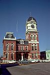
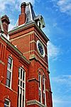
| 7 | Newton County Courthouse |
(#80001216) |
Courthouse Sq. 33°35′49″N 83°51′37″W / 33.596944°N 83.860278°W |
Covington | ||
| 8 | North Covington Historic District |
(#00000526) |
N. Emory and Odum Sts. and Georgia (CSX) Railroad 33°36′26″N 83°51′48″W / 33.607222°N 83.863333°W |
Covington | ||
| 9 | Orna Villa |
(#73000636) |
1008 N. Emory St. 33°37′24″N 83°52′02″W / 33.623333°N 83.867222°W |
Oxford | ||
| 10 | Oxford Historic District |
(#75000603) |
College and residential district centered around Wesley St. 33°37′32″N 83°52′13″W / 33.625556°N 83.870278°W |
Oxford | ||
| 11 | Porterdale Historic District |
(#01000974) |
Roughly the city limits of Porterdale north of Elm St. 33°34′23″N 83°53′45″W / 33.573056°N 83.895833°W |
Porterdale | ||
| 12 | Salem Camp Ground |
(#98000175) |
3940 Salem Rd. 33°35′10″N 83°57′54″W / 33.586111°N 83.965°W |
Covington | ||
| 13 | Starrsville Historic District |
(#98000715) |
Jct. GA 213, Old Starsville and Dixie Rds. 33°31′44″N 83°48′35″W / 33.528889°N 83.809722°W |
Starrsville |

All content from Kiddle encyclopedia articles (including the article images and facts) can be freely used under Attribution-ShareAlike license, unless stated otherwise. Cite this article:
National Register of Historic Places listings in Newton County, Georgia Facts for Kids. Kiddle Encyclopedia.


