National Register of Historic Places listings in Osage County, Kansas facts for kids
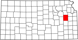
This is a list of the National Register of Historic Places listings in Osage County, Kansas.
This is intended to be a complete list of the properties and districts on the National Register of Historic Places in Osage County, Kansas, United States. The locations of National Register properties and districts for which the latitude and longitude coordinates are included below, may be seen in a map.
There are 14 properties and districts listed on the National Register in the county.
Current listings
| Name on the Register | Image | Date listed | Location | City or town | Description | |
|---|---|---|---|---|---|---|
| 1 | Arvonia School |
(#12000387) |
S. 9th St. 38°28′44″N 95°52′08″W / 38.478874°N 95.868965°W |
Lebo vicinity | part of the Public Schools of Kansas Multiple Property Submission | |
| 2 | Arvonia Township Hall |
(#100000516) |
0000 W. 9th St. Coordinates missing |
Lebo | ||
| 3 | Atchison, Topeka, and Santa Fe Pratt Truss Bridge |
(#03000364) |
SE Pine St., 0.1 miles (0.16 km) south of intersection with E. Emporia St. 38°30′19″N 95°38′07″W / 38.505278°N 95.635278°W |
Melvern | ||
| 4 | Banner Hereford Farm |
(#98000659) |
19355 S. Berryton Rd. 38°42′56″N 95°38′31″W / 38.715556°N 95.641944°W |
Scranton | ||
| 5 | Calvinistic Methodist Church |
(#12000388) |
8090 W. 9th St. 38°28′45″N 95°52′12″W / 38.479243°N 95.870059°W |
Lebo vicinity | ||
| 6 | Cow-Killer Archeological Site |
(#75000719) |
Address restricted |
Melvern | ||
| 7 | Samuel Hunt Grave |
(#95000586) |
K-31, east of crossing of Interstate 335 (the Kansas Turnpike) 38°45′15″N 95°55′32″W / 38.754167°N 95.925556°W |
Burlingame Township | ||
| 8 | Karnes Stone Barn |
(#03001468) |
4204 E. 129th St. 38°50′02″N 95°35′30″W / 38.833889°N 95.591667°W |
Carbondale | ||
| 9 | Lyndon Carnegie Library |
(#87000965) |
127 E. 6th 38°36′27″N 95°40′58″W / 38.6075°N 95.682778°W |
Lyndon | ||
| 10 | Osage City Santa Fe Depot |
(#89000386) |
508 Market 38°38′11″N 95°49′38″W / 38.636389°N 95.827222°W |
Osage City | ||
| 11 | Osage County Courthouse |
(#07000320) |
717 Topeka Ave. 38°36′37″N 95°41′00″W / 38.610278°N 95.683333°W |
Lyndon | ||
| 12 | Rapp School District No. 50 |
(#95000944) |
U.S. Route 56, northwest of Osage City 38°39′07″N 95°54′46″W / 38.651944°N 95.912778°W |
Osage City | ||
| 13 | Schuyler Grade School |
(#11000193) |
117 S. Dacotah St. 38°45′12″N 95°50′13″W / 38.753333°N 95.836944°W |
Burlingame | Public Schools of Kansas MPS |

All content from Kiddle encyclopedia articles (including the article images and facts) can be freely used under Attribution-ShareAlike license, unless stated otherwise. Cite this article:
National Register of Historic Places listings in Osage County, Kansas Facts for Kids. Kiddle Encyclopedia.


