National Register of Historic Places listings in Perry County, Ohio facts for kids
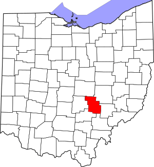
This is a list of the National Register of Historic Places listings in Perry County, Ohio.
This is intended to be a complete list of the properties and districts on the National Register of Historic Places in Perry County, Ohio, United States. The locations of National Register properties and districts for which the latitude and longitude coordinates are included below, may be seen in an online map.
There are 14 properties and districts listed on the National Register in the county.
Current listings
| Name on the Register | Image | Date listed | Location | City or town | Description | |
|---|---|---|---|---|---|---|
| 1 | Bowman Mill Covered Bridge |
(#78002169) |
Perry County Fairgrounds 39°43′15″N 82°13′27″W / 39.720833°N 82.224250°W |
Pike Township | Originally located south of New Reading on Winegardner Rd.; moved to the fairgrounds in 1987 | |
| 2 | Glenford Bank |
(#90000389) |
Main and Broad Sts. 39°53′18″N 82°19′05″W / 39.888333°N 82.318056°W |
Glenford | ||
| 3 | Glenford Fort |
(#71000649) |
Along Jonathan's Creek south of Glenford 39°52′30″N 82°19′00″W / 39.875000°N 82.316667°W |
Hopewell Township | ||
| 4 | Randolph Mitchell House |
(#78002170) |
Rush Creek Rd. in New Reading 39°48′36″N 82°21′12″W / 39.810000°N 82.353333°W |
Reading Township | ||
| 5 | New Straitsville School |
(#01000590) |
402 Clark St. 39°34′57″N 82°14′03″W / 39.582500°N 82.234167°W |
New Straitsville | ||
| 6 | Parks Covered Bridge |
(#74001590) |
North of Somerset on County Road 33, south of Chalfunts 39°51′09″N 82°16′45″W / 39.852389°N 82.279167°W |
Hopewell Township | ||
| 7 | Perry County Courthouse and Jail |
(#81000449) |
Main and Brown Sts. 39°42′50″N 82°12′30″W / 39.713889°N 82.208333°W |
New Lexington | ||
| 8 | Saint Joseph's Catholic Church |
(#86002267) |
5757 State Route 383, southeast of Somerset 39°46′38″N 82°16′37″W / 39.777361°N 82.276944°W |
Reading Township | ||
| 9 | Shawnee Historic District |
(#76001507) |
Both sides of Main St., 2nd St. to Walnut St. 39°36′14″N 82°12′40″W / 39.603889°N 82.211111°W |
Shawnee | ||
| 10 | Sheridan House |
(#80003208) |
S. Columbus St. 39°47′57″N 82°17′32″W / 39.799167°N 82.292361°W |
Somerset | ||
| 11 | Somerset Historic District |
(#75001516) |
Main St. from High St. to properties facing Market Sq; Columbus St. from junction with Sheridan and Gay Sts. 39°48′25″N 82°18′02″W / 39.806903°N 82.300611°W |
Somerset | Includes the Old Perry County Courthouse | |
| 12 | West School |
(#80003207) |
Off State Route 93 39°46′15″N 82°06′11″W / 39.770972°N 82.103056°W |
Crooksville | ||
| 13 | Soloman Whitmer House |
(#79001924) |
North of Thornville at 13917 Zion Road, NW. 39°54′08″N 82°25′04″W / 39.902361°N 82.417778°W |
Thorn Township |

All content from Kiddle encyclopedia articles (including the article images and facts) can be freely used under Attribution-ShareAlike license, unless stated otherwise. Cite this article:
National Register of Historic Places listings in Perry County, Ohio Facts for Kids. Kiddle Encyclopedia.


