National Register of Historic Places listings in Pittsylvania County, Virginia facts for kids
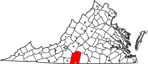
This is a list of the National Register of Historic Places listings in Pittsylvania County, Virginia.
This is intended to be a complete list of the properties and districts on the National Register of Historic Places in Pittsylvania County, Virginia, United States. The locations of National Register properties and districts for which the latitude and longitude coordinates are included below, may be seen in an online map.
There are 21 properties and districts listed on the National Register in the county, including 1 National Historic Landmark. Another 2 properties were once listed but have been removed.
Current listings
| Name on the Register | Image | Date listed | Location | City or town | Description | |
|---|---|---|---|---|---|---|
| 1 | Berry Hill |
(#80004210) |
SW of Berry Hill 36°32′43″N 79°37′12″W / 36.545222°N 79.620000°W |
Berry Hill | ||
| 2 | Bill's Diner |
(#96001450) |
1 Depot St. 36°49′30″N 79°23′54″W / 36.825000°N 79.398333°W |
Chatham | ||
| 3 | Burnett's Diner |
(#96001451) |
19 S. Main St. 36°49′32″N 79°23′55″W / 36.825556°N 79.398611°W |
Chatham | ||
| 4 | Chatham Historic District |
(#01000698) |
Main, Payne, Pruden, Reid, Whittle Sts.; Lanier Ave., Court Place; Gilmer Dr. 36°49′33″N 79°23′54″W / 36.825833°N 79.398333°W |
Chatham | ||
| 5 | Chatham Southern Railway Depot |
(#15000550) |
340 Whitehead St. 36°49′15″N 79°24′09″W / 36.820833°N 79.402500°W |
Chatham | ||
| 6 | Clerk's Office |
(#82004580) |
Main St. 36°49′34″N 79°24′01″W / 36.826111°N 79.400139°W |
Chatham | ||
| 7 | Phillip Craft House |
(#01000144) |
1381 Old Red Eye Rd. 36°54′13″N 79°27′35″W / 36.903611°N 79.459722°W |
Chatham | ||
| 8 | Thomas Claiborne Creasy House |
(#15000018) |
415 S. Main St. 36°56′54″N 79°21′40″W / 36.948333°N 79.361111°W |
Gretna | ||
| 9 | Dan's Hill |
(#79003067) |
4 mi. (6.4 km) W of Danville 36°35′29″N 79°28′41″W / 36.591250°N 79.478056°W |
Danville | ||
| 10 | Gretna Commercial Historic District |
(#13000342) |
N. and S. Main St., and Henry St. 36°57′07″N 79°21′40″W / 36.951944°N 79.361111°W |
Gretna | 26 contributing buildings. | |
| 11 | Hill Grove School |
(#04000104) |
2580 Wards Rd. 37°04′05″N 79°14′58″W / 37.067917°N 79.249306°W |
Hurt | ||
| 12 | Leesville Dam Archeological Site (44PY30) |
(#89001916) |
Address Restricted |
Altavista | ||
| 13 | Little Cherrystone |
(#69000269) |
N of jct. of Rtes. 703 and 832 36°49′11″N 79°20′58″W / 36.819722°N 79.349444°W |
Chatham | ||
| 14 | Locust Hill |
(#02001449) |
7408 Ward's Rd. 37°06′47″N 79°14′41″W / 37.113056°N 79.244722°W |
Hurt | ||
| 15 | Mountain View |
(#79003066) |
2 mi. S of Chatham on VA 703 36°46′56″N 79°24′13″W / 36.782222°N 79.403611°W |
Chatham | ||
| 16 | Pittsylvania County Courthouse |
(#81000643) |
US 29 36°49′35″N 79°23′54″W / 36.826389°N 79.398333°W |
Chatham | ||
| 17 | Windsor |
(#80004211) |
Mountain Run Rd. 36°32′49″N 79°38′25″W / 36.546944°N 79.640278°W |
Cascade | ||
| 18 | Yates Tavern |
(#74002143) |
S of Gretna on U.S. 29 36°56′08″N 79°22′01″W / 36.935555°N 79.366944°W |
Gretna | ||
| 19 | John and Nancy Yeatts House |
(#09000173) |
VA 756 36°53′40″N 79°25′40″W / 36.894306°N 79.427778°W |
Chatham |
Former listings
| Name on the Register | Image | Date listed | Date removed | Location | City or town | Summary | |
|---|---|---|---|---|---|---|---|
| 1 | Oak Hill |
(#79003068) |
|
VA 863 |
Oak Ridge | Destroyed by fire in 1988 | |
| 2 | Woodlawn |
(#05000478) |
|
5321 Henrys Mill Rd. 36°46′31″N 79°09′48″W / 36.775278°N 79.163333°W |
Vernon Hill |

All content from Kiddle encyclopedia articles (including the article images and facts) can be freely used under Attribution-ShareAlike license, unless stated otherwise. Cite this article:
National Register of Historic Places listings in Pittsylvania County, Virginia Facts for Kids. Kiddle Encyclopedia.


