National Register of Historic Places listings in Powhatan County, Virginia facts for kids
This is a list of the National Register of Historic Places listings in Powhatan County, Virginia.
This is intended to be a complete list of the properties and districts on the National Register of Historic Places in Powhatan County, Virginia, United States. The locations of National Register properties and districts for which the latitude and longitude coordinates are included below, may be seen in an online map.
There are 20 properties and districts listed on the National Register in the county.
Current listings
| Name on the Register | Image | Date listed | Location | City or town | Description | |
|---|---|---|---|---|---|---|
| 1 | Beaumont |
(#87000571) |
VA 313 37°40′05″N 77°54′46″W / 37.668056°N 77.912639°W |
Michaux | ||
| 2 | Belmead |
(#69000270) |
NW of jct. of Rtes. 663 and 600 37°37′15″N 77°59′32″W / 37.620833°N 77.992222°W |
Powhatan | ||
| 3 | Belnemus |
(#79003069) |
W of Powhatan off U.S. 60 37°34′04″N 77°59′44″W / 37.567778°N 77.995556°W |
Powhatan | ||
| 4 | Blenheim |
(#86003475) |
6177 Blenheim Rd. 37°30′50″N 78°05′03″W / 37.513889°N 78.084167°W |
Ballsville | ||
| 5 | Elmington |
(#04001538) |
3277 Maidens Rd. 37°36′25″N 77°55′48″W / 37.606944°N 77.930000°W |
Powhatan | ||
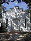
| 6 | Emmanuel Episcopal Church |
(#90001924) |
Emmanuel Church Rd. S of US 60 37°33′05″N 77°56′34″W / 37.551389°N 77.942778°W |
Powhatan | ||
| 7 | Fighting Creek Plantation |
(#13000890) |
1811 Mill Quarter Rd. 37°31′00″N 77°55′55″W / 37.516667°N 77.931944°W |
Powhatan | ||
| 8 | Fine Creek Mills Historic District |
(#03001440) |
2425-2434 Robert E. Lee Rd. (VA 641) 37°35′59″N 77°49′04″W / 37.599722°N 77.817778°W |
Fine Creek Mills | ||
| 9 | French's Tavern |
(#89000293) |
6100 Old Buckingham Rd. 37°29′24″N 78°04′48″W / 37.490000°N 78.080000°W |
Ballsville | ||
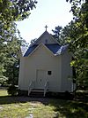
| 10 | Huguenot Memorial Chapel and Monument |
(#88000214) |
VA 711 37°33′53″N 77°42′33″W / 37.564861°N 77.709028°W |
Manakin | ||
| 11 | Keswick |
(#74002144) |
Northeast of Powhatan off VA 711 37°33′25″N 77°39′59″W / 37.557083°N 77.666250°W |
Powhatan | ||
| 12 | Mosby Tavern |
(#03000214) |
2625 Old Tavern Rd. 37°33′55″N 78°02′13″W / 37.565139°N 78.036944°W |
Powhatan | ||
| 13 | Norwood |
(#80004212) |
NE of Powhatan 37°35′04″N 77°44′35″W / 37.584444°N 77.743056°W |
Powhatan | ||
| 14 | Paxton |
(#90001987) |
3032 Genito Rd. 37°27′47″N 77°51′33″W / 37.463056°N 77.859167°W |
Powhatan | ||
| 15 | Powhatan Courthouse Historic District |
(#70000821) |
Jct. of Rtes. 13 and 300 37°32′30″N 77°55′06″W / 37.541667°N 77.918333°W |
Powhatan | ||
| 16 | Provost |
(#99001603) |
4801 Cartersville Rd. 37°36′19″N 77°59′01″W / 37.605278°N 77.983611°W |
Powhatan | ||
| 17 | Red Lane Tavern |
(#01001516) |
3009 Lower Hill Rd. 37°31′47″N 77°51′28″W / 37.529722°N 77.857778°W |
Powhatan | ||
| 18 | Rosemont |
(#08000482) |
4747 Cosby Rd. 37°36′20″N 77°58′55″W / 37.605417°N 77.981806°W |
Powhatan | ||
| 19 | St. Luke's Episcopal Church |
(#89000193) |
2245 Huguenot Trail 37°35′39″N 77°48′01″W / 37.594283°N 77.800278°W |
Fine Creek Mills | ||
| 20 | Somerset |
(#06000804) |
2310 Ballsville Rd. 37°32′50″N 78°05′20″W / 37.547222°N 78.088889°W |
Powhatan |

All content from Kiddle encyclopedia articles (including the article images and facts) can be freely used under Attribution-ShareAlike license, unless stated otherwise. Cite this article:
National Register of Historic Places listings in Powhatan County, Virginia Facts for Kids. Kiddle Encyclopedia.


