National Register of Historic Places listings in Raleigh County, West Virginia facts for kids
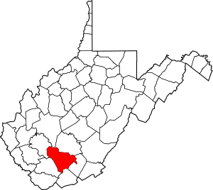
This is a list of the National Register of Historic Places listings in Raleigh County, West Virginia.
This is intended to be a complete list of the properties and districts on the National Register of Historic Places in Raleigh County, West Virginia, United States. The locations of National Register properties and districts for which the latitude and longitude coordinates are included below, may be seen in an online map.
There are 9 properties and districts listed on the National Register in the county.
|
Barbour - Berkeley - Boone - Braxton - Brooke - Cabell - Calhoun - Clay - Doddridge - Fayette - Gilmer - Grant - Greenbrier - Hampshire - Hancock - Hardy - Harrison - Jackson - Jefferson - Kanawha - Lewis - Lincoln - Logan - Marion - Marshall - Mason - McDowell - Mercer - Mineral - Mingo - Monongalia - Monroe - Morgan - Nicholas - Ohio - Pendleton - Pleasants - Pocahontas - Preston - Putnam - Raleigh - Randolph - Ritchie - Roane - Summers - Taylor - Tucker - Tyler - Upshur - Wayne - Webster - Wetzel - Wirt - Wood - Wyoming |
Current listings
| Name on the Register | Image | Date listed | Location | City or town | Description | |
|---|---|---|---|---|---|---|
| 1 | Beckley Courthouse Square Historic District |
(#94000722) |
Roughly bounded by Prince, Kanawha, Church, Lebanon, Howe, McCreery and Earwood Sts. and Alaska and First Aves. 37°46′36″N 81°11′16″W / 37.776667°N 81.187778°W |
Beckley | ||
| 2 | Beckley Feed and Hardware Company |
(#00001309) |
405 Prince St. 37°46′36″N 81°11′38″W / 37.776667°N 81.193889°W |
Beckley | Demolished in 2013. | |
| 3 | Little Beaver Dam |
(#98000287) |
Little Beaver State Park off WV 307 37°45′18″N 81°04′48″W / 37.755°N 81.08°W |
Crow | ||
| 4 | Phillips-Sprague Mine |
(#88000266) |
New River Park 37°47′03″N 81°11′37″W / 37.784167°N 81.193611°W |
Beckley | ||
| 5 | St. Colman's Roman Catholic Church and Cemetery |
(#84003658) |
County Route 26 37°45′57″N 80°55′16″W / 37.7659513°N 80.9212017°W |
Dillon | ||
| 6 | Sophia Historic District |
(#06000163) |
Main St., between Polk St. and Riffe St. 37°42′34″N 81°15′07″W / 37.709444°N 81.251944°W |
Sophia | ||
| 7 | Trump-Lilly Farmstead |
(#90001640) |
County Route 26/3, 2.5 miles from County Route 26 37°41′54″N 80°54′01″W / 37.698333°N 80.900278°W |
Hinton | Extends into Summers County | |
| 8 | Wildwood |
(#70000665) |
117 Laurel Ter. 37°46′18″N 81°10′26″W / 37.771667°N 81.173889°W |
Beckley |


