National Register of Historic Places listings in Richland Parish, Louisiana facts for kids
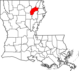
This is a list of the National Register of Historic Places listings in Richland Parish, Louisiana.
This is intended to be a complete list of the properties on the National Register of Historic Places in Richland Parish, Louisiana, United States. The locations of National Register properties for which the latitude and longitude coordinates are included below, may be seen in a map.
There are 9 properties listed on the National Register in the parish. One property was once listed, but has since been removed.
Current listings
| Name on the Register | Image | Date listed | Location | City or town | Description | |
|---|---|---|---|---|---|---|
| 1 | Delhi Municipal Baseball Park |
(#00000007) |
Chicago and Louisiana Sts. 32°27′19″N 91°29′48″W / 32.455278°N 91.496667°W |
Delhi | ||
| 2 | Downtown Delhi Historic District |
(#97000234) |
606-708 1st St. and 115-201 Broadway 32°27′26″N 91°29′36″W / 32.457222°N 91.493333°W |
Delhi | ||
| 3 | Miles-Hanna House |
(#96001161) |
206 Charter 32°27′31″N 91°29′36″W / 32.458611°N 91.493333°W |
Delhi | ||
| 4 | Poplar Chapel AME Church |
(#89000475) |
Louisiana Highway 135 32°23′55″N 91°50′02″W / 32.398611°N 91.833889°W |
Rayville | ||
| 5 | Rayville High School |
(#92001491) |
109 Madeline St. 32°28′33″N 91°45′25″W / 32.475833°N 91.756944°W |
Rayville | ||
| 6 | Nonnie Roark Rhymes Memorial Library |
(#90001736) |
206 S. Louisa St. 32°28′31″N 91°45′25″W / 32.475278°N 91.756944°W |
Rayville | ||
| 7 | St. David's Episcopal Church |
(#07001006) |
834 Louisa St. 32°28′27″N 91°45′29″W / 32.474167°N 91.758056°W |
Rayville | ||
| 8 | Trio Plantation House |
(#99000257) |
312 Trio Rd. 32°32′00″N 91°43′07″W / 32.533333°N 91.718611°W |
Rayville | ||
| 9 | Vickers House |
(#86001056) |
Louisiana Highway 15 32°21′27″N 91°51′37″W / 32.3575°N 91.860278°W |
Alto |
Former listing
| Name on the Register | Image | Date listed | Date removed | Location | City or town | Summary | |
|---|---|---|---|---|---|---|---|
| 3 | Mangham State Bank Building |
(#85000975) |
|
Main and Horace Sts. 32°18′29″N 91°46′33″W / 32.308056°N 91.775833°W |
Mangham |

All content from Kiddle encyclopedia articles (including the article images and facts) can be freely used under Attribution-ShareAlike license, unless stated otherwise. Cite this article:
National Register of Historic Places listings in Richland Parish, Louisiana Facts for Kids. Kiddle Encyclopedia.


