National Register of Historic Places listings in Richmond County, Virginia facts for kids
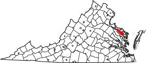
This is a list of the National Register of Historic Places listings in Richmond County, Virginia.
This is intended to be a complete list of the properties and districts on the National Register of Historic Places in Richmond County, Virginia, United States. The locations of National Register properties and districts for which the latitude and longitude coordinates are included below, may be seen in an online map.
There are 10 properties and districts listed on the National Register in the county, including 3 National Historic Landmarks. Another property was once listed but has been removed.
Current listings
| Name on the Register | Image | Date listed | Location | City or town | Description | |
|---|---|---|---|---|---|---|
| 1 | Farnham Church |
(#73002053) |
VA 3 37°53′09″N 76°37′31″W / 37.885972°N 76.625278°W |
Farnham | ||
| 2 | Grove Mount |
(#90001995) |
Jct. of VA 635 and VA 624 38°00′42″N 76°49′58″W / 38.011667°N 76.832833°W |
Warsaw | ||
| 3 | Indian Banks |
(#80004218) |
Address Restricted |
Simonson | ||
| 4 | Linden Farm |
(#77001492) |
N of Farnham on VA 3 37°53′25″N 76°37′59″W / 37.890139°N 76.633056°W |
Farnham | ||
| 5 | Menokin |
(#69000276) |
NW of jct. of Rtes. 690 and 621 38°00′30″N 76°48′13″W / 38.008333°N 76.803611°W |
Warsaw | ||
| 6 | Mount Airy |
(#66000845) |
West of Warsaw on U.S. 360 37°58′15″N 76°47′28″W / 37.970833°N 76.791111°W |
Warsaw | ||
| 7 | Richmond County Courthouse |
(#72001413) |
Jct. of U.S. 360 with VA 3 37°57′29″N 76°45′27″W / 37.958056°N 76.757500°W |
Warsaw | ||
| 8 | Sabine Hall |
(#69000277) |
S of jct. of Rtes. 624 and 360 37°56′24″N 76°47′05″W / 37.940000°N 76.784722°W |
Tappahannock | ||
| 9 | Woodford |
(#83003311) |
VA 610 37°49′59″N 76°40′15″W / 37.833056°N 76.670833°W |
Simons Corner |
Former listing
| Name on the Register | Image | Date listed | Date removed | Location | City or town | Summary | |
|---|---|---|---|---|---|---|---|
| 1 | Bladensfield |
(#80004219) |
|
NE of Warsaw off VA 203 |
Warsaw | Destroyed by fire November 1996 |

All content from Kiddle encyclopedia articles (including the article images and facts) can be freely used under Attribution-ShareAlike license, unless stated otherwise. Cite this article:
National Register of Historic Places listings in Richmond County, Virginia Facts for Kids. Kiddle Encyclopedia.


