National Register of Historic Places listings in Rush County, Indiana facts for kids
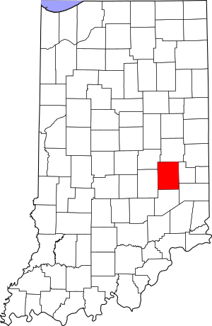
This is a list of the National Register of Historic Places listings in Rush County, Indiana.
This is intended to be a complete list of the properties and districts on the National Register of Historic Places in Rush County, Indiana, United States. Latitude and longitude coordinates are provided for many National Register properties and districts; these locations may be seen together in a map.
There are 28 properties and districts listed on the National Register in the county. Another property was once listed but has been removed.
Properties and districts located in incorporated areas display the name of the municipality, while properties and districts in unincorporated areas display the name of their civil township. Properties and districts split between multiple jurisdictions display the names of all jurisdictions.
Current listings
| Name on the Register | Image | Date listed | Location | City or town | Description | |
|---|---|---|---|---|---|---|
| 1 | Dr. John Arnold Farm |
(#89001409) |
West of Glenwood and northeast of Rushville 39°38′14″N 85°21′30″W / 39.637222°N 85.358333°W |
Union Township | ||
| 2 | Center Township Grade and High School |
(#04000211) |
929 E. South St. at Mays 39°44′31″N 85°25′46″W / 39.741944°N 85.429444°W |
Center Township | ||
| 3 | County Line Bridge |
(#94001356) |
County Road 1000W over the Big Blue River, northeast of Morristown 39°42′35″N 85°37′59″W / 39.709722°N 85.633056°W |
Ripley Township | Extends into Hancock County | |
| 4 | Durbin Hotel |
(#82000072) |
137 W. 2nd St. 39°36′29″N 85°26′46″W / 39.608056°N 85.446111°W |
Rushville | ||
| 5 | East Hill Cemetery |
(#14001039) |
704 E. State Road 44, east of Rushville 39°36′24″N 85°25′57″W / 39.606667°N 85.432500°W |
Rushville Township | ||
| 6 | Forsythe Covered Bridge |
(#83000094) |
W. County Road 650S, southwest of Rushville 39°31′02″N 85°31′50″W / 39.517222°N 85.530556°W |
Orange Township | ||
| 7 | John K. Gowdy House |
(#93001414) |
619 N. Perkins St. 39°36′48″N 85°26′37″W / 39.613472°N 85.443611°W |
Rushville | ||
| 8 | Hall-Crull Octagonal House |
(#84001575) |
North of Rushville 39°44′39″N 85°23′10″W / 39.744167°N 85.386111°W |
Washington Township | ||
| 9 | James F. Harcourt House |
(#89001412) |
County Road 500W at County Road 750S, northeast of Moscow 39°30′15″N 85°32′06″W / 39.504167°N 85.535°W |
Orange Township | ||
| 10 | Henry Henley Public Library |
(#16000908) |
103 N. Main St. 39°44′22″N 85°34′17″W / 39.739555°N 85.571473°W |
Carthage | ||
| 11 | Indiana Soldiers' and Sailors' Children's Home |
(#11000916) |
10892 N. State Road 140, south of Knightstown 39°46′00″N 85°31′00″W / 39.766666°N 85.516666°W |
Center Township | ||
| 12 | Archibald M. Kennedy House |
(#83000095) |
E. County Road 200N, northeast of Rushville 39°38′17″N 85°24′03″W / 39.638056°N 85.400833°W |
Rushville Township | ||
| 13 | Maurice W. Manche Farmstead |
(#89001411) |
County Road 900W, west of Carthage 39°44′18″N 85°36′48″W / 39.738333°N 85.613333°W |
Ripley Township | ||
| 14 | Melodeon Hall |
(#73000041) |
210 N. Morgan St. 39°36′30″N 85°26′46″W / 39.608333°N 85.446111°W |
Rushville | ||
| 15 | Moscow Covered Bridge |
(#83000096) |
County Roads 625W and 875S at Moscow 39°29′06″N 85°33′17″W / 39.485000°N 85.554722°W |
Orange Township | Destroyed by 2008 tornado | |
| 16 | Norris Ford Covered Bridge |
(#83000097) |
E. County Road 150N, northeast of Rushville 39°38′00″N 85°24′59″W / 39.633333°N 85.416389°W |
Rushville Township | ||
| 17 | Offutt Covered Bridge |
(#83000098) |
N. County Road 550W, northwest of Rushville 39°39′38″N 85°32′22″W / 39.660417°N 85.539444°W |
Posey Township | ||
| 18 | Jabez Reeves Farmstead |
(#89000776) |
County Road 900N, north of Rushville 39°44′25″N 85°29′21″W / 39.740278°N 85.489167°W |
Center Township | ||
| 19 | Rush County Bridge No. 188 |
(#00001542) |
County Road 150W over the Little Flatrock River at Milroy 39°30′10″N 85°28′01″W / 39.502778°N 85.466944°W |
Anderson Township | ||
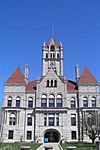
| 20 | Rush County Courthouse |
(#75000048) |
Courthouse Square 39°36′28″N 85°26′38″W / 39.607778°N 85.443889°W |
Rushville | ||
| 21 | Rushville Commercial Historic District |
(#93001416) |
Roughly bounded by 4th, N. Morgan, 1st, and N. Perkins Sts. 39°36′30″N 85°26′42″W / 39.608333°N 85.445000°W |
Rushville | ||
| 22 | St. Paul Methodist Episcopal Church |
(#97001536) |
426 N. Morgan St. 39°36′41″N 85°26′46″W / 39.611389°N 85.446111°W |
Rushville | ||
| 23 | Smith Covered Bridge |
(#83000099) |
E. County Road 300N, north of Rushville 39°39′19″N 85°24′34″W / 39.655278°N 85.409444°W |
Jackson Township | ||
| 24 | Walnut Ridge Friends Meetinghouse |
(#84001616) |
West of Carthage 39°43′41″N 85°36′48″W / 39.728056°N 85.613333°W |
Ripley Township | ||
| 25 | Booker T. Washington School |
(#90000809) |
525 E. 7th St. 39°36′51″N 85°26′16″W / 39.614167°N 85.437778°W |
Rushville | ||
| 26 | Wendell Lewis Willkie House |
(#93001415) |
601 N. Harrison St. 39°36′46″N 85°26′53″W / 39.612778°N 85.448056°W |
Rushville | ||
| 27 | John Wood Farmstead |
(#00000201) |
5255 W. County Road 900S, west of Milroy 39°28′46″N 85°32′28″W / 39.479444°N 85.541111°W |
Orange Township |
Former listing
| Name on the Register | Image | Date listed | Date removed | Location | City or town | Summary | |
|---|---|---|---|---|---|---|---|
| 1 | Ferree Covered Bridge |
(#83000093) |
|
Base Rd. |
Rushville |


