National Register of Historic Places listings in Smyth County, Virginia facts for kids
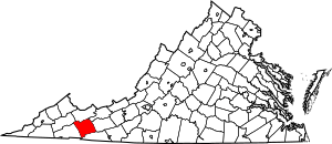
This is a list of the National Register of Historic Places listings in Smyth County, Virginia.
This is intended to be a complete list of the properties and districts on the National Register of Historic Places in Smyth County, Virginia, United States. The locations of National Register properties and districts for which the latitude and longitude coordinates are included below, may be seen in a Google map.
There are 23 properties and districts listed on the National Register in the county.
Current listings
| Name on the Register | Image | Date listed | Location | City or town | Description | |
|---|---|---|---|---|---|---|
| 1 | Aspenvale Cemetery |
(#80004226) |
Off U.S. 11 36°48′53″N 81°38′25″W / 36.814722°N 81.640278°W |
Seven Mile Ford | ||
| 2 | A.C. Beatie House |
(#01000697) |
249 W. Lee Hwy. 36°47′55″N 81°41′04″W / 36.798611°N 81.684444°W |
Chilhowie | ||
| 3 | H.L. Bonham House |
(#00000485) |
408 White Top Rd. 36°47′43″N 81°40′53″W / 36.795278°N 81.681389°W |
Chilhowie | ||
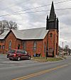
| 4 | Chilhowie Methodist Episcopal Church |
(#91000830) |
501 Old Stage Rd. 36°48′09″N 81°40′55″W / 36.802500°N 81.681944°W |
Chilhowie | ||
| 5 | Downtown Chilhowie Historic District |
(#00000065) |
Main St., S. Whitetop Rd., and the Lee Highway 36°47′54″N 81°40′53″W / 36.798333°N 81.681389°W |
Chilhowie | ||
| 6 | Fox Farm Site |
(#78003045) |
Address Restricted |
McMullin | ||
| 7 | R. T. Greer and Company |
(#97000481) |
107 Pendleton St. 36°50′02″N 81°30′57″W / 36.833889°N 81.515833°W |
Marion | ||
| 8 | Henderson Building, Southwestern State Hospital |
(#89001919) |
E. Main St. 36°50′00″N 81°30′43″W / 36.833333°N 81.511944°W |
Marion | Now part of Southwestern Virginia Mental Health Institute | |
| 9 | Hotel Lincoln |
(#95000897) |
107 E. Main St. 36°50′00″N 81°31′10″W / 36.833333°N 81.519444°W |
Marion | ||
| 10 | Hungry Mother State Park Historic District |
(#07000303) |
2854 Park Blvd. 36°53′04″N 81°31′31″W / 36.884444°N 81.525278°W |
Marion | ||
| 11 | Konnarock Training School |
(#97000483) |
Jct. of VA 603 and VA 600 36°40′24″N 81°36′42″W / 36.673333°N 81.611528°W |
Konnarock | ||
| 12 | Lincoln Theatre |
(#92001710) |
117 E. Main St. 36°50′01″N 81°31′09″W / 36.833611°N 81.519167°W |
Marion | ||
| 13 | Marion Historic District |
(#00000888) |
Roughly along Main, Cherry, Strother, Lee, North College and College Sts.; also W. Cherry, E. Main, N. Main, Maple, N. Chestnut, Broad, and N. Commerce Sts. 36°49′59″N 81°31′13″W / 36.833056°N 81.520278°W |
Marion | Second set of boundaries represents a boundary increase of July 28, 2011 | |
| 14 | Marion Male Academy |
(#89001915) |
343 College St. 36°49′53″N 81°31′34″W / 36.831250°N 81.526111°W |
Marion | ||
| 15 | Norfolk & Western Railway Depot |
(#95000025) |
651 N. Main St. 36°50′22″N 81°30′42″W / 36.839444°N 81.511667°W |
Marion | ||
| 16 | Old Stone Tavern |
(#82004595) |
US 11 36°51′52″N 81°26′12″W / 36.864583°N 81.436667°W |
Atkins | ||
| 17 | Preston House |
(#69000280) |
S of jct. of Rtes. 645 and U.S. 11 36°48′23″N 81°37′13″W / 36.806250°N 81.620278°W |
Marion | ||
| 18 | Preston House |
(#76002120) |
VA 107 36°52′16″N 81°45′41″W / 36.871111°N 81.761389°W |
Saltville | ||
| 19 | Saltville Battlefields Historic District |
(#10000096) |
Virginia State Route 91, Virginia State Route 107, County Route 632 36°53′20″N 81°44′44″W / 36.888889°N 81.745556°W |
Saltville | Extends into Washington County | |
| 20 | Saltville Historic District |
(#02000367) |
Main St., 1st Ave., Palmer Ave, Palmer Ln., Stadium Dr., and Henrytown Rd. 36°52′46″N 81°45′57″W / 36.879444°N 81.765833°W |
Saltville | ||
| 21 | Scott-Walker House |
(#94000450) |
VA 635 E side, 2 mi. SE of Saltville 36°53′01″N 81°43′22″W / 36.883611°N 81.722778°W |
Saltville | ||
| 22 | Smyth County Community Hospital |
(#15000908) |
565 Radio Hill Rd. 36°51′05″N 81°30′28″W / 36.851378°N 81.507778°W |
Marion | ||
| 23 | Abijah Thomas House |
(#80004225) |
SW of Marion on VA 657 36°46′28″N 81°34′12″W / 36.774306°N 81.570000°W |
Marion |

All content from Kiddle encyclopedia articles (including the article images and facts) can be freely used under Attribution-ShareAlike license, unless stated otherwise. Cite this article:
National Register of Historic Places listings in Smyth County, Virginia Facts for Kids. Kiddle Encyclopedia.


