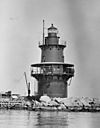
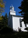
National Register of Historic Places listings in Southold (town), New York facts for kids
This list is intended to provide a comprehensive listing of entries on the National Register of Historic Places in Town of Southold, New York. The locations of National Register properties for which the latitude and longitude coordinates are included below, may be seen in an online map.
Listings
| Name on the Register | Image | Date listed | Location | City or town | Description | |
|---|---|---|---|---|---|---|
| 1 | Brecknock Hall |
(#05000331) |
North Road near Manhassett Avenue 41°07′00″N 72°21′43″W / 41.116667°N 72.361944°W |
Stirling | ||
| 2 | Congregation Tifereth Israel Synagogue |
(#06000161) |
519 Fourth Street 41°06′02″N 72°21′55″W / 41.100556°N 72.365278°W |
Greenport | ||
| 3 | Richard Cox House |
(#86001721) |
Mill Road 40°59′55″N 72°33′28″W / 40.998611°N 72.557778°W |
Mattituck | ||
| 4 | Fort Corchaug Archeological Site |
(#74001308) |
Address Restricted |
Cutchogue | ||
| 5 | Andrew Gildersleeve Octagonal Building |
(#76001280) |
Main Road and Love Lane 40°59′28″N 72°31′25″W / 40.991111°N 72.523611°W |
Mattituck | ||
| 6 | Greenport Railroad Station |
(#89000947) |
Third and Wiggins Streets 41°05′59″N 72°21′49″W / 41.099722°N 72.363611°W |
Greenport | ||
| 7 | Greenport Village Historic District |
(#84002973) |
Roughly bounded by Stirling Basin, Main, Monsell, 2nd, and Front Streets 41°06′17″N 72°21′53″W / 41.104722°N 72.364722°W |
Greenport | ||
| 8 | Joseph Nelson Hallock House |
(#05000330) |
Main Road and Maple Avenue 41°03′55″N 72°25′26″W / 41.065278°N 72.423889°W |
Southold | ||
| 9 | Horton Point Lighthouse |
(#94001237) |
N end of Lighthouse Road 41°05′07″N 72°26′47″W / 41.085278°N 72.446389°W |
Southold | ||
| 10 | Samuel Landon House |
(#05000329) |
Main Road Bet. Hobart Road and Maple Lane 41°03′57″N 72°25′25″W / 41.065833°N 72.423611°W |
Southold | ||
| 11 | Latimer Reef Light Station |
(#06000635) |
In Fisher's Island Sound, one mi NW of East Point on Fisher's Island 41°18′15″N 71°56′02″W / 41.304167°N 71.933889°W |
Fisher's Island | ||
| 12 | New Suffolk School |
(#02001050) |
Fifth Street at King Street 40°59′32″N 72°28′32″W / 40.992222°N 72.475556°W |
New Suffolk | ||
| 13 | The Old House |
(#66000573) |
NY 25 41°00′29″N 72°29′10″W / 41.008056°N 72.486111°W |
Cutchogue | ||
| 14 | Orient Historic District |
(#76001283) |
NY 25 41°08′21″N 72°18′11″W / 41.139167°N 72.303056°W |
Orient | ||
| 15 | Orient Point Light Station |
(#06001229) |
NE tip of Long Island, 1.1 mi. NE of Eastern Terminus of NY 25 41°09′48″N 72°13′27″W / 41.163333°N 72.224167°W |
Orient | ||
| 16 | Plum Island Light Station |
(#11000014) |
NW corner of Plum Island 41°10′25″N 72°12′41″W / 41.173611°N 72.211389°W |
Orient Point | New listing; refnum 11000014; Light Stations of the United States MPS | |
| 17 | Henry W. Prince Building |
(#05000091) |
54325 Main Road 41°03′53″N 72°25′40″W / 41.064722°N 72.427778°W |
Southold | ||
| 18 | Race Rock Light Station |
(#05000347) |
0.6 mi. SW of Race Point 41°14′44″N 72°02′49″W / 41.245556°N 72.046944°W |
Fishers Island | ||
| 19 | Southold Historic District |
(#97001202) |
Along Main Road, roughly bounded by Jockey Creek Drive, Griswold Street, Long Island RR Tracks, and Wells Road 41°03′35″N 72°26′01″W / 41.059722°N 72.433611°W |
Southold | ||
| 20 | Terry-Mulford House |
(#84003003) |
NY 25 41°09′06″N 72°16′38″W / 41.151667°N 72.277222°W |
Orient | ||
| 21 | Town Doctors' House and Site |
(#04001448) |
310 Ackerly Pond Lane 41°03′25″N 72°26′12″W / 41.056944°N 72.436667°W |
Southold | ||
| 22 | David Tuthill Farmstead |
(#84000295) |
New Suffolk Lane 41°00′25″N 72°29′39″W / 41.006944°N 72.494167°W |
Cutchogue | ||
| 23 | Jesse and Ira Tuthill House |
(#06000158) |
Main Road and Cardinal Drive 40°59′49″N 72°31′11″W / 40.996944°N 72.519722°W |
Mattituck | ||
| 24 | Joshua Wells House |
(#02000139) |
525 New Suffolk Road 41°00′35″N 72°29′05″W / 41.009722°N 72.484722°W |
Cutchogue |

All content from Kiddle encyclopedia articles (including the article images and facts) can be freely used under Attribution-ShareAlike license, unless stated otherwise. Cite this article:
National Register of Historic Places listings in Southold (town), New York Facts for Kids. Kiddle Encyclopedia.


