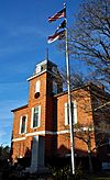
National Register of Historic Places listings in Transylvania County, North Carolina facts for kids
This list includes properties and districts listed on the National Register of Historic Places in Transylvania County, North Carolina. Click the "Map of all coordinates" link to the right to view a Google map of all properties and districts with latitude and longitude coordinates in the table below.
Current listings
| Name on the Register | Image | Date listed | Location | City or town | Description | |
|---|---|---|---|---|---|---|
| 1 | E. M. Backus Lodge |
(#88000689) |
Cold Mountain Gap Rd. 35°09′38″N 82°59′51″W / 35.160556°N 82.9975°W |
Lake Toxaway | Extends into Jackson County | |
| 2 | Biltmore Forest School |
(#74001377) |
NW of Brevard off U.S. 276 in Pisgah National Forest 35°21′04″N 82°46′52″W / 35.351111°N 82.781111°W |
Brevard | ||
| 3 | William Breese Jr. House |
(#83001920) |
401 E. Main St. 35°13′53″N 82°43′45″W / 35.231483°N 82.729294°W |
Brevard | ||
| 4 | Brevard College Stone Fence and Gate |
(#93001436) |
Jct. of N. Broad St. and French Broad Ave., NW corner 35°14′12″N 82°43′55″W / 35.236547°N 82.731867°W |
Brevard | ||
| 5 | Max and Claire Brombacher House |
(#01001111) |
571 E. Main St. 35°13′30″N 82°43′43″W / 35.225°N 82.728611°W |
Brevard | ||
| 6 | William Deaver House |
(#79001755) |
N of Pisgah Forest on NC 280 35°16′34″N 82°42′07″W / 35.276111°N 82.701944°W |
Pisgah Forest | ||
| 7 | East Main Street Historic District |
(#09000638) |
249-683 and 768 East Main St.; 6-7 Rice St.; St. Phillip's Ln.; 1-60 Woodside Dr.; and 33 Deacon Ln. 35°14′05″N 82°44′13″W / 35.234608°N 82.736814°W |
Brevard | ||
| 8 | Flem Galloway House |
(#95000137) |
NC 1388 W side, 2 miles S of jct. with NC 1129 35°09′17″N 82°48′41″W / 35.154722°N 82.811389°W |
Calvert | ||
| 9 | Godfrey-Barnette House |
(#93001437) |
411 S. Broad St. 35°13′37″N 82°44′15″W / 35.226944°N 82.7375°W |
Brevard | ||
| 10 | William H. Grogan House |
(#08000890) |
24 Warren La. 35°13′38″N 82°43′15″W / 35.227239°N 82.72095°W |
Brevard | ||
| 11 | Hanckel-Barclay House |
(#99001495) |
0.8 miles W of Jct. NC 1114 and US 276 35°11′41″N 82°43′53″W / 35.194722°N 82.731389°W |
Brevard | Boundary increased on July 20, 2000 | |
| 12 | Hillmont |
(#86002871) |
W side of Lake Toxaway 3 miles N of US 64 35°08′27″N 82°57′10″W / 35.140833°N 82.952778°W |
Lake Toxaway | ||
| 13 | Lake Toxaway Methodist Church |
(#94000033) |
Cold Mountain Rd. N side, 0.1 miles NW of jct. with NC 281 35°08′22″N 82°55′59″W / 35.139444°N 82.933056°W |
Lake Toxaway | ||
| 14 | Main Street Historic District |
(#02000945) |
Roughly bounded by Gaston St., England St., Probart St., and Jordan St. 35°13′59″N 82°44′04″W / 35.233056°N 82.734444°W |
Brevard | ||
| 15 | McMinn Building |
(#94000034) |
2-6 W. Main St. 35°14′02″N 82°44′04″W / 35.233889°N 82.734444°W |
Brevard | ||
| 16 | Morgan's Mill |
(#79001753) |
SW of Brevard on SR 1331 35°10′17″N 82°48′41″W / 35.171389°N 82.811389°W |
Brevard | ||
| 17 | Royal and Louise Morrow House |
(#06001107) |
630 E. Main St. 35°13′36″N 82°43′40″W / 35.226667°N 82.727778°W |
Brevard | ||
| 18 | Charles E. Orr House |
(#06001108) |
269 E. Main St. 35°13′54″N 82°43′46″W / 35.231667°N 82.729444°W |
Brevard | ||
| 19 | Dillard B. and Georgia Sewell House |
(#15000164) |
64 Clipper Ln. 35°15′36″N 82°36′15″W / 35.26°N 82.6042°W |
Penrose | Extends into Henderson County | |
| 20 | Silvermont |
(#81000427) |
E. Main St. 35°13′44″N 82°43′47″W / 35.228889°N 82.729722°W |
Brevard | ||
| 21 | St. Philip's Episcopal Church |
(#97001594) |
317 E. Main St. 35°13′54″N 82°43′51″W / 35.231667°N 82.730833°W |
Brevard | ||
| 22 | Transylvania County Courthouse |
(#79001754) |
N. Broad and E. Main St. 35°14′01″N 82°44′01″W / 35.233611°N 82.733611°W |
Brevard |

All content from Kiddle encyclopedia articles (including the article images and facts) can be freely used under Attribution-ShareAlike license, unless stated otherwise. Cite this article:
National Register of Historic Places listings in Transylvania County, North Carolina Facts for Kids. Kiddle Encyclopedia.


