National Register of Historic Places listings in Union County, Illinois facts for kids
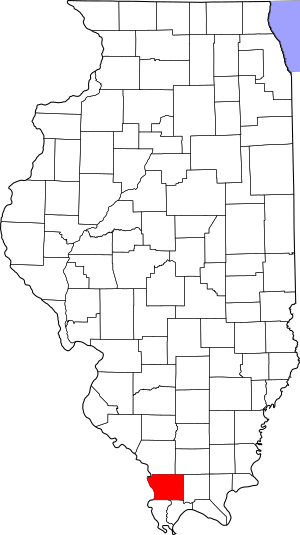
This is a list of the National Register of Historic Places listings in Union County, Illinois.
This is intended to be a complete list of the properties and districts on the National Register of Historic Places in Union County, Illinois, United States. Latitude and longitude coordinates are provided for many National Register properties and districts; these locations may be seen together in a map.
There are 8 properties and districts listed on the National Register in the county. Another property was once listed but has been removed.
Current listings
| Name on the Register | Image | Date listed | Location | City or town | Description | |
|---|---|---|---|---|---|---|
| 1 | Giant City State Park Lodge and Cabins |
(#85002403) |
RR #1 37°35′32″N 89°11′00″W / 37.592222°N 89.183333°W |
Makanda | ||
| 2 | St. Anne's Episcopal Church |
(#02001758) |
507 S. Main St. 37°27′28″N 89°15′11″W / 37.457778°N 89.253056°W |
Anna | ||
| 3 | St. Paulus Evangelisch Lutherischen Gemeinde |
(#80001413) |
South of Jonesboro off Illinois Route 127 37°24′56″N 89°16′31″W / 37.415694°N 89.275139°W |
Jonesboro | ||
| 4 | Stinson Memorial Library |
(#78001193) |
409 S. Main St. 37°27′30″N 89°15′06″W / 37.458333°N 89.251667°W |
Anna | ||
| 5 | Thompson Brothers Rock Art |
(#15000933) |
Giant City Nature Trail 37°35′42″N 89°11′36″W / 37.595000°N 89.193333°W |
Makanda | ||
| 6 | Union Lookout |
(#02001759) |
¾ miles south of the junction of County Road 13 and Trail of Tears State Forest Rd. 37°28′44″N 89°21′28″W / 37.478750°N 89.357778°W |
Jonesboro | ||
| 7 | Ware Mounds and Village Site |
(#77000490) |
West of the junction of Illinois Routes 3 and 146 at Ware 37°26′47″N 89°24′00″W / 37.44638°N 89.40000°W |
Ware |
Former listing
| Name on the Register | Image | Date listed | Date removed | Location | City or town | Summary | |
|---|---|---|---|---|---|---|---|
| 1 | Willard House |
(#76000730) |
|
608 S. Main St. |
Anna |

All content from Kiddle encyclopedia articles (including the article images and facts) can be freely used under Attribution-ShareAlike license, unless stated otherwise. Cite this article:
National Register of Historic Places listings in Union County, Illinois Facts for Kids. Kiddle Encyclopedia.


