National Register of Historic Places listings in Warren County, Iowa facts for kids
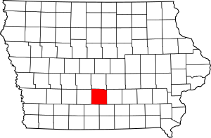
This is a list of the National Register of Historic Places listings in Warren County, Iowa.
This is intended to be a complete list of the properties and districts on the National Register of Historic Places in Warren County, Iowa, United States. Latitude and longitude coordinates are provided for many National Register properties and districts; these locations may be seen together in a map.
There are 13 properties and districts listed on the National Register in the county.
Current listings
| Name on the Register | Image | Date listed | Location | City or town | Description | |
|---|---|---|---|---|---|---|
| 1 | Coal Creek Bridge |
(#98000473) |
2404 Fillmore St. over Coal Creek 41°25′44″N 93°20′46″W / 41.428889°N 93.346111°W |
Carlisle | ||
| 2 | Hoosier Row School |
(#11000393) |
15246 County Road R63 41°18′15″N 93°37′02″W / 41.304167°N 93.617222°W |
Indianola vicinity | ||
| 3 | Indianola High School |
(#02001247) |
301 N. Buxton 41°21′46″N 93°33′45″W / 41.362778°N 93.5625°W |
Indianola | ||
| 4 | Lake Ahquabi State Park, Picnic Area (Area A) |
(#90001663) |
1650 118th Ave. 41°17′23″N 93°35′01″W / 41.289722°N 93.583611°W |
Indianola | ||
| 5 | Lake Ahquabi State Park, Bathhouse Area (Area B) |
(#90001664) |
1650 118th Ave. 41°17′25″N 93°35′25″W / 41.290278°N 93.590278°W |
Indianola | ||
| 6 | Lake Ahquabi State Park, Refectory Area (Area C) |
(#90001665) |
1650 118th Ave. 41°17′19″N 93°35′25″W / 41.288611°N 93.590278°W |
Indianola | ||
| 7 | Octagon Barn, Otter Township |
(#86001448) |
Off Iowa Highway 205 41°16′07″N 93°26′35″W / 41.268611°N 93.443056°W |
Otter Township | ||
| 8 | Palmyra Methodist Episcopal Church |
(#79000945) |
Southwest of Hartford 41°26′04″N 93°26′05″W / 41.434444°N 93.434722°W |
Palmyra | ||
| 9 | Polled Hereford Breed Origin Site |
(#83000408) |
Southwest of Indianola 41°15′32″N 93°40′54″W / 41.258889°N 93.681667°W |
Indianola | ||
| 10 | Science Hall |
(#91000535) |
Simpson College campus 41°21′54″N 93°34′25″W / 41.365°N 93.573611°W |
Indianola | ||
| 11 | United Presbyterian Church, Summerset |
(#76000811) |
U.S. Route 65 41°28′16″N 93°33′38″W / 41.471111°N 93.560556°W |
Scotch Ridge | ||
| 12 | Warren County Court House |
(#03000818) |
115 N. Howard Ave. 41°21′40″N 93°33′41″W / 41.361111°N 93.561389°W |
Indianola |

All content from Kiddle encyclopedia articles (including the article images and facts) can be freely used under Attribution-ShareAlike license, unless stated otherwise. Cite this article:
National Register of Historic Places listings in Warren County, Iowa Facts for Kids. Kiddle Encyclopedia.


