National Register of Historic Places listings in Wayne County, North Carolina facts for kids
This list includes properties and districts listed on the National Register of Historic Places in Wayne County, North Carolina. Click the "Map of all coordinates" link to the right to view a Google map of all properties and districts with latitude and longitude coordinates in the table below.
Current listings
| Name on the Register | Image | Date listed | Location | City or town | Description | |
|---|---|---|---|---|---|---|
| 1 | Charles B. Aycock Birthplace |
(#70000482) |
6 miles from jct. of SR 1542 and U.S. 117 35°31′11″N 77°58′30″W / 35.519722°N 77.975°W |
Fremont | ||
| 2 | Barnes-Hooks Farm |
(#95001072) |
414 Stuckey Rd. 35°34′15″N 77°59′05″W / 35.570833°N 77.984722°W |
Fremont | ||
| 3 | Borden Manufacturing Company |
(#04001583) |
800 and 801 N. William St. 35°23′41″N 77°59′19″W / 35.394722°N 77.988611°W |
Goldsboro | ||
| 4 | Eureka United Methodist Church |
(#82003520) |
Church St. 35°32′40″N 77°52′47″W / 35.544444°N 77.879722°W |
Eureka | ||
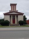
| 5 | First Presbyterian Church |
(#79003340) |
111 W. Ash St. 35°23′10″N 77°59′50″W / 35.386111°N 77.997222°W |
Goldsboro | ||
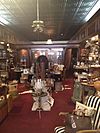
| 6 | L. D. Giddens and Son Jewelry Store |
(#79001763) |
135 S. Center St. 35°22′56″N 77°59′52″W / 35.382325°N 77.997733°W |
Goldsboro | ||
| 7 | Goldsboro Union Station |
(#77001015) |
101 North Carolina St. 35°23′05″N 78°00′15″W / 35.384722°N 78.004167°W |
Goldsboro | ||
| 8 | Harry Fitzhugh Lee House |
(#84002542) |
310 W. Walnut St. 35°23′03″N 78°00′11″W / 35.384167°N 78.003056°W |
Goldsboro | ||
| 9 | Mount Olive High School |
(#98001266) |
100 Wooten St. 35°12′01″N 78°04′23″W / 35.200278°N 78.073056°W |
Mount Olive | ||
| 10 | Mount Olive Historic District |
(#99000639) |
Roughly bounded by Park Ave., Wooten, Nelson, and Johnson Sts. 35°11′42″N 78°04′09″W / 35.195°N 78.069167°W |
Mount Olive | ||
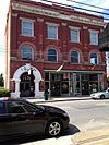
| 11 | Odd Fellows Lodge |
(#78001984) |
111-115 N. John St. 35°23′00″N 77°59′43″W / 35.383261°N 77.995386°W |
Goldsboro | ||
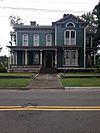
| 12 | Perry-Cherry House |
(#86000392) |
308 W. Main St. 35°11′50″N 78°04′14″W / 35.197222°N 78.070556°W |
Mount Olive | ||
| 13 | Southerland-Burnette House |
(#88000057) |
201 N. Chesnut St. 35°11′51″N 78°04′04″W / 35.1975°N 78.067778°W |
Mount Olive | ||
| 14 | U.S. Post Office, Former |
(#95000670) |
124 W. James St. 35°11′50″N 78°04′01″W / 35.197222°N 78.066944°W |
Mount Olive | ||
| 15 | Vernon |
(#74001387) |
Address Restricted |
Mount Olive | Demolished | |
| 16 | Solomon and Henry Weil Houses |
(#76001350) |
204 and 200 W. Chestnut St. 35°22′56″N 78°00′00″W / 35.382169°N 78.000067°W |
Goldsboro | ||
| 17 | Dred and Ellen Yelverton House |
(#09000662) |
1979 NC 222 E. 35°33′36″N 78°00′28″W / 35.559897°N 78.0078°W |
Fremont |

All content from Kiddle encyclopedia articles (including the article images and facts) can be freely used under Attribution-ShareAlike license, unless stated otherwise. Cite this article:
National Register of Historic Places listings in Wayne County, North Carolina Facts for Kids. Kiddle Encyclopedia.


