
National Register of Historic Places listings in White County, Tennessee facts for kids
This is a list of the National Register of Historic Places listings in White County, Tennessee.
This is intended to be a complete list of the properties and districts on the National Register of Historic Places in White County, Tennessee, United States. Latitude and longitude coordinates are provided for many National Register properties and districts; these locations may be seen together in a map.
There are 12 properties and districts listed on the National Register in the county.
| Anderson – Bedford – Benton – Bledsoe – Blount – Bradley – Campbell – Cannon – Carroll – Carter – Cheatham – Chester – Claiborne – Clay – Cocke – Coffee – Crockett – Cumberland – Davidson – Decatur – DeKalb – Dickson – Dyer – Fayette – Fentress – Franklin – Gibson – Giles – Grainger – Greene – Grundy – Hamblen – Hamilton – Hancock – Hardeman – Hardin – Hawkins – Haywood – Henderson – Henry – Hickman – Houston – Humphreys – Jackson – Jefferson – Johnson – Knox – Lake – Lauderdale – Lawrence – Lewis – Lincoln – Loudon – Macon – Madison – Marion – Marshall – Maury – McMinn – McNairy – Meigs – Monroe – Montgomery – Moore – Morgan – Obion – Overton – Perry – Pickett – Polk – Putnam – Rhea – Roane – Robertson – Rutherford – Scott – Sequatchie – Sevier – Shelby – Smith – Stewart – Sullivan – Sumner – Tipton – Trousdale – Unicoi – Union – Van Buren – Warren – Washington – Wayne – Weakley – White – Williamson – Wilson |
Current listings
| Name on the Register | Image | Date listed | Location | City or town | Description | |
|---|---|---|---|---|---|---|
| 1 | Cherry Creek Mound |
(#78002648) |
Address Restricted |
Key | ||
| 2 | Community Building |
 |
(#02000085) |
5 W. Maple St. 35°55′30″N 85°27′53″W / 35.925°N 85.464722°W |
Sparta | Now known as "Liberty Hall," home to an American Legion order |
| 3 | Great Falls Hydroelectric Station |
 |
(#90001004) |
Off U.S. Route 70 at mile 91.1 on the Caney Fork 35°48′07″N 85°37′19″W / 35.801944°N 85.621944°W |
Rock Island | Extends into Warren County |
| 4 | Indian Cave Petroglyphs |
(#78002649) |
Address Restricted |
Onward | ||
| 5 | Nashville, Chattanooga and St. Louis Railway Section House |
 |
(#11000421) |
9479 Crossville Hwy. 35°57′03″N 85°18′30″W / 35.950833°N 85.308333°W |
DeRossett | 1900s-era railroad section house; now home to the Bon Air Historical Society Museum |
| 6 | Ravencroft Mine |
(#15000449) |
Glade Creek Rd. Coordinates missing |
Sparta vicinity | ||
| 7 | Sparta Electric Building |
 |
(#93000238) |
S. Main St. 35°55′26″N 85°27′55″W / 35.923889°N 85.465278°W |
Sparta | Located at the corner of S. Main and Young streets |
| 8 | Sparta Hydroelectric Station |
(#90000306) |
State Route 111 at the Calfkiller River 35°54′45″N 85°28′34″W / 35.9125°N 85.476111°W |
Sparta | ||
| 9 | Sparta Nashville, Chattanooga and St. Louis Railroad Depot |
 |
(#92001658) |
Junction of Depot and Clark Sts. 35°56′14″N 85°28′18″W / 35.937222°N 85.471667°W |
Sparta | |
| 10 | Sparta Residential Historic District |
 |
(#91001586) |
Roughly bounded by N. Main, College, Everett, and Church Sts. 35°55′43″N 85°27′49″W / 35.928611°N 85.463611°W |
Sparta | |
| 11 | Sparta Rock House |
 |
(#73001856) |
3 miles east of Sparta on U.S. Route 70 35°55′13″N 85°24′13″W / 35.920278°N 85.403611°W |
Sparta | Mid-19th century toll house and stagecoach stop; maintained as a state historic site |
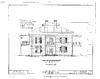
| 12 | Sperry-Smith House |
 |
(#96001357) |
121 E. Maple St. 35°55′28″N 85°27′42″W / 35.924444°N 85.461667°W |
Sparta |
Former listings
| Name on the Register | Image | Date listed | Date removed | Location | City or town | Summary | |
|---|---|---|---|---|---|---|---|
| 1 | Jessee Lincoln House |
 |
(#73002244) |
|
W of Sparta on TN 26 |
Sparta | |
| 2 | Oldham Theater |
 |
(#93001188) |
|
W. Liberty Square |
Sparta |

All content from Kiddle encyclopedia articles (including the article images and facts) can be freely used under Attribution-ShareAlike license, unless stated otherwise. Cite this article:
National Register of Historic Places listings in White County, Tennessee Facts for Kids. Kiddle Encyclopedia.