National Register of Historic Places listings in Williamsburg County, South Carolina facts for kids
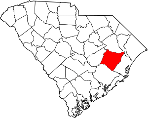
This is a list of the National Register of Historic Places listings in Williamsburg County, South Carolina.
This is intended to be a complete list of the properties and districts on the National Register of Historic Places in Williamsburg County, South Carolina, United States. The locations of National Register properties and districts for which the latitude and longitude coordinates are included below, may be seen in a map.
There are 12 properties and districts listed on the National Register in the county. Another 2 properties and districts were once listed but have been removed.
Current listings
| Name on the Register | Image | Date listed | Location | City or town | Description | |
|---|---|---|---|---|---|---|
| 1 | Clarkson Farm Complex |
(#88001706) |
U.S. Route 52, 1.5 miles south of its junction with U.S. Route 521 33°33′38″N 79°55′57″W / 33.560556°N 79.9325°W |
Greeleyville | ||
| 2 | Gamble House |
(#78002535) |
West of Nesmith off South Carolina Highway 502 33°40′17″N 79°35′26″W / 33.671389°N 79.590556°W |
Nesmith | ||
| 3 | M.F. Heller House |
(#94000452) |
405 Academy St. 33°40′05″N 79°49′56″W / 33.66801°N 79.8322°W |
Kingstree | ||
| 4 | Kingstree Historic District |
(#82003906) |
Main, Hampton and Academy Sts. 33°39′49″N 79°49′51″W / 33.663611°N 79.830833°W |
Kingstree | ||
| 5 | McCollum-Murray House |
(#06000579) |
C.E. Murray Boulevard 33°34′59″N 79°59′33″W / 33.583056°N 79.9925°W |
Greeleyville | ||
| 6 | New Market |
(#98000290) |
South Carolina Highway 375, approximately 5 miles south of Greeleyville 33°32′21″N 79°59′23″W / 33.539167°N 79.989722°W |
Greeleyville | ||
| 7 | Colonel John Gotea Pressley House |
(#97000534) |
216 N. Academy St. 33°40′18″N 79°50′07″W / 33.67172°N 79.83532°W |
Kingstree | ||
| 8 | Salters Plantation House |
(#00000591) |
Gapway Rd. (County Road 197) 33°36′01″N 79°51′18″W / 33.600278°N 79.855°W |
Salters | ||
| 9 | Scott House |
(#82004797) |
506 Live Oak St. 33°40′16″N 79°49′52″W / 33.67116°N 79.83103°W |
Kingstree | ||
| 10 | Thorntree |
(#70000606) |
South Carolina Highway 527, in Fluitt-Nelson Memorial Park 33°39′44″N 79°49′35″W / 33.662222°N 79.826389°W |
Kingstree | ||
| 11 | John Calvin Wilson House |
(#82003905) |
South Carolina Highway 512, 3.7 miles northwest of its junction with SC Hwy 261 33°45′10″N 79°39′31″W / 33.75271°N 79.65865°W |
Indiantown |
Former listings
| Name on the Register | Image | Date listed | Date removed | Location | City or town | Summary | |
|---|---|---|---|---|---|---|---|
| 1 | Black Mingo Baptist Church |
(#80003713) |
|
Nesmith vicinity | Burned | ||
| 2 | Brockinton-Scott House |
(#80003712) |
|
221 West Railroad Avenue |
Kingstree | Demolished |

All content from Kiddle encyclopedia articles (including the article images and facts) can be freely used under Attribution-ShareAlike license, unless stated otherwise. Cite this article:
National Register of Historic Places listings in Williamsburg County, South Carolina Facts for Kids. Kiddle Encyclopedia.


