National Register of Historic Places listings in Woodford County, Illinois facts for kids
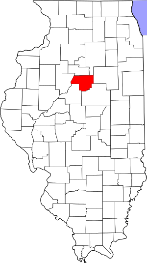
This is a list of the National Register of Historic Places listings in Woodford County, Illinois.
This is intended to be a complete list of the properties and districts on the National Register of Historic Places in Woodford County, Illinois, United States. Latitude and longitude coordinates are provided for many National Register properties and districts; these locations may be seen together in a map.
There are 7 properties and districts listed on the National Register in the county, and one former listing.
Current listings
| Name on the Register | Image | Date listed | Location | City or town | Description | |
|---|---|---|---|---|---|---|
| 1 | Benson Water Tower |
(#87002034) |
Clayton St. between Front and Pleasant Sts. 40°51′04″N 89°07′13″W / 40.851111°N 89.120278°W |
Benson | ||
| 2 | El Paso Public Library |
(#94000972) |
149 W. First St. 40°44′22″N 89°01′06″W / 40.739444°N 89.018333°W |
El Paso | ||
| 3 | Eureka College Administration and Chapel |
(#80001426) |
300 College Ave. 40°42′50″N 89°16′09″W / 40.713889°N 89.269167°W |
Eureka | ||
| 4 | Eureka College Campus Historic District |
(#10000365) |
300 College Ave. 40°42′52″N 89°16′12″W / 40.714389°N 89.270075°W |
Eureka | ||
| 5 | Illinois Central Railroad and Toledo, Peoria, and Western Railroad Freight House |
(#94000973) |
8-10 E. Front St. 40°44′17″N 89°00′56″W / 40.738056°N 89.015556°W |
El Paso | ||
| 6 | Metamora Courthouse |
(#78001203) |
113 E. Partridge St. 40°47′30″N 89°21′45″W / 40.791667°N 89.3625°W |
Metamora | ||
| 7 | Joseph Schertz House |
(#95000491) |
Illinois Route 116, 1 mile west of the city limits 40°46′43″N 89°24′35″W / 40.778611°N 89.409722°W |
Metamora | ||
| 8 | Adlai E. Stevenson I House |
(#80001427) |
104 W. Walnut St. 40°47′22″N 89°21′48″W / 40.789306°N 89.363472°W |
Metamora |

All content from Kiddle encyclopedia articles (including the article images and facts) can be freely used under Attribution-ShareAlike license, unless stated otherwise. Cite this article:
National Register of Historic Places listings in Woodford County, Illinois Facts for Kids. Kiddle Encyclopedia.


