
National Register of Historic Places listings in the upper NW Quadrant of Washington, D.C. facts for kids
This is a list of properties and districts listed on the National Register of Historic Places in the Northwest quadrant of Washington, D.C. that are both east of Rock Creek and north of M Street.
Current listings
| Name on the Register | Image | Date listed | Location | Neighborhood | Description | |
|---|---|---|---|---|---|---|
| 1 | Adams Memorial |
 |
(#72001420) |
Webster St. and Rock Creek Church Rd., NW. 38°56′50″N 77°00′39″W / 38.9472°N 77.0108°W |
Petworth | |
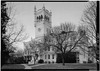
| 2 | Administration Building, Carnegie Institute of Washington |
 |
(#66000959) |
1530 P St., NW. 38°54′34″N 77°02′10″W / 38.9094°N 77.0361°W |
Dupont Circle | |
| 3 | Alden, Babcock, Calvert Apartments |
 |
(#90000737) |
2620 13th St., NW. 38°55′27″N 77°01′49″W / 38.9242°N 77.0303°W |
Columbia Heights | |
| 4 | All Souls Church, Unitarian |
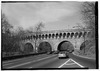
 |
(#100005905) |
1500 Harvard St. NW 38°55′34″N 77°02′10″W / 38.9260°N 77.0360°W |
||
| 5 | American Revolution Statuary |
 |
(#78000256) |
Public buildings and various parks within DC 38°54′25″N 77°02′29″W / 38.9069°N 77.0414°W |
Dupont Circle | 14 statues including 11 in central DC, and Doctor John Witherspoon south of Dupont Circle |
| 6 | Larz Anderson House |
 |
(#71000993) |
2118 Massachusetts Ave., NW. 38°54′39″N 77°02′53″W / 38.9108°N 77.0481°W |
Dupont Circle | National headquarters of the Society of the Cincinnati |
| 7 | Andrew Rankin Memorial Chapel, Frederick Douglas Memorial Hall, Founders Library |
 |
(#01000070) |
2441 and 2365 6th St. NW; and 500 Howard Place NW 38°55′21″N 77°01′13″W / 38.9225°N 77.0204°W |
Howard University | |
| 8 | Apartment Building at 2225 N Street |
 |
(#94001043) |
2225 N St., NW. 38°54′27″N 77°03′00″W / 38.9075°N 77.05°W |
West End (Washington, D.C.) | |
| 9 | Apartments at 5922 13th Street, NW. |
 |
(#100000471) |
5922 13th St., NW. 38°57′45″N 77°01′47″W / 38.9624°N 77.0298°W |
Brightwood | |
| 10 | Armed Forces Retirement Home-Washington |
 |
(#07001237) |
3700 N Capitol St NW 38°56′11″N 77°00′33″W / 38.9363°N 77.0091°W |
Park View, Petworth | |
| 11 | Armstrong Manual Training School |
 |
(#96000893) |
Junction of 1st and P Sts., NW 38°54′32″N 77°00′49″W / 38.9089°N 77.0136°W |
Truxton Circle | |
| 12 | Army Medical Museum |
 |
(#66000854) |
Armed Forces Institute of Pathology Building, Walter Reed Army Medical Center, 13th St. and Fern Pl. 38°58′41″N 77°01′47″W / 38.9780°N 77.0297°W |
Walter Reed Army Medical Center | Original listed building has been demolished; collection is now in Maryland. |
| 13 | Francis Asbury Memorial |
 |
(#07001052) |
Reservation 309-B, 16th & Mt. Pleasant Sts. NW 38°55′47″N 77°02′13″W / 38.9297°N 77.0369°W |
Mount Pleasant | |
| 14 | Banneker Recreation Center |
 |
(#86000876) |
2500 Georgia Ave. NW 38°55′20″N 77°01′25″W / 38.9222°N 77.0236°W |
Columbia Heights | |
| 15 | George M. Barker Company Warehouse |
 |
(#08000820) |
1525 7th St., NW. 38°54′36″N 77°01′17″W / 38.9100°N 77.0214°W |
Logan Circle | |
| 16 | Battleground National Cemetery |
 |
(#66000032) |
6625 Georgia Ave., NW. 38°58′14″N 77°01′37″W / 38.9706°N 77.0269°W |
Brightwood | |
| 17 | Joseph Beale House |
 |
(#73002073) |
2301 Massachusetts Ave., NW. 38°54′46″N 77°03′05″W / 38.9128°N 77.0514°W |
Kalorama Heights | |
| 18 | Perry Belmont House |
.JPG) |
(#73002074) |
1618 New Hampshire Ave., NW. 38°54′44″N 77°02′30″W / 38.9122°N 77.0417°W |
Dupont Circle | |
| 19 | Blagden Alley-Naylor Court Historic District |
 |
(#90001734) |
Bounded by O, 9th, M, & 10th Sts. NW. 38°54′44″N 77°01′33″W / 38.9122°N 77.0258°W |
Logan Circle | |
| 20 | Bloomingdale Historic District |
 |
(#100003129) |
Bounded by Florida Ave., Channing, Bryant, North Capital & 2nd Sts. NW 38°54′59″N 77°00′41″W / 38.9164°N 77.0114°W |
Bloomingdale | |
| 21 | Boulder Bridge and Ross Drive Bridge |
 |
(#80000348) |
Rock Creek Park 38°56′53″N 77°02′42″W / 38.9481°N 77.045°W |
Rock Creek Park | Extends to both sides of Rock Creek |
| 22 | Anthony Bowen YMCA |
 |
(#83003523) |
1816 12th St. NW 38°54′53″N 77°02′25″W / 38.914722°N 77.040278°W |
U Street Corridor (Cardozo/Shaw) | |
| 23 | Brodhead-Bell-Morton Mansion |
 |
(#87001769) |
1500 Rhode Island Ave., NW 38°54′27″N 77°02′06″W / 38.907469°N 77.034992°W |
Logan Circle | |
| 24 | Blanche Kelso Bruce Elementary School |
 |
(#15000114) |
770 Kenyon St., NW. 38°55′47″N 77°01′32″W / 38.9296°N 77.0256°W |
Park View | |
| 25 | Blanche K. Bruce House |
 |
(#75002046) |
909 M St., NW 38°54′21″N 77°01′29″W / 38.905833°N 77.024722°W |
Logan Circle | |
| 26 | Buildings at 1644–1666 Park Road NW |
 |
(#86003019) |
1644–1666 Park Rd. NW 38°55′54″N 77°02′17″W / 38.931667°N 77.038056°W |
Mount Pleasant | |
| 27 | Lucinda Cady House |
 |
(#75002047) |
7064 Eastern Ave., NW. 38°58′40″N 77°01′07″W / 38.977778°N 77.018611°W |
Takoma | |
| 28 | Cairo Apartment Building |
 |
(#94001033) |
1615 Q St., NW. 38°54′41″N 77°02′16″W / 38.911389°N 77.037778°W |
Dupont Circle | |
| 29 | Capital Traction Company Car Barn |
 |
(#13000290) |
4615 14th St., N.W. 38°56′50″N 77°01′56″W / 38.947332°N 77.032303°W |
Sixteenth Street Heights | |
| 30 | Canadian Embassy |
 |
(#73002076) |
1746 Massachusetts Ave., NW. 38°54′29″N 77°02′26″W / 38.908169°N 77.040633°W |
Dupont Circle | Now the Embassy of Uzbekistan; also known as the Clarence Moore House |
| 31 | Francis L. Cardozo Senior High School |
 |
(#93001015) |
Junction of 13th and Clifton Sts., NW. 38°55′14″N 77°01′48″W / 38.920556°N 77.03°W |
Columbia Heights | |
| 32 | Mary Ann Shadd Cary House |
 |
(#76002128) |
1421 W. St., NW 38°55′10″N 77°02′08″W / 38.919444°N 77.035556°W |
U Street Corridor (Cardozo/Shaw) | |
| 33 | Chapman Coal Company Garage and Stable |
 |
(#13000845) |
57 N St., NW. 38°54′27″N 77°00′40″W / 38.907498°N 77.011113°W |
Downtown | |
| 34 | Chilchester Arms Apartments |
.jpg) |
(#100000559) |
1388 Tuckerman St., NW 38°58′02″N 77°01′59″W / 38.967351°N 77.033025°W |
Brightwood | |
| 35 | Civil War Fort Sites |
 |
(#74000274) |
Arc of sites surrounding central Washington in Maryland, Virginia, and D.C. 38°57′50″N 77°01′46″W / 38.963944°N 77.029444°W |
All quadrants | At the outset of the Civil War in 1861, Washington became a critical target for rebel attacks but was virtually without protection. The Union Army hastily began construction of a fortified defense line around the city, the physical remnants of which encompass these 19 earthwork forts, including Fort Stevens and Fort Slocum. See also National Register listings in central D.C., western NW D.C., NE D.C., SE D.C., Prince George's County, Maryland, and Fairfax County, Virginia. |
| 36 | Civil War Monuments in Washington, DC |
.jpg) |
(#78000257) |
Various parks within the original boundaries of city 38°54′26″N 77°02′12″W / 38.907222°N 77.036667°W |
Various | 18 statues about people and topics related to the Civil War, including 11 in central Washington, 6 in the NW quadrant, and 1 in Lincoln Park (NE & SE quadrants). |
| 37 | Clifton Terrace |
 |
(#01001366) |
1308,1312,1350 Clifton St. 38°55′19″N 77°01′52″W / 38.921944°N 77.031111°W |
Columbia Heights | |
| 38 | Codman-Davis House |
 |
(#79003100) |
2145 Decatur Pl., NW 38°54′49″N 77°02′54″W / 38.913572°N 77.048353°W |
Kalorama Heights | |
| 39 | Congressional Club |
 |
(#11000717) |
2001 New Hampshire Ave., NW 38°55′02″N 77°02′09″W / 38.917222°N 77.035833°W |
U Street | |
| 40 | Connecticut Avenue Bridge |
|
(#03000584) |
Connecticut Ave., northwest of Rock Creek 38°55′16″N 77°03′02″W / 38.921111°N 77.050556°W |
Kalorama Heights and Woodley Park | Extends to both sides of Rock Creek |
| 41 | Cosmos Club |
 |
(#73002079) |
2121 Massachusetts Ave., NW. 38°54′41″N 77°02′54″W / 38.911389°N 77.048333°W |
Dupont Circle | Also known as the Richard H. Townsend House |
| 42 | Elliott Coues House |
 |
(#75002049) |
1726 N St., NW 38°54′25″N 77°02′24″W / 38.906944°N 77.04°W |
Dupont Circle | |
| 43 | Dorsch's White Cross Bakery |
 |
(#11001076) |
641 S St., NW 38°54′52″N 77°01′16″W / 38.91455°N 77.021097°W |
U Street Corridor (Cardozo/Shaw) | |
| 44 | Dumbarton Bridge |
 |
(#73002080) |
Q St. over Rock Creek 38°54′39″N 77°03′04″W / 38.910833°N 77.051111°W |
Dupont Circle | |
| 45 | Dupont Circle Historic District |
 |
(#78003056) |
Roughly bounded by Florida and Rhode Island Aves., T, 17th, 21st, and 22nd Sts. 38°54′38″N 77°02′38″W / 38.910556°N 77.043889°W |
Dupont Circle | |
| 46 | Eighteen Hundred Block Park Road, NW |
 |
(#78003057) |
1801–1869 Park Rd., NW. 38°55′57″N 77°02′35″W / 38.9325°N 77.043056°W |
Mount Pleasant | |
| 47 | Embassy Building No. 10 |
 |
(#86003023) |
3149 Sixteenth St. NW 38°55′52″N 77°02′11″W / 38.931111°N 77.036389°W |
Columbia Heights | |
| 48 | Embassy Gulf Service Station |
 |
(#93001014) |
2200 P St., NW. 38°54′33″N 77°02′59″W / 38.909167°N 77.049722°W |
Dupont Circle | |
| 49 | Embassy of Mexico-MacVeagh House |
 |
(#13000001) |
2829 16th St., NW 38°55′32″N 77°02′09″W / 38.92553°N 77.035815°W |
Columbia Heights | now the Mexican Cultural Institute |
| 50 | Emory United Methodist Church |
 |
(#15000717) |
6100 Georgia Ave., NW. 38°57′51″N 77°01′41″W / 38.9641°N 77.0281°W |
Brightwood | |
| 51 | Engine Company 12 |
 |
(#07000537) |
1626 N. Capitol St., NW 38°54′43″N 77°00′35″W / 38.911944°N 77.009722°W |
Bloomingdale | |
| 52 | Engine Company No 21 |
 |
(#07000594) |
1763 Lanier Place NW 38°55′34″N 77°02′31″W / 38.926111°N 77.041944°W |
Lanier Heights | |
| 53 | Engine Company 22 |
 |
(#11000282) |
5760 Georgia Ave., NW 38°57′36″N 77°01′42″W / 38.96°N 77.028333°W |
Brightwood Park | |
| 54 | Euclid Apartments |
 |
(#10000239) |
1740 Euclid St, NW 38°55′22″N 77°02′26″W / 38.922883°N 77.040433°W |
Adams Morgan | |
| 55 | Evans-Tibbs House |
 |
(#86003025) |
1910 Vermont Ave. NW 38°54′58″N 77°01′35″W / 38.916028°N 77.026250°W |
U Street Corridor (Cardozo/Shaw) | |
| 56 | Fire Department Headquarters-Fire Alarm Headquarters |
 |
(#11000286) |
300 McMillan Dr., NW. 38°55′24″N 77°00′47″W / 38.923333°N 77.013056°W |
Bloomingdale | |
| 57 | First African New Church |
 |
(#08001375) |
2105-07 10th St., NW. 38°55′06″N 77°01′33″W / 38.918333°N 77.025833°W |
U Street Corridor (Cardozo/Shaw) | |
| 58 | First Church of Christ, Scientist |
 |
(#14001206) |
1770 Euclid St., NW. 38°55′23″N 77°02′31″W / 38.9230°N 77.0420°W |
Adams Morgan | |
| 59 | Fort View Apartments |
 |
(#09001264) |
6000–6020 and 6030–6050 13th Place, N.W. 38°57′49″N 77°01′52″W / 38.963572°N 77.030975°W |
Brightwood | |
| 60 | Fourteenth Street Historic District |
 |
(#94000992) |
Roughly bounded by S, 12th, N and 15th Sts., NW. 38°54′30″N 77°01′47″W / 38.908333°N 77.029722°W |
Logan Circle | |
| 61 | Fraser Mansion |
 |
(#75002054) |
1701 20th St., NW. 38°54′46″N 77°02′42″W / 38.912778°N 77.045°W |
Dupont Circle | |
| 62 | Frelinghuysen University, Former Classroom Building |
 |
(#95001228) |
1800 Vermont Ave., NW. 38°54′54″N 77°01′37″W / 38.915°N 77.026944°W |
U Street Corridor (Cardozo/Shaw) | |
| 63 | The Fulford |
 |
(#100002179) |
2518 17th St. NW 38°55′26″N 77°02′21″W / 38.923772°N 77.039029°W |
Adams Morgan | |
| 64 | Fuller House |
 |
(#85000302) |
2317 Ashmead Pl., NW 38°55′08″N 77°02′53″W / 38.918889°N 77.048056°W |
Adams Morgan | |
| 65 | Nathaniel Parker Gage School |
 |
(#08001064) |
2035 2nd St., NW. 38°55′04″N 77°00′52″W / 38.917772°N 77.014561°W |
Bloomingdale | |
| 66 | Garden Club of America Entrance Marker at Georgia Avenue |
 |
(#08000347) |
Georgia Ave. at Kalmia Rd. & Alaska Ave. 38°59′02″N 77°01′36″W / 38.983808°N 77.026578°W |
Shepherd Park | |
| 67 | General Baking Company Bakery |
 |
(#13000961) |
2146 Georgia Ave., NW. 38°55′06″N 77°01′19″W / 38.918318°N 77.021906°W |
Howard University | |
| 68 | General Federation of Women's Clubs Headquarters |
 |
(#91002057) |
1734 N St., NW. 38°54′25″N 77°02′25″W / 38.906944°N 77.040278°W |
Dupont Circle | |
| 69 | James Cardinal Gibbons Memorial |
 |
(#07001051) |
Reservation 309-G, 16th St. & Park Rd. NW. 38°55′59″N 77°02′11″W / 38.933056°N 77.036389°W |
Mount Pleasant | |
| 70 | Glade Apartments |
 |
(#100000595) |
1370–1372 Ft. Stevens Dr., NW. 38°57′50″N 77°02′00″W / 38.964008°N 77.033283°W |
Brightwood | |
| 71 | Gladstone and Hawarden Apartment Buildings |
 |
(#94001034) |
1419 and 1423 R St., NW. 38°54′46″N 77°01′59″W / 38.912778°N 77.033056°W |
Logan Circle | |
| 72 | The Glenn Arms |
 |
(#100002180) |
2524 17th St. NW 38°55′26″N 77°02′21″W / 38.924000°N 77.039036°W |
Adams Morgan | |
| 73 | Samuel Gompers House |
 |
(#74002161) |
2122 1st St., NW 38°55′02″N 77°00′46″W / 38.917222°N 77.012778°W |
Bloomingdale | |
| 74 | Grace Evangelical Lutheran Church |
 |
(#13000712) |
4300 16th St., NW. 38°56′36″N 77°02′13″W / 38.943316°N 77.036919°W |
Crestwood | |
| 75 | Grace Reformed Church, Sunday School and Parish House |
.JPG) |
(#91000396) |
1405 15th St., NW. 38°54′32″N 77°02′03″W / 38.908889°N 77.034167°W |
Logan Circle | |
| 76 | Grant Circle Historic District |
 |
(#15000718) |
4–33 Grant Cir., NW. 38°56′35″N 77°01′09″W / 38.9430°N 77.0193°W |
Petworth | |
| 77 | Greater U Street Historic District |
|
(#98001557) |
Roughly bounded by New Hampshire Ave., Florida Ave, 6th St., R St., and 16th St. 38°54′59″N 77°01′45″W / 38.916389°N 77.029167°W |
U Street | |
| 78 | Charlotte Forten Grimke House |
 |
(#76002129) |
1608 R St., NW. 38°54′45″N 77°02′13″W / 38.9125°N 77.036944°W |
Dupont Circle | |
| 79 | Samuel Hahnemann Monument |
 |
(#07001055) |
Reservation 64, Massachusetts & Rhode Island Aves. at Scott Cir. NW 38°54′26″N 77°02′08″W / 38.907222°N 77.035694°W |
Golden Triangle | |
| 80 | Hampshire Garden Apartment Buildings |
 |
(#94001031) |
4912 New Hampshire Ave., 208, 222, 236 and 250 Farragut St., 4915 3rd St. and 215, 225 and 235 Emerson St., NW. 38°57′02″N 77°00′53″W / 38.950556°N 77.014722°W |
Brightwood Park | |
| 81 | Hebrew Home for the Aged and Jewish Social Service Agency |
 |
(#14000436) |
1125–1131 Spring Rd., NW. 38°56′10″N 77°01′43″W / 38.9361°N 77.0285°W |
Petworth | |
| 82 | Christian Heurich Mansion |
 |
(#69000296) |
1307 New Hampshire Ave., NW. 38°54′29″N 77°02′40″W / 38.908056°N 77.044444°W |
Golden Triangle | |
| 83 | Hilltop Manor |
 |
(#07000810) |
3500 14th St., NW 38°56′05″N 77°02′00″W / 38.934606°N 77.033217°W |
Columbia Heights | |
| 84 | Anthony Holmead Archeological Site |
 |
(#95000527) |
1801 23rd St., NW 38°54′52″N 77°03′01″W / 38.914492°N 77.050242°W |
Kalorama Heights | |
| 85 | Holt House |
 |
(#73002090) |
Adams Mill Rd. in the National Zoological Park 38°55′31″N 77°02′50″W / 38.925278°N 77.047222°W |
Rock Creek Park | |
| 86 | Holzbeierlein Bakery |
 |
(#100000845) |
1815–1827 Wiltberger St., NW 38°54′53″N 77°01′15″W / 38.914803°N 77.020860°W |
U Street Corridor (Cardozo/Shaw) | |
| 87 | The Homestead Apartments |
 |
(#100002111) |
812 Jefferson St. NW 38°57′18″N 77°01′29″W / 38.954889°N 77.024758°W |
Petworth | |
| 88 | House at 2437 Fifteenth Street, NW |
 |
(#88000171) |
2437 Fifteenth St., NW 38°55′20″N 77°02′11″W / 38.922222°N 77.036389°W |
Columbia Heights | Also known as the Old Hungarian Embassy |
| 89 | Howard Theatre |
 |
(#74002162) |
620 T St., NW. 38°54′55″N 77°01′17″W / 38.915278°N 77.021389°W |
U Street Corridor (Cardozo/Shaw) | |
| 90 | Charles Evans Hughes House |
 |
(#72001424) |
2223 R St., NW 38°54′45″N 77°02′58″W / 38.9125°N 77.049444°W |
Kalorama Heights | |
| 91 | Immaculate Conception Church |
 |
(#03000946) |
1315 8th St., NW 38°54′26″N 77°01′22″W / 38.907222°N 77.022778°W |
Logan Circle | |
| 92 | Indonesian Embassy |
 |
(#73002091) |
2020 Massachusetts Ave., NW. 38°54′36″N 77°02′47″W / 38.91°N 77.046389°W |
Dupont Circle | Also known as the Walsh-McLean House |
| 93 | Ingleside |
 |
(#86002936) |
1818 Newton St. NW 38°56′01″N 77°02′35″W / 38.933611°N 77.043056°W |
Mount Pleasant | |
| 94 | Japanese Embassy |
 |
(#73002092) |
2520 Massachusetts Ave., NW. 38°54′54″N 77°03′23″W / 38.915°N 77.056389°W |
Kalorama Heights | |
| 95 | Jost-Kuhn House |
 |
(#16000127) |
1354 Madison St. NW 38°57′30″N 77°01′58″W / 38.958358°N 77.032773°W |
Sixteenth Street Heights | |
| 96 | Kalorama Park and Archeological District |
 |
(#16000193) |
1875 Columbia Rd., NW 38°55′13″N 77°02′41″W / 38.920148°N 77.044793°W |
Kalorama Heights | House destroyed in 1937 subject of archeological investigation. Also part of Kalorama Historic District. |
| 97 | Kalorama Triangle Historic District |
 |
(#87000627) |
Roughly bounded by Connecticut Ave., Columbia Rd., and Calvert St. 38°55′14″N 77°02′47″W / 38.920556°N 77.046389°W |
Kalorama Heights | |
| 98 | Kelsey Temple Church of God in Christ |
 |
(#16000684) |
1435–1437 Park Rd., NW. 38°55′51″N 77°02′02″W / 38.930747°N 77.033937°W |
Columbia Heights | |
| 99 | Lafayette Apartment Building |
 |
(#94001044) |
1605–1607 7th St., NW. 38°54′42″N 77°01′18″W / 38.911667°N 77.021667°W |
Logan Circle | |
| 100 | John Mercer Langston School |
 |
(#13000143) |
43 P St., NW. 38°54′35″N 77°00′38″W / 38.909651°N 77.010556°W |
Truxton Circle | [1] |
| 101 | LeDroit Park Historic District |
 |
(#74002165) |
Bounded roughly by Florida and Rhode Island Aves., 2nd and Elm Sts., Howard University 38°54′57″N 77°01′03″W / 38.915833°N 77.0175°W |
LeDroit Park | |
| 102 | George M. Lightfoot House |
 |
(#13001070) |
1329 Missouri Ave., NW 38°57′43″N 77°01′51″W / 38.961927°N 77.030772°W |
Brightwood | |
| 103 | Lincoln Industrial Mission-Lincoln Memorial Congregational Church |
 |
(#95000163) |
1701 11th St., NW. 38°54′47″N 77°01′36″W / 38.913056°N 77.026667°W |
Logan Circle | |
| 104 | Lincoln Theatre |
 |
(#93001129) |
1215 U St. NW 38°55′01″N 77°01′46″W / 38.916944°N 77.029444°W |
U Street Corridor (Cardozo/Shaw) | |
| 105 | The Lindens |
 |
(#69000297) |
2401 Kalorama Rd., NW. 38°55′06″N 77°03′13″W / 38.918333°N 77.053611°W |
Kalorama Heights | |
| 106 | Logan Circle Historic District |
 |
(#72001426) |
Junction of Rhode Island and Vermont Aves. 38°54′35″N 77°01′49″W / 38.909722°N 77.030278°W |
Logan Circle | |
| 107 | Henry Wadsworth Longfellow Memorial |
.jpg) |
(#07001056) |
Reservation 150, Connecticut Ave., M & 18th Sts. NW. 38°54′28″N 77°02′30″W / 38.907778°N 77.041667°W |
Golden Triangle | |
| 108 | Lothrop Mansion |
.JPG) |
(#88001346) |
2001 Connecticut Ave. 38°55′01″N 77°02′48″W / 38.916944°N 77.046667°W |
Adams Morgan | |
| 109 | Luther Place Memorial Church |
 |
(#73002096) |
1226 Vermont Ave., NW. (Thomas Circle) 38°54′25″N 77°01′56″W / 38.906944°N 77.032222°W |
Logan Circle | |
| 110 | MacFarland Junior High School |
 |
(#100003212) |
4400 Iowa Ave. NW 38°56′38″N 77°01′39″W / 38.9440°N 77.0274°W |
Petworth | |
| 111 | Manhattan Laundry |
 |
(#94001327) |
1326–1346 Florida Ave., NW. 38°55′12″N 77°01′51″W / 38.920000°N 77.030833°W |
U Street Corridor (Cardozo/Shaw) | |
| 112 | Mansion at 2401 15th St., NW |
 |
(#90002147) |
2401 15th St., NW. 38°55′18″N 77°02′06″W / 38.921667°N 77.035°W |
Columbia Heights | Also known as Meridian Hall |
| 113 | Guglielmo Marconi Memorial |
 |
(#07001057) |
Reservation 309A, 16th & Lamont Sts. NW 38°55′56″N 77°02′13″W / 38.932222°N 77.036944°W |
Mount Pleasant | |
| 114 | Mary McLeod Bethune Council House National Historic Site |
 |
(#82005389) |
1318 Vermont Ave., NW 38°54′27″N 77°01′52″W / 38.9075°N 77.031111°W |
Logan Circle | |
| 115 | Massachusetts Avenue Historic District |
 |
(#74002166) |
Both sides of Massachusetts Ave. between 17th St. and Observatory Circle, NW 38°54′50″N 77°03′06″W / 38.913889°N 77.051667°W |
Dupont Circle, Kalorama Heights and Woodland-Normanstone Terrace | |
| 116 | The Maycroft |
 |
(#12000864) |
1474 Columbia Rd., NW. 38°55′37″N 77°02′07″W / 38.926999°N 77.035146°W |
Columbia Heights | |
| 117 | McMillan Park Reservoir Historic District |
 |
(#13000022) |
Roughly bounded by Hobart Pl., NW, Michigan Ave., NW, 1st, 4th, Bryant & North Capitol Sts., NW 38°55′28″N 77°00′53″W / 38.924578°N 77.01485°W |
Bloomingdale | |
| 118 | McCormick Apartments |
 |
(#73002100) |
1785 Massachusetts Ave., NW 38°54′33″N 77°02′30″W / 38.909167°N 77.041667°W |
Dupont Circle | Also known as the Andrew Mellon Building |
| 119 | Meeting House of the Friends Meeting of Washington |
 |
(#90001294) |
2111 Florida Ave., NW. 38°54′46″N 77°02′52″W / 38.912778°N 77.047778°W |
Kalorama Heights | |
| 120 | Meridian Hill Historic District |
 |
(#14000211) |
2201–2319 15th, 2400–2600 blocks 15th & 16th, 2600–3000 blocks 16th Sts., NW., 1600 blk. of Crescent Pl., NW. 38°55′16″N 77°02′10″W / 38.9211°N 77.0361°W |
Columbia Heights | |
| 121 | Meridian Hill Park |
 |
(#74000273) |
Bounded by 16th, Euclid, 15th, and W Sts., NW. 38°55′16″N 77°02′10″W / 38.921111°N 77.036111°W |
Columbia Heights | |
| 122 | Meridian House |
 |
(#73002101) |
1630 Crescent Pl., NW. 38°55′13″N 77°02′18″W / 38.920278°N 77.038333°W |
Adams Morgan | |
| 123 | Meridian Manor |
 |
(#01000324) |
1424 Chapin St., NW 38°55′17″N 77°01′59″W / 38.921389°N 77.033056°W |
Columbia Heights | |
| 124 | Meridian Mansions |
 |
(#83001417) |
2400 16th St. NW 38°55′17″N 77°02′13″W / 38.921389°N 77.036944°W |
Adams Morgan | |
| 125 | Military Road School |
 |
(#03000674) |
1375 Missouri Ave., NW 38°57′43″N 77°01′58″W / 38.961944°N 77.032778°W |
Brightwood | |
| 126 | Miner Normal School |
 |
(#91001490) |
2565 Georgia Ave., NW. 38°55′24″N 77°01′21″W / 38.923333°N 77.0225°W |
Howard University | |
| 127 | Mount Pleasant Historic District |
 |
(#87001726) |
Roughly bounded by Sixteenth & Harvard Sts., Rock Creek Church Rd., & Adams Mill Rd. 38°55′53″N 77°02′22″W / 38.931389°N 77.039444°W |
Mount Pleasant | |
| 128 | Mount Vernon Square Historic District |
 |
(#99001070) |
Roughly bounded by New York Ave., 7th St., N St., and 1st St. NW 38°54′24″N 77°01′04″W / 38.906667°N 77.017778°W |
Mount Vernon Square | Extends to both sides of M Street |
| 129 | Mount Vernon West Historic District |
 |
(#99001071) |
Roughly bounded by Rhode Island Ave., 6th St., Massachusetts Ave., and Vermont Ave. 38°54′26″N 77°01′34″W / 38.907222°N 77.026111°W |
Mount Vernon Square | Extends to both sides of M Street |
| 130 | Northumberland Apartments |
 |
(#80004304) |
2039 New Hampshire Ave., NW 38°55′04″N 77°02′09″W / 38.917778°N 77.035833°W |
U Street | |
| 131 | Northeast No. 2 Boundary Marker of the Original District of Columbia |
_NE_2.jpg) |
(#96001257) |
6980 Maple Ave., NW 38°58′32″N 77°00′53″W / 38.975556°N 77.014722°W |
Takoma | |
| 132 | O Street Market |
 |
(#95000442) |
1400 7th St., NW. 38°54′31″N 77°01′11″W / 38.908611°N 77.019722°W |
Logan Circle | |
| 133 | Olympia Apartments |
 |
(#03000534) |
1368 Euclid St. NW 38°55′25″N 77°01′54″W / 38.923536°N 77.031683°W |
Columbia Heights | |
| 134 | General Oliver Otis Howard House |
 |
(#74002163) |
607 Howard Pl. 38°55′23″N 77°01′20″W / 38.923056°N 77.022222°W |
Howard University | |
| 135 | Thomas Nelson Page House |
 |
(#75002053) |
1759 R St., NW. 38°54′46″N 77°02′28″W / 38.912778°N 77.041111°W |
Dupont Circle | |
| 136 | Park Road Courts |
 |
(#12000380) |
1346 Park Rd., NW 38°55′49″N 77°01′53″W / 38.930404°N 77.031376°W |
Columbia Heights | |
| 137 | Park Tower |
 |
(#89001744) |
2440 Sixteenth St., NW. 38°55′19″N 77°02′14″W / 38.921944°N 77.037222°W |
Adams Morgan | |
| 138 | Park View Christian Church |
 |
(#14001082) |
625 Park Rd., NW. 38°55′59″N 77°01′22″W / 38.9331°N 77.0228°W |
Park View | |
| 139 | Park View Playground and Field House |
 |
(#14000014) |
693 Otis Pl., NW. 38°56′06″N 77°01′17″W / 38.935042°N 77.021433°W |
Park View | |
| 140 | Park View School |
|
(#13000213) |
3570 Warder Street. NW,. 38°56′04″N 77°01′16″W / 38.9344300°N 77.0212100°W |
Park View | |
| 141 | Park Vista and Pine Manor Apartments |
 |
(#16000725) |
5807–5825 14th St., NW. 38°57′40″N 77°02′00″W / 38.960998°N 77.033250°W |
Brightwood | |
| 142 | W. H. Penland & Company |
 |
(#94001510) |
1211–1219 13th St., NW. 38°54′22″N 77°01′45″W / 38.906111°N 77.029167°W |
Logan Circle | Also known as Proctor Alley Livery Stable and Mount Vernon Stables |
| 143 | Frances Perkins House |
 |
(#91002048) |
2326 California St., NW. 38°54′55″N 77°03′07″W / 38.915278°N 77.051944°W |
Kalorama Heights | |
| 144 | Petworth Branch Library |
 |
(#100003149) |
4200 Kansas Ave. NW 38°56′32″N 77°01′34″W / 38.942186°N 77.026165°W |
Petworth | |
| 145 | Petworth Gardens |
 |
(#08001029) |
124, 126, 128, and 130 Webster St., NW. 38°56′39″N 77°00′47″W / 38.944111°N 77.013142°W |
Petworth | |
| 146 | Duncan Phillips House |
 |
(#73002108) |
1600–1614 21st St., NW. 38°54′40″N 77°02′51″W / 38.911111°N 77.0475°W |
Dupont Circle | |
| 147 | Pierce-Klingle Mansion |
 |
(#73000223) |
3545 Williamsburg Lane, NW 38°56′18″N 77°03′00″W / 38.938333°N 77.05°W |
Cleveland Park | |
| 148 | Pink Palace |
 |
(#91000916) |
2600 16th St., NW. 38°55′23″N 77°02′13″W / 38.923056°N 77.036944°W |
Adams Morgan | |
| 149 | The Plymouth |
 |
(#86001242) |
1236 Eleventh St. NW 38°54′23″N 77°01′39″W / 38.906389°N 77.0275°W |
Logan Circle | |
| 150 | Prince Hall Masonic Temple |
 |
(#83001418) |
1000 U St., NW 38°55′00″N 77°01′35″W / 38.916667°N 77.026389°W |
U Street Corridor (Cardozo/Shaw) | |
| 151 | Potomac Electric Power Company Substation No. 13 |
 |
(#100004072) |
1001 Harvard St. NW 38°55′36″N 77°01′35″W / 38.9268°N 77.0264°W |
Columbia Heights | |
| 152 | Potomac Electric Power Company Substation No. 25 |
 |
(#100004073) |
2119 Champlain St. NW 38°55′08″N 77°02′25″W / 38.9188°N 77.0404°W |
Adams Morgan | |
| 153 | Walter Reed Army Medical Center (WRAMC) Historic District |
 |
(#15000061) |
6900 Georgia Ave., NW 38°58′30″N 77°01′48″W / 38.975°N 77.03°W |
Brightwood | |
| 154 | Zalmon Richards House |
 |
(#66000866) |
1301 Corcoran St., NW 38°54′42″N 77°01′49″W / 38.911667°N 77.030278°W |
Logan Circle | |
| 155 | Riggs-Tompkins Building |
 |
(#86002915) |
1403–1405 and 1413 Park Rd. NW and 3300, 3306–3316, 3328, and 3336 Fourteenth St. NW 38°55′50″N 77°01′59″W / 38.930556°N 77.033056°W |
Columbia Heights | |
| 156 | Rock Creek and Potomac Parkway Historic District |
 |
(#05000367) |
Rock Creek and Potomac Parkway 38°54′47″N 77°03′16″W / 38.913056°N 77.054444°W |
NW | Extends to both sides of Rock Creek |
| 157 | Rock Creek Church Yard and Cemetery |
 |
(#77001498) |
Webster St. and Rock Creek Church Rd., NW. 38°56′52″N 77°00′47″W / 38.947778°N 77.013056°W |
Fort Totten | |
| 158 | Rock Creek Park Historic District |
 |
(#91001524) |
Roughly, Rock Creek Park from Klingle Rd. to Montgomery County line 38°57′27″N 77°02′42″W / 38.9575°N 77.045°W |
NW | See Rock Creek Park. Extends to both sides of Rock Creek. |
| 159 | Theodore Roosevelt Senior High School |
 |
(#100003213) |
4301 13th St. NW 38°56′37″N 77°01′47″W / 38.9435°N 77.0297°W |
Petworth | |
| 160 | St. Luke's Episcopal Church |
 |
(#76002131) |
15th and Church Sts., NW 38°54′36″N 77°02′07″W / 38.91°N 77.035278°W |
Dupont Circle | NHL - First independent black Episcopal parish in Washington |
| 161 | St. Matthew's Cathedral and Rectory |
 |
(#74002173) |
1725–1739 Rhode Island Ave., NW. 38°54′22″N 77°02′24″W / 38.906111°N 77.04°W |
Golden Triangle | |
| 162 | St. Paul's Episcopal Church |
 |
(#72001433) |
Rock Creek Church Rd. and Webster St., NW. 38°56′49″N 77°00′44″W / 38.946944°N 77.012222°W |
Fort Totten | |
| 163 | Brigadier General George P. Scriven House |
 |
(#13000620) |
1300 New Hampshire Ave., NW. 38°54′27″N 77°02′44″W / 38.907465°N 77.045574°W |
Dupont Circle | |
| 164 | Seventh Street Savings Bank |
 |
(#03000944) |
1300 7th St. NW 38°54′26″N 77°01′20″W / 38.907222°N 77.022222°W |
Logan Circle | |
| 165 | Shaw Junior High School |
 |
(#08001206) |
7th St., and Rhode Island Ave., NW 38°54′44″N 77°01′19″W / 38.912253°N 77.021925°W |
Logan Circle | |
| 166 | Sheridan-Kalorama Historic District |
 |
(#89001743) |
Roughly bounded by Rock Creek Park, Connecticut Ave., NW., Florida Ave., NW., 22nd St., NW., and P St., NW. 38°54′56″N 77°03′06″W / 38.915556°N 77.051667°W |
Kalorama Heights | |
| 167 | Billy Simpson's House of Seafood and Steaks |
 |
(#09000152) |
3815 Georgia Avenue, NW 38°56′17″N 77°01′27″W / 38.938181°N 77.024267°W |
Petworth | |
| 168 | Sixteenth Street Historic District |
 |
(#78003060) |
16th St. between Scott Cir. and Florida Ave. NW 38°54′46″N 77°02′13″W / 38.912778°N 77.036944°W |
Dupont Circle | |
| 169 | John Fox Slater Elementary School |
 |
(#13000144) |
45 P St., NW. 38°54′35″N 77°00′38″W / 38.909651°N 77.010556°W |
Truxton Circle | Documentation |
| 170 | Southern Aid Society-Dunbar Theater Building |
 |
(#86003071) |
1901–1903 Seventh St. NW 38°54′56″N 77°01′19″W / 38.915556°N 77.021944°W |
U Street Corridor (Cardozo/Shaw) | |
| 171 | Spencer Carriage House and Stable |
 |
(#96000894) |
2123 Twining Crt., NW 38°54′33″N 77°02′53″W / 38.909167°N 77.048056°W |
Dupont Circle | |
| 172 | Standard Material Company-Gyro Motor Company |
 |
(#14000799) |
770–774 Girard St. NW 38°55′33″N 77°01′30″W / 38.9258°N 77.0251°W |
Pleasant Plains | |
| 173 | Strivers' Section Historic District |
 |
(#85000239) |
Roughly bounded by New Hampshire and Florida Aves., 17th and 18th Sts. along T, U, and Willard Sts. NW 38°55′00″N 77°02′26″W / 38.916667°N 77.040556°W |
Dupont Circle | |
| 174 | Studio House |
 |
(#95000528) |
2306 Massachusetts Ave., NW. 38°54′43″N 77°03′05″W / 38.911944°N 77.051389°W |
Kalorama Heights | |
| 175 | Sulgrave Club |
 |
(#72001434) |
1801 Massachusetts Ave., NW. 38°54′34″N 77°02′32″W / 38.909444°N 77.042222°W |
Dupont Circle | Also known as Herbert Wadsworth House |
| 176 | Charles Sumner School |
 |
(#79003150) |
17th and M Sts., NW 38°54′21″N 77°02′18″W / 38.905833°N 77.038333°W |
Golden Triangle | |
| 177 | Tabard Inn |
.jpg) |
(#100005295) |
1737–1741 N St. NW 38°54′27″N 77°02′24″W / 38.907428°N 77.039893°W |
Dupont Circle | |
| 178 | Takoma Park Historic District |
 |
(#83001416) |
Roughly bounded by DC/MD boundary, 7th, Piney Branch, Aspen, and Fern Sts. 38°58′31″N 77°01′11″W / 38.975278°N 77.019722°W |
Takoma | |
| 179 | Tenth Precinct Station House |
 |
(#86003063) |
750 Park Rd. NW 38°55′57″N 77°01′32″W / 38.932592°N 77.025618°W |
Park View | |
| 180 | Mary Church Terrell House |
.jpg) |
(#75002055) |
326 T St., NW 38°54′56″N 77°01′00″W / 38.915556°N 77.016667°W |
Le Droit Park | |
| 181 | Third Baptist Church |
 |
(#08001094) |
1546 5th St., NW. 38°54′38″N 77°01′09″W / 38.910661°N 77.019236°W |
Logan Circle | |
| 182 | Alma Thomas House |
 |
(#86002923) |
1530 Fifteenth St. NW 38°54′39″N 77°02′06″W / 38.910833°N 77.035°W |
Dupont Circle | |
| 183 | Tivoli Theatre |
 |
(#85000716) |
3301–3325 14th St. NW 38°55′50″N 77°02′39″W / 38.930556°N 77.044167°W |
Columbia Heights | |
| 184 | Trinity Towers |
 |
(#01001367) |
3023 14th St., NW 38°55′41″N 77°01′57″W / 38.928056°N 77.0325°W |
Columbia Heights | |
| 185 | Truck Company F |
 |
(#07000539) |
1336–1338 Park Rd. NW 38°55′49″N 77°01′54″W / 38.930278°N 77.031667°W |
Columbia Heights | |
| 186 | True Reformer Building |
 |
(#88003063) |
1200 U St., NW 38°55′00″N 77°01′43″W / 38.916667°N 77.028611°W |
U Street Corridor (Cardozo/Shaw) | |
| 187 | Tucker House and Myers House |
 |
(#73002119) |
2310–2320 S St., NW. 38°54′50″N 77°03′07″W / 38.913889°N 77.051944°W |
Kalorama Heights | |
| 188 | Twin Oaks Playground and Field House |
 |
(#100004941) |
4025 14th St. NW 38°56′26″N 77°01′56″W / 38.9406°N 77.0322°W |
Petworth | |
| 189 | U.S. Soldiers' and Airmen's Home |
 |
(#74002176) |
Rock Creek Church Rd., NW 38°56′27″N 77°00′44″W / 38.940833°N 77.012222°W |
Park View, Petworth | |
| 190 | United States Daughters of 1812, National Headquarters |
 |
(#97001469) |
1461 Rhode Island Ave., NW 38°54′30″N 77°02′02″W / 38.908333°N 77.033889°W |
Logan Circle | |
| 191 | Van View |
 |
(#14001083) |
7714 13th St., NW. 38°59′02″N 77°01′48″W / 38.984°N 77.03°W |
Shepherd Park | |
| 192 | Walsh Stable |
 |
(#86002932) |
1511 (rear) 22nd St. NW 38°54′36″N 77°02′54″W / 38.91°N 77.048333°W |
Dupont Circle | |
| 193 | Warder-Totten House |
 |
(#72001437) |
2633 16th St., NW. 38°55′26″N 77°02′10″W / 38.923889°N 77.036111°W |
Columbia Heights | |
| 194 | Wardman Flats |
 |
(#100004500) |
Square 519 bounded by 3rd, 4th& R Sts., & Florida Ave. NW 38°54′47″N 77°00′57″W / 38.9131°N 77.0157°W |
||
| 195 | Wardman Row |
 |
(#84000871) |
1416–1440 R St. NW 38°54′44″N 77°02′02″W / 38.912222°N 77.033889°W |
Logan Circle | |
| 196 | Washington Animal Rescue League Animal Shelter |
 |
(#1000052968) |
71 O St. NW 38°54′31″N 77°00′41″W / 38.908730°N 77.011353°W |
Truxton Circle | |
| 197 | Washington Club |
 |
(#72001438) |
15 Dupont Circle, NW. 38°54′36″N 77°02′33″W / 38.91°N 77.0425°W |
Dupont Circle | Also known as Patterson House |
| 198 | Washington Heights Historic District |
 |
(#06000875) |
Bounded by Columbia Rd., NW, 19th St. NW, 18th St. NW and Florida Ave. NW 38°55′07″N 77°02′35″W / 38.918744°N 77.043049°W |
Adams Morgan | |
| 199 | Margaret Murray Washington School |
 |
(#11000843) |
27 O St., NW 38°54′31″N 77°00′37″W / 38.908611°N 77.010278°W |
Truxton Circle | |
| 200 | Washington Railway and Electric Company Garage |
 |
(#13001133) |
2112 Georgia Ave., NW. 38°55′06″N 77°01′20″W / 38.918212°N 77.022211°W |
Howard University | |
| 201 | Daniel Webster Memorial |
 |
(#07001063) |
Reservation 62, Massachusetts and Rhode Island Aves. at Scott Circle, NW. 38°54′26″N 77°02′14″W / 38.907222°N 77.037222°W |
NW | |
| 202 | Marjorie Webster Junior College Historic District |
 |
(#14000015) |
1638 & 1640 Kalmia Rd., NW., 7753 & 7775 17th St., NW. 38°59′08″N 77°02′19″W / 38.985647°N 77.038512°W |
Colonial Village | |
| 203 | Phillis Wheatley YWCA |
 |
(#83003532) |
901 Rhode Island Ave. NW 38°54′42″N 77°01′28″W / 38.911667°N 77.024444°W |
Logan Circle | |
| 204 | David White House |
 |
(#76002133) |
1459 Girard St., NW 38°55′32″N 77°02′04″W / 38.925556°N 77.034444°W |
Columbia Heights | |
| 205 | White-Meyer House |
 |
(#87002293) |
1624 Crescent Pl., NW 38°55′13″N 77°02′15″W / 38.920278°N 77.0375°W |
Adams Morgan | |
| 206 | Whitelaw Hotel |
 |
(#93000595) |
1839 13th St. NW 38°54′55″N 77°01′45″W / 38.915339°N 77.029256°W |
U Street Corridor (Cardozo/Shaw) | |
| 207 | Whittemore House |
 |
(#73002126) |
1526 New Hampshire Ave., NW. 38°54′39″N 77°02′35″W / 38.910833°N 77.043056°W |
Dupont Circle | |
| 208 | James Ormond Wilson Normal School |
 |
(#15000115) |
1100 Harvard St., NW 38°55′36″N 77°01′38″W / 38.9266°N 77.0273°W |
Columbia Heights | |
| 209 | Woodrow Wilson House |
 |
(#66000873) |
2340 S St., NW 38°54′49″N 77°03′08″W / 38.913611°N 77.052222°W |
Kalorama Heights | |
| 210 | Windsor Lodge |
 |
(#76002134) |
2139–2141 Wyoming Ave., NW 38°55′03″N 77°02′57″W / 38.9175°N 77.049167°W |
Kalorama Heights | |
| 211 | Carter G. Woodson House |
 |
(#76002135) |
1538 9th St., NW 38°54′36″N 77°01′27″W / 38.91°N 77.024167°W |
Logan Circle | |
| 212 | Robert Simpson Woodward House |
 |
(#76002136) |
1513 16th St., NW 38°54′32″N 77°02′11″W / 38.908889°N 77.036389°W |
Dupont Circle | Home of geologist Robert Simpson Woodward |
| 213 | Wyoming Apartments |
 |
(#83001414) |
2022 Columbia Rd., NW 38°55′02″N 77°02′45″W / 38.917222°N 77.045833°W |
Adams Morgan |

All content from Kiddle encyclopedia articles (including the article images and facts) can be freely used under Attribution-ShareAlike license, unless stated otherwise. Cite this article:
National Register of Historic Places listings in the upper NW Quadrant of Washington, D.C. Facts for Kids. Kiddle Encyclopedia.