
Nickerson, Kansas facts for kids
Quick facts for kids
Nickerson, Kansas
|
|
|---|---|

Grain elevator (2003)
|
|

Location within Reno County and Kansas
|
|

|
|
| Country | United States |
| State | Kansas |
| County | Reno |
| Founded | 1870s |
| Platted | 1872 |
| Incorporated | 1879 |
| Named for | Thomas Nickerson |
| Area | |
| • Total | 1.29 sq mi (3.35 km2) |
| • Land | 1.29 sq mi (3.35 km2) |
| • Water | 0.00 sq mi (0.00 km2) |
| Elevation | 1,595 ft (486 m) |
| Population
(2020)
|
|
| • Total | 1,058 |
| • Density | 820/sq mi (315.8/km2) |
| Time zone | UTC-6 (CST) |
| • Summer (DST) | UTC-5 (CDT) |
| ZIP code |
67561
|
| Area code | 620 |
| FIPS code | 20-50525 |
| GNIS ID | 475913 |
Nickerson is a city in Reno County, Kansas, United States. As of the 2020 census, the population of the city was 1,058. It was named in honor of Thomas Nickerson, former president of Atchison, Topeka and Santa Fe Railway.
Contents
History
Nickerson was laid out in 1872 when the Atchison, Topeka and Santa Fe Railway was extended to that point. The first houses were built at the site in 1875. Nickerson was incorporated as a city in 1879.
Geography
Nickerson is located at 38°8′55″N 98°5′3″W / 38.14861°N 98.08417°W (38.148508, −98.084154). According to the United States Census Bureau, the city has a total area of 1.35 square miles (3.50 km2), all of it land.
Climate
The climate in this area is characterized by hot, humid summers and generally mild to cool winters. According to the Köppen Climate Classification system, Nickerson has a humid subtropical climate, abbreviated "Cfa" on climate maps.
Demographics
| Historical population | |||
|---|---|---|---|
| Census | Pop. | %± | |
| 1880 | 597 | — | |
| 1890 | 1,662 | 178.4% | |
| 1900 | 1,038 | −37.5% | |
| 1910 | 1,195 | 15.1% | |
| 1920 | 1,049 | −12.2% | |
| 1930 | 1,052 | 0.3% | |
| 1940 | 1,052 | 0.0% | |
| 1950 | 1,013 | −3.7% | |
| 1960 | 1,091 | 7.7% | |
| 1970 | 1,187 | 8.8% | |
| 1980 | 1,292 | 8.8% | |
| 1990 | 1,137 | −12.0% | |
| 2000 | 1,194 | 5.0% | |
| 2010 | 1,070 | −10.4% | |
| 2020 | 1,058 | −1.1% | |
| U.S. Decennial Census | |||
2010 census
As of the census of 2010, there were 1,070 people, 422 households, and 318 families residing in the city. The population density was 792.6 inhabitants per square mile (306.0/km2). There were 493 housing units at an average density of 365.2 per square mile (141.0/km2). The racial makeup of the city was 98.7% White, 0.4% African American, 0.1% Native American, 0.1% from other races, and 0.7% from two or more races. Hispanic or Latino of any race were 2.1% of the population.
There were 422 households, of which 32.2% had children under the age of 18 living with them, 55.7% were married couples living together, 13.0% had a female householder with no husband present, 6.6% had a male householder with no wife present, and 24.6% were non-families. 21.8% of all households were made up of individuals, and 10.4% had someone living alone who was 65 years of age or older. The average household size was 2.54 and the average family size was 2.91.
The median age in the city was 38.8 years. 26.2% of residents were under the age of 18; 7.1% were between the ages of 18 and 24; 24.4% were from 25 to 44; 26.5% were from 45 to 64; and 15.7% were 65 years of age or older. The gender makeup of the city was 50.7% male and 49.3% female.
Gallery
-
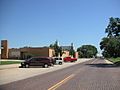
Nickerson High School 2005
-
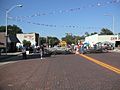
Nickerson Main Street
-
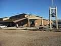
United Methodist Church
-
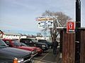
Panther Den


- City
- Schools
- Maps
Education
The community is served by Nickerson–South Hutchinson USD 309 public school district. The district's schools, which have an average enrollment of 350 students annually, include Nickerson High School and Nickerson Grade School.
Infrastructure
Transportation
Highway
K-96 state highway passes through Nickerson. KDOT has proposed converting K-96 into a 4-lane highway and bypass the cities of Nickerson and Sterling. Numerous routes have been studied.
Rail
The Kansas and Oklahoma Railroad passes through the city.
See also
 In Spanish: Nickerson (Kansas) para niños
