
Nixon, Texas facts for kids
Quick facts for kids
Nixon, Texas
|
|
|---|---|
  Nixon-area, listed as "Rancho" and "Clear Fork" c. 1873. "Riddleville" is now Karnes City. 20th-century Baptist-architecture of Nixon shown above
|
|
| Country | United States |
| State | Texas |
| Counties | Gonzales, Wilson |
| Settled | 1849 (Rancho) |
| Founded | 1852 (R.T. Nixon Plantation) |
| Incorporated | 1906 (John T. Nixon Tract) |
| Area | |
| • Total | 1.57 sq mi (4.06 km2) |
| • Land | 1.56 sq mi (4.05 km2) |
| • Water | 0.01 sq mi (0.01 km2) |
| Elevation | 390 ft (119 m) |
| Population
(2010)
|
|
| • Total | 2,385 |
| • Estimate
(2019)
|
2,542 |
| • Density | 1,626.36/sq mi (627.94/km2) |
| Time zone | UTC-6 (Central (CST)) |
| • Summer (DST) | UTC-5 (CDT) |
| ZIP code |
78140
|
| Area code(s) | 830 |
| FIPS code | 48-51588 |
| GNIS feature ID | 1363917 |
Nixon is a city, self-described as a "compact neighborhood," at ![]() US 87 and the junction of Karnes, Gonzales and Wilson counties; alongside the Clear Fork Creek in the Juan J. Tejada League, in the U.S. state of Texas. Approaching 100 city blocks, the Nixon urban-area is defined by its schools at its north-end in the neighborhood of Rancho; with the southwest boundary hosting its industrial park and meat packing facilities, upon the 87-corridor towards Pandora and the county seat of Floresville.
US 87 and the junction of Karnes, Gonzales and Wilson counties; alongside the Clear Fork Creek in the Juan J. Tejada League, in the U.S. state of Texas. Approaching 100 city blocks, the Nixon urban-area is defined by its schools at its north-end in the neighborhood of Rancho; with the southwest boundary hosting its industrial park and meat packing facilities, upon the 87-corridor towards Pandora and the county seat of Floresville.
The population was 2,385 at the 2010 census. Nixon is located primarily within Gonzales County; however, most of its major employers and assets are alongside the eastern Wilson County line. The city has a total area of 1.6 square miles (4.1 km2), all land. The Wilson County portion of Nixon is part of the San Antonio Metropolitan Statistical Area.
Nixon was formed across the landholdings of the Nixon family through the end of the 19th century, beginning as a 14,000 acre plantation south of Luling and north of Belmont. In the early 20th century through the present day, Nixon continually consolidated southward at John T. Nixon's land closer to the original settlements of Cuero, Goliad and Indianola, once acting as a rail station; this confluence once having the original name of "Rancho," so named for its free-range cattle industry.
The city is served primarily by employers that include a publicly-traded oil refinery, a chicken slaughterhouse, and its municipal services, especially the Nixon-Smiley Consolidated Independent School District. In 2018, the aggregate income of urban Nixon was an estimated $58,035,500. In 2019 according to the Texas Department of Transportation, the aggregate annual-average-daily-traffic (AADT) of urban Nixon was rated at 22,928 vehicles.
Contents
Geography
Nixon is located at 29°16′14″N 97°45′45″W / 29.27056°N 97.76250°W (29.270443, -97.762423), primarily within Gonzales County. The city has a total area of 1.6 square miles (4.1 km2), all land.
History
Nixon was founded in 1906 as Nixonville, when the Galveston, Harrisburg and San Antonio Railway built its lines through the John T. Nixon Ranch.
Demographics
| Historical population | |||
|---|---|---|---|
| Census | Pop. | %± | |
| 1920 | 1,124 | — | |
| 1930 | 1,037 | −7.7% | |
| 1940 | 1,835 | 77.0% | |
| 1950 | 1,875 | 2.2% | |
| 1960 | 1,751 | −6.6% | |
| 1970 | 1,925 | 9.9% | |
| 1980 | 2,008 | 4.3% | |
| 1990 | 1,995 | −0.6% | |
| 2000 | 2,186 | 9.6% | |
| 2010 | 2,385 | 9.1% | |
| 2019 (est.) | 2,542 | 6.6% | |
| U.S. Decennial Census | |||
As of the census of 2000, there were 2,186 people, 686 households, and 506 families residing in the city. The population density was 1,928.1 people per square mile (746.9/km2). There were 803 housing units at an average density of 708.3 per square mile (274.4/km2). The racial makeup of the city was 69.99% White, 2.84% African American, 0.91% Native American, 0.09% Asian, 24.15% from other races, and 2.01% from two or more races. Hispanic or Latino of any race were 61.57% of the population.
There were 686 households, out of which 42.1% had children under the age of 18 living with them, 48.0% were married couples living together, 17.2% had a female householder with no husband present, and 26.2% were non-families. 24.1% of all households were made up of individuals, and 13.3% had someone living alone who was 65 years of age or older. The average household size was 3.02 and the average family size was 3.53.
In the city, the population was spread out, with 31.5% under the age of 18, 10.8% from 18 to 24, 26.7% from 25 to 44, 16.2% from 45 to 64, and 14.7% who were 65 years of age or older. The median age was 31 years. For every 100 females, there were 94.8 males. For every 100 females age 18 and over, there were 89.5 males.
The median income for a household in the city was $22,104, and the median income for a family was $25,139. Males had a median income of $21,250 versus $15,491 for females. The per capita income for the city was $10,135. About 22.3% of families and 27.5% of the population were below the poverty line, including 37.7% of those under age 18 and 25.0% of those age 65 or over.
Notable people
- LiL Honesty (rapper)
- Little Joe, Tejano singer
- Andre Marrou, 1992 Libertarian Party presidential nominee
- Chris Marrou, former news anchor for KENS 5-TV in San Antonio
- Carlton McKinney, retired professional basketball player
Manuel Zepeda
Auvye Trammel
The then-current Nixon police chief was fired during the trafficking investigation just prior to Trammel's arrest; the former chief cites reasons of retaliation for investigating the then-councilman, while the city claims he failed to meet occupational standards.
Images for kids
-
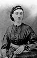
Fannie Andrews Nixon, wife of Old Nixon, Texas founder, Robert Thomas Nixon (1879); one of the first schoolteachers of the area

See also
 In Spanish: Nixon (Texas) para niños
