
North Fremantle, Western Australia facts for kids
Quick facts for kids North FremantlePerth, Western Australia |
|||||||||||||||
|---|---|---|---|---|---|---|---|---|---|---|---|---|---|---|---|

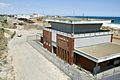
Dingo Flour mill
|
|||||||||||||||
| Population | 3,340 (2016 census) | ||||||||||||||
| Postcode(s) | 6159 | ||||||||||||||
| Location |
|
||||||||||||||
| LGA(s) | City of Fremantle | ||||||||||||||
| State electorate(s) | Cottesloe | ||||||||||||||
| Federal Division(s) | Fremantle | ||||||||||||||
|
|||||||||||||||
North Fremantle is a suburb of Perth, Western Australia, located within the City of Fremantle, a local government area of the state. Its postcode is 6159.
North Fremantle is situated on a peninsula, with the Indian Ocean bounding the west side and the Swan River the east side. On the north side it is separated from the suburb of Mosman Park by McCabe Street. North Fremantle has one train station, located on Stirling Highway, which provides train services into Fremantle and Perth city. There are various bus stations in North Fremantle, providing access to outer Perth suburbs.
Marshalling yard
The suburb was once the site of Western Australian Government Railways Leighton Marshalling Yards, which linked the North Fremantle industrial area and North Quay.
The area is now being redveloped by the state government.
The Swan river on the border of North Fremantle, holds great significance to the Aboriginal community who call the river “Derbal Yaragan”.
Images for kids
-
The old Leighton Marshalling Yards building

