
North Uist facts for kids
| Gaelic name | Uibhist a Tuath |
|---|---|
| Meaning of name | North Uist (etymology of "Uibhist" is unclear) |
| OS grid reference | NF835697 |
| Coordinates | 57°36′00″N 7°19′59″W / 57.6°N 7.333°W |
| Physical geography | |
| Island group | Uists and Barra |
| Area | 30,305 hectares (117 sq mi) |
| Area rank | 10 |
| Highest elevation | Eaval 1,138 ft (347 m) |
| Administration | |
| Sovereign state | United Kingdom |
| Country | Scotland |
| Council area | Comhairle nan Eilean Siar |
| Demographics | |
| Population | 1,254 |
| Population density | 4.14 people/km2 |
| Largest settlement | Lochmaddy |
| References | |
| Official name: North Uist Machair and Islands | |
| Designated: | 22 July 1997 |
| Reference #: | 1004 |
North Uist (Scottish Gaelic: Uibhist a Tuath) is an island and community in the Outer Hebrides of Scotland.
North Uist is the tenth largest Scottish island, and the thirteenth largest island surrounding Great Britain. It has an area of 117 square miles (303 km2), slightly smaller than South Uist. North Uist is connected by causeways to Benbecula via Grimsay, to Berneray, and to Baleshare.
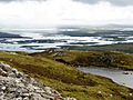
With the exception of the south east, the island is very flat, and covered with a patchwork of peat bogs, low hills and lochs, with more than half the land being covered by water. Some of the lochs contain a mixture of fresh and tidal salt water, giving rise to some complex and unusual habitats.
Loch Sgadabhagh is the largest loch by area on North Uist but Loch Obisary has about twice the volume of water. The northern part of the island is part of the South Lewis, Harris and North Uist National Scenic Area, one of 40 in Scotland.
-
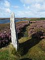
The remains of Pobull Fhinn stone circle
-
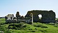
The ruins of Teampull na Trionaid, a church said to have been built by Amy of Garmoran, after her divorce
-
View over western North Uist
-
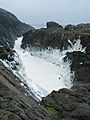
sea foam in North West North Uist
-
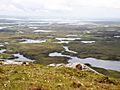
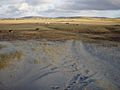
View over northern North Uist
-
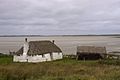
Traditional cottage on uist
-
The Battlefield at Carinish
-
View over southern North Uist
-
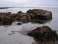
Kelp on the coast of North Uist
-
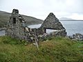
One of many abandoned buildings on Uist
-
Causeway from Benbecula (foreground) to North Uist


Images for kids
-
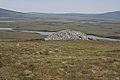
The cairn at Langass

See also
 In Spanish: North Uist para niños
