Norwood, New Jersey facts for kids
Quick facts for kids
Norwood, New Jersey
|
|
|---|---|
|
Borough
|
|
| Borough of Norwood | |
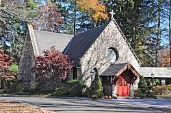
Church of the Holy Communion
|
|
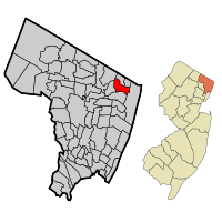
Map highlighting Norwood's location within Bergen County. Inset: Bergen County's location within New Jersey.
|
|
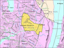
Census Bureau map of Norwood, New Jersey
|
|
| Country | |
| State | |
| County | |
| Incorporated | March 21, 1905 |
| Named for | "North-woods" |
| Government | |
| • Type | Borough |
| • Body | Borough Council |
| Area | |
| • Total | 2.79 sq mi (7.24 km2) |
| • Land | 2.79 sq mi (7.21 km2) |
| • Water | 0.01 sq mi (0.02 km2) 0.32% |
| Area rank | 355th of 565 in state 32nd of 70 in county |
| Elevation | 30 ft (9 m) |
| Population | |
| • Total | 5,711 |
| • Estimate
(2019)
|
5,793 |
| • Rank | 360th of 566 in state 57th of 70 in county |
| • Density | 2,093.5/sq mi (808.3/km2) |
| • Density rank | 286th of 566 in state 56th of 70 in county |
| Time zone | UTC−05:00 (Eastern (EST)) |
| • Summer (DST) | UTC−04:00 (Eastern (EDT)) |
| ZIP Code |
07648
|
| Area code(s) | 201 exchanges: 750, 767, 768, 784 |
| FIPS code | 3400353610 |
| GNIS feature ID | 0885329 |
| Website | |
Norwood is a borough in Bergen County, New Jersey, United States. As of the 2010 United States Census, the borough's population was 5,711, reflecting a decline of 40 (-0.7%) from the 5,751 counted in the 2000 Census, which had in turn increased by 893 (+18.4%) from the 4,858 counted in the 1990 Census.
Norwood was formed as a borough by an act of the New Jersey Legislature on March 14, 1905, from portions of Harrington Township.
Contents
History
The territory comprising Norwood was originally settled about 1670 by a dozen or more families mostly from the Dutch Republic, who purchased the land under the Tappan Patent. About that time a grant was also given by Philip Carteret, Governor of the Province of East Jersey, during the reign of King Charles II of England. The Lenni Lenape Native Americans roamed the valley.
The name Norwood emanated from the old description of its location in the "North-Woods". It was a part of Harrington Township, which was formed in 1775 from the northernmost portions of Hackensack Township and New Barbadoes Township, stretching from the Hudson River in the east to the Saddle River in the west.
In 1840, the portions of Harrington Township west of the Hackensack River were taken away to create Washington Township. At that point, Harrington Township was somewhat in the form of a square measuring across each way about 5 miles (8 km), bounded on the north by Rockland County, New York; east by the Hudson River, south by Hackensack Township and west by the Hackensack River. At that time, Norwood, Northvale (once called Neuvy), Old Tappan, Demarest, Closter and Harrington Park were communities within Harrington Township.
On March 14, 1905, Norwood seceded from its parent Harrington Township and was incorporated as an independent borough.
Geography
According to the United States Census Bureau, Norwood borough had a total area of 2.735 square miles (7.083 km2), including 2.728 square miles (7.066 km2) of land and 0.007 square miles (0.017 km2) of water (0.24%).
Norwood is in the northeastern part of New Jersey, about 2 miles (3 km) from the New York state line. It is bordered by the boroughs of Northvale, Old Tappan, Harrington Park, Closter, Alpine and Rockleigh.
Unincorporated communities, localities and place names within the borough include West Norwood.
Demographics
| Historical population | |||
|---|---|---|---|
| Census | Pop. | %± | |
| 1900 | 400 | — | |
| 1910 | 564 | 41.0% | |
| 1920 | 820 | 45.4% | |
| 1930 | 1,358 | 65.6% | |
| 1940 | 1,512 | 11.3% | |
| 1950 | 1,792 | 18.5% | |
| 1960 | 2,852 | 59.2% | |
| 1970 | 4,398 | 54.2% | |
| 1980 | 4,413 | 0.3% | |
| 1990 | 4,858 | 10.1% | |
| 2000 | 5,751 | 18.4% | |
| 2010 | 5,711 | −0.7% | |
| 2019 (est.) | 5,793 | 1.4% | |
| Population sources: 1910-1930 1900-2010 2000 2010 |
|||
2010 Census
As of the census of 2010, there were 5,711 people, 1,927 households, and 1,542 families residing in the borough. The population density was 2,093.5 per square mile (808.3/km2). There were 2,007 housing units at an average density of 735.7 per square mile (284.1/km2)*. The racial makeup of the borough was 69.25% (3,955) White, 1.37% (78) Black or African American, 0.00% (0) Native American, 27.18% (1,552) Asian, 0.02% (1) Pacific Islander, 1.03% (59) from other races, and 1.16% (66) from two or more races. [[Hispanic (U.S. Census)|Hispanic or Latino of any race were 4.55% (260) of the population. Korean Americans accounted for 20.1% of the population.
There were 1,927 households out of which 36.8% had children under the age of 18 living with them, 67.8% were married couples living together, 9.0% had a female householder with no husband present, and 20.0% were non-families. 18.2% of all households were made up of individuals, and 10.5% had someone living alone who was 65 years of age or older. The average household size was 2.84 and the average family size was 3.23. Same-sex couples headed 7 households in 2010, an increase from the 6 counted in 2000.
In the borough, the population was spread out with 23.1% under the age of 18, 6.5% from 18 to 24, 18.6% from 25 to 44, 31.7% from 45 to 64, and 20.0% who were 65 years of age or older. The median age was 46.1 years. For every 100 females there were 88.0 males. For every 100 females ages 18 and old there were 85.4 males.
The Census Bureau's 2006-2010 American Community Survey showed that (in 2010 inflation-adjusted dollars) median household income was $102,132 (with a margin of error of +/- $9,413) and the median family income was $107,356 (+/- $10,538). Males had a median income of $80,837 (+/- $8,419) versus $56,429 (+/- $15,763) for females. The per capita income for the borough was $38,755 (+/- $5,524). About 0.6% of families and 1.3% of the population were below the poverty line, including 0.9% of those under age 18 and 0.9% of those age 65 or over.
Transportation
Roads and highways
As of May 2010[update], the borough had a total of 25.31 miles (40.73 km) of roadways, of which 18.27 miles (29.40 km) were maintained by the municipality and 7.04 miles (11.33 km) by Bergen County.
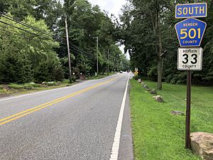
County Route 501 and County Route 505 pass through Norwood.
Public transportation
Rockland Coaches provides service on routes 20/20T to the Port Authority Bus Terminal in Midtown Manhattan.
Saddle River Tours / Ameribus offered service on the 20 / 84 route to the George Washington Bridge Bus Station.
Wildlife
The forests in Norwood house many deciduous species, sheltering deer, wild turkey, turtles, foxes, rabbits, wolves, and even coyote. Suburban sprawl is beginning to interfere with the wildlife. Deer and auto collisions as well as coyote and human interaction is a problem. Wolves have never been seen in Norwood.
Education
The Norwood Public School District serves students in kindergarten through eighth grade at Norwood Public School. As of the 2018–19 school year, the district, comprised of one school, had an enrollment of 618 students and 48.5 classroom teachers (on an FTE basis), for a student–teacher ratio of 12.7:1.
Students in public school for ninth through twelfth grades attend Northern Valley Regional High School at Old Tappan, together with students from Harrington Park, Northvale and Old Tappan, along with students from Rockleigh who attend the high school as part of a sending/receiving relationship. The school is one of the two schools of the Northern Valley Regional High School District, which also serves students from the neighboring communities of Closter, Demarest and Haworth at the Northern Valley Regional High School at Demarest. During the 1994–96 school years, Northern Valley Regional High School at Old Tappan was awarded the Blue Ribbon School Award of Excellence by the United States Department of Education. As of the 2018–19 school year, the high school had an enrollment of 1,170 students and 97.9 classroom teachers (on an FTE basis), for a student–teacher ratio of 12.0:1. Seats on the high school district's nine-member board of education are allocated based on the population of the constituent municipalities, with one seat allocated to Norwood.
Public school students from the borough, and all of Bergen County, are eligible to attend the secondary education programs offered by the Bergen County Technical Schools, which include the Bergen County Academies in Hackensack, and the Bergen Tech campus in Teterboro or Paramus. The district offers programs on a shared-time or full-time basis, with admission based on a selective application process and tuition covered by the student's home school district.
Notable people
People who were born in, residents of, or otherwise closely associated with Norwood include:
- Kenny Anderson (born 1970), basketball player who began his NBA career with the New Jersey Nets.
- Colleen Broomall (born 1983), actress and journalist.
- Devin Fuller (born 1994), wide receiver who played for the Atlanta Falcons of the National Football League.
- Jordan Fuller (born 1998), American football safety for the Los Angeles Rams.
- Bruce Harper (born 1955), former running back for the New York Jets.
- Catfish Hunter (1946–1999), pitcher who played for the Kansas City / Oakland A's and New York Yankees.
- Walter H. Jones (1912–1982), politician who served in the New Jersey Senate and was a candidate for Governor of New Jersey.
- Don Mattingly (born 1961), manager of the Los Angeles Dodgers who lived in the borough while playing for the New York Yankees.
- Frank Messina (born c. 1968), poet and author.
- Gene Michael (1938-2017), former player, manager and executive in Major League Baseball.
- Thurman Munson (1947–1979), former baseball player who played catcher for the New York Yankees.
- Graig Nettles (born 1944), former baseball player who played third base for the New York Yankees.
- Dianna Russini (born 1983), sports journalist on ESPN.
- Julian Sanchez (born 1979), libertarian writer and journalist.
- Pamela Redmond Satran, author.
- Abi Varghese, director and writer, best known for his Netflix released show Brown Nation.
See also
 In Spanish: Norwood (Nueva Jersey) para niños


