Olean, Indiana facts for kids
Quick facts for kids
Olean, Indiana
|
|
|---|---|
| Country | United States |
| State | Indiana |
| County | Ripley |
| Township | Brown |
| Elevation | 955 ft (291 m) |
| Time zone | UTC-5 (Eastern (EST)) |
| • Summer (DST) | UTC-4 (EDT) |
| ZIP code |
47882
|
| Area code(s) | 812, 930 |
| GNIS feature ID | 440628 |
Olean is an unincorporated community in Brown Township, Ripley County, in the U.S. state of Indiana.
History
Olean was laid out in 1858. The community was named after Olean, New York. A post office was established at Olean in 1844, and remained in operation until it was discontinued in 1905.
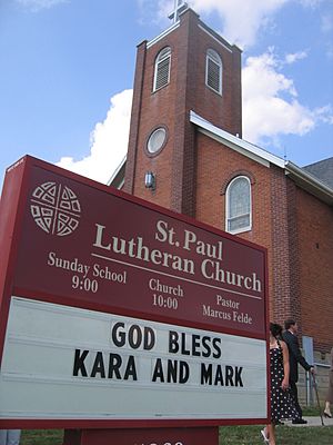
St. Paul Lutheran Church in Olean was recognized by the Indiana Senate in 2007 on its 150th anniversary.
Geography
Olean lies on Indiana State Road 129 about 6 miles (9.7 km) south of Versailles and Versailles State Park. Cross Plains is 3.3 miles (5.3 km) south of Olean, and Friendship about 6.5 miles (10.5 km) southeast.

All content from Kiddle encyclopedia articles (including the article images and facts) can be freely used under Attribution-ShareAlike license, unless stated otherwise. Cite this article:
Olean, Indiana Facts for Kids. Kiddle Encyclopedia.


