
Ontonagon County, Michigan facts for kids
Quick facts for kids
Ontonagon County
|
|
|---|---|

|
|

Location within the U.S. state of Michigan
|
|
 Michigan's location within the U.S. |
|
| Country | |
| State | |
| Founded | March 9, 1843 1848 organized |
| Named for | Ontonagon River |
| Seat | Ontonagon |
| Largest village | Ontonagon |
| Area | |
| • Total | 3,741 sq mi (9,690 km2) |
| • Land | 1,311 sq mi (3,400 km2) |
| • Water | 2,430 sq mi (6,300 km2) 65%% |
| Population
(2020)
|
|
| • Total | 5,816 |
| • Density | 5.2/sq mi (2.0/km2) |
| Time zone | UTC−5 (Eastern) |
| • Summer (DST) | UTC−4 (EDT) |
| Congressional district | 1st |
| Website | http://ontonagoncounty.org/ |

Ontonagon County ( ON-tə-NAH-gən) is a county in the Upper Peninsula of the U.S. state of Michigan. As of the 2020 Census, the population was 5,816, making it Michigan's third-least populous county. The county seat is Ontonagon. The county was set off in 1843, and organized in 1848. Its territory had been organized as part of Chippewa and Mackinac counties. With increasing population in the area, more counties were organized. After Ontonagon was organized, it was split to create Gogebic County. It is also the westernmost U.S. county that uses the Eastern Time Zone.
The county is named after the Ontonagon River. The name is said to be loosely derived from an Ojibwe language word noojitoon ziibi, meaning "hunting river." A French transliteration, Nantounagon, identified the river on a 1670 French map. Alternatively, and perhaps more accurately, it is said to be derived from the Ojibwa onagon, which means "dish" or "bowl." See List of Michigan county name etymologies.
Contents
Geography
According to the U.S. Census Bureau, the county has a total area of 3,741 square miles (9,690 km2), of which 1,311 square miles (3,400 km2) is land and 2,430 square miles (6,300 km2) (65%) is water. It is the third-largest county in Michigan by area.
At a longitude of 89.5°W, it is the westernmost county in the United States contained entirely within the Eastern Time Zone.
Geographic features
- Lake Superior
- Lake Gogebic is the largest lake in the Upper Peninsula.
- Corpse Pond
- Ontonagon River
- Firesteel River
- Flintsteel River
- Halfway Creek
- Townline Creek
- Maple Leaf Creek
Major highways
 US 45
US 45 M-26
M-26 M-28
M-28 M-38
M-38 M-64
M-64
Airport
Ontonagon County Airport (KOGM) serves the county and surrounding communities.
Adjacent counties
- Keweenaw County (northeast)
- Houghton County (east)
- Iron County (southeast/CST Border)
- Gogebic County (south/CST Border)
- Ashland County, Wisconsin (west/CST Border)
- Cook County, Minnesota (northwest/CST Border)
National protected areas
- Keweenaw National Historical Park (part)
- Ottawa National Forest (part)
Demographics
| Historical population | |||
|---|---|---|---|
| Census | Pop. | %± | |
| 1850 | 389 | — | |
| 1860 | 4,568 | 1,074.3% | |
| 1870 | 2,845 | −37.7% | |
| 1880 | 2,565 | −9.8% | |
| 1890 | 3,756 | 46.4% | |
| 1900 | 6,197 | 65.0% | |
| 1910 | 8,650 | 39.6% | |
| 1920 | 12,428 | 43.7% | |
| 1930 | 11,114 | −10.6% | |
| 1940 | 11,359 | 2.2% | |
| 1950 | 10,282 | −9.5% | |
| 1960 | 10,584 | 2.9% | |
| 1970 | 10,548 | −0.3% | |
| 1980 | 9,861 | −6.5% | |
| 1990 | 8,854 | −10.2% | |
| 2000 | 7,818 | −11.7% | |
| 2010 | 6,780 | −13.3% | |
| 2020 | 5,816 | −14.2% | |
| US Decennial Census 1790-1960 1900-1990 1990-2000 2010-2018 |
|||
The 2010 United States Census indicates Ontonagon County had a population of 6,780. This decrease of 1038 people from the 2000 United States Census represents a -13.3% change in population. In 2010 there were 3,258 households and 1,954 families in the county. The population density was 6 people per square mile (2/km2). There were 5,672 housing units at an average density of 4 per square mile (2/km2). 97.3% of the population were White, 1.1% Native American, 0.2% Asian, 0.1% Black or African American, 0.1% of some other race and 1.3% of two or more races. 0.9% were Hispanic or Latino (of any race).
There were 3,258 households, out of which 15.8% had children under the age of 18 living with them, 50.3% were married couples living together, 6.0% had a female householder with no husband present, and 40.0% were non-families. 34.8% of all households were made up of individuals, and 17.0% had someone living alone who was 65 years of age or older. The average household size was 2.06 and the average family size was 2.61.
The county population contained 15.8% under the age of 18, 4.1% from 18 to 24, 16.7% from 25 to 44, 37.0% from 45 to 64, and 26.3% who were 65 years of age or older. The median age was 52.7 years. The population is 51.6% male and 48.4% female.
The median income for a household in the county was $34,786, and the median income for a family was $46,845. The per capita income for the county was $22,195. About 9.0% of families and 14.3% of the population were below the poverty line, including 22.2% of those under age 18 and 6.7% of those age 65 or over.
Communities
Village
- Ontonagon (county seat)
Census-designated place
Unincorporated communities
Townships
- Bergland Township
- Bohemia Township
- Carp Lake Township
- Greenland Township
- Haight Township
- Interior Township
- Matchwood Township
- McMillan Township
- Ontonagon Township
- Rockland Township
- Stannard Township
Ghost town
Images for kids
-
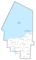
U.S. Census data map showing local municipal boundaries within Ontonagon County

See also
 In Spanish: Condado de Ontonagon para niños
