
Osage Beach, Missouri facts for kids
Quick facts for kids
Osage Beach, Missouri
|
|
|---|---|

Main Street Music Hall
|
|

Location of Osage Beach, Missouri
|
|
| Country | United States |
| State | Missouri |
| Counties | Camden, Miller |
| Founded | 1886 (as Zebra) 1935 (as Osage Beach) |
| Incorporated | 1959 |
| Area | |
| • Total | 10.38 sq mi (26.89 km2) |
| • Land | 9.81 sq mi (25.41 km2) |
| • Water | 0.57 sq mi (1.48 km2) |
| Elevation | 860 ft (262 m) |
| Population
(2010)
|
|
| • Total | 4,351 |
| • Estimate
(2019)
|
4,666 |
| • Density | 475.59/sq mi (183.63/km2) |
| Time zone | UTC-6 (Central (CST)) |
| • Summer (DST) | UTC-5 (CDT) |
| ZIP code |
65065
|
| Area code(s) | 573 |
| FIPS code | 29-55244 |
| GNIS feature ID | 0729792 |
| U.S. Routes | |
| Website | http://www.osagebeach-mo.gov/ |
Osage Beach is a city in Camden and Miller counties in the U.S. state of Missouri. Most of the city is in Camden County, while a small eastern sliver is in Miller County. The population was 4,351 at the 2010 census.
Contents
History
The city, known today as Osage Beach, was originally named Zebra, Missouri. The city's post office was established in 1886 and was located on the riverbottom, which was east of the present day post office. The Grand Glaize bridge was replaced in the 1980s. Like the surrounding areas, Zebra was nothing more than a name with a post office. Zebra was soon flooded out during the construction of the Bagnell Dam, which created one of the North America's largest man-made lakes — the Lake of the Ozarks. The post office was rebuilt on the top of a nearby cliff at the heart of the brand new lake. In 1935, residents of the city changed the post office designation to Osage Beach, but no official boundaries were formulated until the early 1960s.
Osage Beach was officially incorporated on May 22, 1959. However, due to political upheaval and discontent among some in the new town, a petition for disincorporation was filed. On May 17, 1960, voters approved legal disincorporation in a special election. But the battle wasn't over yet. In late 1963, a group interested in re-incorporation began organizing and planning a strategy for change. The group lobbied for incorporation stating that with a growing community certain services could only be afforded to the people through local government organization; for instance, sanitation, fire and police protection, street development, sewer and water service, and even the right to serve liquor-by-the-drink through city liquor licensing. Tourists were becoming more common to the area as entertainment and lake activities grew in popularity, many residents were moving in permanently, new businesses were forming, and the group feared without incorporation Osage Beach did not progress and ultimately would lose its identity as the Lake's largest and most progressive recreational area. The group met publicly to discuss the advantages and disadvantages of incorporation and directly confronted the issues that dealt with the disincorporation of 1960. The public was eventually called to another special election in 1965.
In the spring of 1965, voters approved the second and final incorporation of the City of Osage Beach and a fourth class city was created or more appropriately stated — re-created. Official boundaries of the city were established, four wards were formed (two on each side of the Grand Glaize bridge) and two aldermen per ward, a mayor, and a marshall were to be elected at large.
Geography
Osage Beach is located at 38°8′18″N 92°38′55″W / 38.13833°N 92.64861°W (38.138354, -92.648678).
According to the United States Census Bureau, the city has a total area of 10.33 square miles (26.75 km2), of which, 9.75 square miles (25.25 km2) is land and 0.58 square miles (1.50 km2) is water. The city is located on the shores of the Lake of the Ozarks.
Demographics
| Historical population | |||
|---|---|---|---|
| Census | Pop. | %± | |
| 1960 | 741 | — | |
| 1970 | 1,091 | 47.2% | |
| 1980 | 1,992 | 82.6% | |
| 1990 | 2,599 | 30.5% | |
| 2000 | 3,662 | 40.9% | |
| 2010 | 4,351 | 18.8% | |
| 2019 (est.) | 4,666 | 7.2% | |
|
|
|||
2010 census
At the 2010 census there were 4,351 people, 2,038 households, and 1,166 families living in the city. The population density was 446.3 inhabitants per square mile (172.3/km2). There were 5,261 housing units at an average density of 539.6 per square mile (208.3/km2). The racial makeup of the city was 93.6% White, 1.1% African American, 0.6% Native American, 1.1% Asian, 0.2% Pacific Islander, 2.4% from other races, and 1.1% from two or more races. Hispanic or Latino of any race were 4.8%.
Of the 2,038 households 19.9% had children under the age of 18 living with them, 44.3% were married couples living together, 8.0% had a female householder with no husband present, 5.0% had a male householder with no wife present, and 42.8% were non-families. 35.3% of households were one person and 13% were one person aged 65 or older. The average household size was 2.04 and the average family size was 2.57.
The median age was 48.9 years. 15.8% of residents were under the age of 18; 8.6% were between the ages of 18 and 24; 20.2% were from 25 to 44; 31.3% were from 45 to 64; and 24% were 65 or older. The gender makeup of the city was 48.9% male and 51.1% female.
Education
Schools
- Osage Beach Elementary-Camdenton R-III
- School of the Osage (Miller County R-II School District)
Colleges and universities
- Columbia College - Lake of the Ozarks campus
- State Fair Community College - Lake of the Ozarks campus
- Central Methodist University - Lake of the Ozarks campus
Library
Osage Beach has a public library, the Osage Beach Library.
Transportation
There are two general aviation airports in the Osage Beach area: Grand Glaize-Osage Beach Airport, which is within the city limits, and Lee C. Fine Memorial Airport, which is located about 7 miles (11 km) away in Kaiser.
The nearest primary commercial airports are Columbia Regional Airport (about 65 miles [105 km] away) and Springfield–Branson National Airport (about 93 miles [150 km] away). The smaller Waynesville-St. Robert Regional Airport is about 53 miles (85 km) away.
US Route 54 runs through Osage Beach. US Route 54 runs north to Jefferson City. US Route 54 runs south to Camdenton.
Infrastructure
As Osage Beach is predominantly a resort town, as such it boast several tourist attractions and amenities including a outlet mall with brands such as J Crew, Coach, and Sunglass Hut.
Images for kids
-
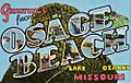
Postcard featuring Osage Beach

See also
 In Spanish: Osage Beach (Misuri) para niños
