
Ozark, Alabama facts for kids
Quick facts for kids
Ozark
|
|
|---|---|

Location of Ozark in Dale County, Alabama.
|
|
| Country | United States |
| State | Alabama |
| County | Dale |
| Settled | 1822 |
| Incorporated | October 27, 1870 |
| Government | |
| • Type | Mayor/City Council |
| Area | |
| • Total | 34.34 sq mi (88.94 km2) |
| • Land | 34.10 sq mi (88.33 km2) |
| • Water | 0.23 sq mi (0.61 km2) |
| Elevation | 417 ft (127 m) |
| Population
(2020)
|
|
| • Total | 14,368 |
| • Density | 421.30/sq mi (162.66/km2) |
| Time zone | UTC-6 (Central (CST)) |
| • Summer (DST) | UTC-5 (CDT) |
| ZIP codes |
36360-36361
|
| Area code(s) | 334 |
| FIPS code | 01-57648 |
| GNIS feature ID | 0152832 |
Ozark is a city in and the county seat of Dale County, Alabama, United States. As of the 2010 census, the population of the city was 14,907.
Ozark is the principal city of the Ozark Micropolitan Statistical Area, as well as a part of the Dothan-Ozark Combined Statistical Area. Ozark was originally a part of Enterprise–Ozark micropolitan area before being split, and for a longer while was originally part of the Dothan-Enterprise-Ozark combined statistical area but Enterprise is now its own separate primary statistical area in later censuses. Fort Rucker, the primary flight training base for Army Aviation, abuts Ozark.
History
The Ozark area was originally inhabited by the Muscogee people. It is said that Ozark received its name after a traveler visited and was reminded of the Ozark Mountains in Arkansas.
The first known European settler in Ozark was John Merrick, Sr., a veteran of the Revolutionary War, in 1822. In honor of him, the town was named Merricks. It was later changed to Woodshop, which was its name when the town received its post office. The first appearance of the name Ozark was in 1855, when the citizens requested a name change.
The county seat was moved from Newton to Ozark 1870.
Ozark is home to three sites listed on the National Register of Historic Places: the Claybank Log Church, the Samuel Lawson Dowling House, and the J. D. Holman House.
Geography
Ozark is located at 31°26′53″N 85°38′31″W / 31.44806°N 85.64194°W (31.448169, −85.642009). It is part of the Wiregrass Region.
According to the U.S. Census Bureau, the city has a total area of 34.5 square miles (89 km2) of which 34.2 square miles (89 km2) is land and 0.2 square miles (0.52 km2) (0.70%) is water.
Demographics
| Historical population | |||
|---|---|---|---|
| Census | Pop. | %± | |
| 1880 | 512 | — | |
| 1890 | 1,195 | 133.4% | |
| 1900 | 1,570 | 31.4% | |
| 1910 | 2,229 | 42.0% | |
| 1920 | 2,518 | 13.0% | |
| 1930 | 3,103 | 23.2% | |
| 1940 | 3,601 | 16.0% | |
| 1950 | 5,238 | 45.5% | |
| 1960 | 9,534 | 82.0% | |
| 1970 | 13,555 | 42.2% | |
| 1980 | 13,188 | −2.7% | |
| 1990 | 12,922 | −2.0% | |
| 2000 | 15,119 | 17.0% | |
| 2010 | 14,907 | −1.4% | |
| 2020 | 14,368 | −3.6% | |
| U.S. Decennial Census | |||
2010 census
At the 2010 census, there were 14,907 people, 6,209 households, and 4,064 families living in the city. The population density was 440 inhabitants per square mile (170/km2). There were 6,920 housing units at an average density of 201.1 per square mile (77.6/km2). The racial makeup of the city was 64.8% White, 30.2% Black or African American, 0.7% Native American, 0.9% Asian, 0.0% Pacific Islander, 0.8% from other races, and 2.6% from two or more races. 3.2% of the population were Hispanic or Latino of any race.

Of the 6,209 households 26.1% had children under the age of 18 living with them, 43.3% were married couples living together, 17.5% had a female householder with no husband present, and 34.5% were non-families. 30.5% of households were one person and 12.0% were one person aged 65 or older. The average household size was 2.35 and the average family size was 2.91.
The age distribution was 23.1% under the age of 18, 8.4% from 18 to 24, 23.1% from 25 to 44, 28.2% from 45 to 64, and 17.2% 65 or older. The median age was 41.2 years. For every 100 females, there were 90.7 males. For every 100 females age 18 and over, there were 92.6 males.
The median household income was $41,079 and the median family income was $52,061. Males had a median income of $41,513 versus $28,227 for females. The per capita income for the city was $22,103. About 13.6% of families and 18.4% of the population were below the poverty line, including 27.2% of those under age 18 and 14.4% of those age 65 or over.
2020 census
| Race | Num. | Perc. |
|---|---|---|
| White (non-Hispanic) | 8,147 | 56.7% |
| Black or African American (non-Hispanic) | 4,760 | 33.13% |
| Native American | 65 | 0.45% |
| Asian | 151 | 1.05% |
| Pacific Islander | 8 | 0.06% |
| Other/Mixed | 671 | 4.67% |
| Hispanic or Latino | 566 | 3.94% |
As of the 2020 United States census, there were 14,368 people, 5,946 households, and 3,651 families residing in the city.
Education
Ozark is served by the Ozark City Schools. Schools located in the city are Carroll High School (grades 9 through 12), Carroll Career Center (grades 9 through 12), D.A. Smith Middle School (grades 6 through 8), Harry N. Mixon Intermediate School (grades 3 through 5), and Joseph W. Lisenby Primary School (grades k through 2.)
There is one private school in Ozark – Harvest Christian School (K-12).
Post-secondary education is available at Enterprise State Community College's Alabama Aviation Center at Ozark. Programs are offered in aviation maintenance technology.
-
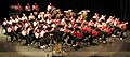
Carroll High School Band 2009
-

Carroll High School Marching Band "Pride of the Wiregrass" 2007


Notable people
- Steve Clouse, state representative
- Larry Donnell, tight end for the New York Giants
- Wilbur Jackson, National Football League
- Meg McGuffin, Miss Alabama 2015
- Steve McLendon, nose tackle/defensive end, Pittsburgh Steelers
- Byron Mitchell, former super middleweight boxing champion
- Marc Ronan, Major League Baseball catcher
- Naseeb Saliba, co-founder of Tutor-Saliba Corporation
- Josh Savage, professional football player
See also
 In Spanish: Ozark (Alabama) para niños
