
Palominas, Arizona facts for kids
Quick facts for kids
Palominas, Arizona
|
|
|---|---|

Location of Palominas in Cochise County, Arizona.
|
|

Palominas, Arizona
Location in Arizona
|
|
| Country | United States |
| State | Arizona |
| County | Cochise |
| Area | |
| • Total | 1.95 sq mi (5.05 km2) |
| • Land | 1.95 sq mi (5.04 km2) |
| • Water | 0.00 sq mi (0.01 km2) |
| Population
(2020)
|
|
| • Total | 222 |
| • Density | 114.02/sq mi (44.02/km2) |
| Time zone | UTC-7 (MST (no daylight saving time)) |
| ZIP code |
85615
|
| Area code(s) | 520 |
| FIPS code | 04-52230 |
| Website | [1] |
Palominas is a census-designated place located along the San Pedro River in the southern portion of Cochise County in the state of Arizona, United States. Palominas is located very close to the community of Miracle Valley along Arizona State Highway 92. The population of Palominas as of the 2010 U.S. Census was 212.
Demographics
| Historical population | |||
|---|---|---|---|
| Census | Pop. | %± | |
| 2020 | 222 | — | |
| U.S. Decennial Census | |||
Transportation
Cochice Connection provides bus connections between Douglas, Bisbee, and Sierra Vista, with a stop in Palominas.
Images for kids
-
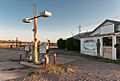
Old Abandoned Palominas Trading Post
-
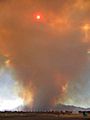
Monument Fire from Palominas, AZ on June 14, 2011


See also
 In Spanish: Palominas (Arizona) para niños

All content from Kiddle encyclopedia articles (including the article images and facts) can be freely used under Attribution-ShareAlike license, unless stated otherwise. Cite this article:
Palominas, Arizona Facts for Kids. Kiddle Encyclopedia.