
Parmer County, Texas facts for kids
Quick facts for kids
Parmer County
|
|
|---|---|

The Parmer County Courthouse in Farwell
|
|

Location within the U.S. state of Texas
|
|
 Texas's location within the U.S. |
|
| Country | |
| State | |
| Founded | 1907 |
| Named for | Martin Parmer |
| Seat | Farwell |
| Largest city | Friona |
| Area | |
| • Total | 885 sq mi (2,290 km2) |
| • Land | 881 sq mi (2,280 km2) |
| • Water | 4.4 sq mi (11 km2) 0.5% |
| Population
(2020)
|
|
| • Total | 9,869 |
| • Density | 11.151/sq mi (4.3056/km2) |
| Time zone | UTC−6 (Central) |
| • Summer (DST) | UTC−5 (CDT) |
| Congressional district | 19th |
Parmer County is a county located in the southwestern Texas Panhandle on the High Plains of the Llano Estacado in the U.S. state of Texas. As of the 2020 census, the population was 9,869. The county seat is Farwell. The county was created in 1876 and later organized in 1907. It is named in honor of Martin Parmer, a signer of the Texas Declaration of Independence and early judge. Parmer County was one of 10 prohibition, or entirely dry, counties in the state of Texas, but is now a wet county.
Contents
Geography
According to the U.S. Census Bureau, the county has a total area of 885 square miles (2,290 km2), of which 881 square miles (2,280 km2) is land and 4.4 square miles (11 km2) (0.5%) is water.
Major highways
 U.S. Highway 60
 U.S. Highway 70
 U.S. Highway 84
 State Highway 86
 State Highway 214
Adjacent counties
- Deaf Smith County (north)
- Castro County (east)
- Lamb County (southeast)
- Bailey County (south)
- Curry County, New Mexico (west)
Demographics
| Historical population | |||
|---|---|---|---|
| Census | Pop. | %± | |
| 1890 | 7 | — | |
| 1900 | 34 | 385.7% | |
| 1910 | 1,555 | 4,473.5% | |
| 1920 | 1,699 | 9.3% | |
| 1930 | 5,869 | 245.4% | |
| 1940 | 5,890 | 0.4% | |
| 1950 | 5,787 | −1.7% | |
| 1960 | 9,583 | 65.6% | |
| 1970 | 10,509 | 9.7% | |
| 1980 | 11,038 | 5.0% | |
| 1990 | 9,863 | −10.6% | |
| 2000 | 10,016 | 1.6% | |
| 2010 | 10,269 | 2.5% | |
| 2020 | 9,869 | −3.9% | |
| U.S. Decennial Census 1850–2010 2010 2020 |
|||
2020 census
| Race / Ethnicity | Pop 2010 | Pop 2020 | % 2010 | % 2020 |
|---|---|---|---|---|
| White alone (NH) | 3,943 | 3,187 | 38.40% | 32.29% |
| Black or African American alone (NH) | 91 | 53 | 0.89% | 0.54% |
| Native American or Alaska Native alone (NH) | 17 | 11 | 0.17% | 0.11% |
| Asian alone (NH) | 18 | 14 | 0.18% | 0.14% |
| Pacific Islander alone (NH) | 8 | 0 | 0.08% | 0.00% |
| Some Other Race alone (NH) | 2 | 39 | 0.02% | 0.40% |
| Mixed Race/Multi-Racial (NH) | 26 | 61 | 0.25% | 0.62% |
| Hispanic or Latino (any race) | 6,164 | 6,504 | 60.03% | 65.90% |
| Total | 10,269 | 9,869 | 100.00% | 100.00% |
Note: the US Census treats Hispanic/Latino as an ethnic category. This table excludes Latinos from the racial categories and assigns them to a separate category. Hispanics/Latinos can be of any race.
Communities
Cities
Unincorporated communities
Gallery
-
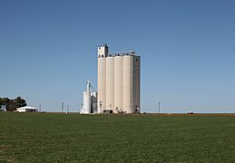
Grain elevator in northwestern Parmer County
-
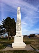
Ozark Trail monument in Farwell
-
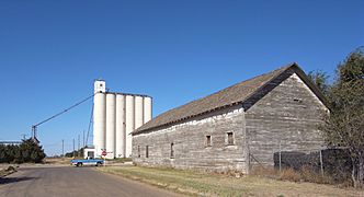
Weathered building and grain elevator in Farwell


Education
School districts:
- Bovina Independent School District
- Farwell Independent School District
- Friona Independent School District
- Hereford Independent School District
- Lazbuddie Independent School District
All of the county is in the service area of Amarillo College.
See also
 In Spanish: Condado de Parmer para niños
