Parshall, Colorado facts for kids
Quick facts for kids
Parshall, Colorado
|
|
|---|---|

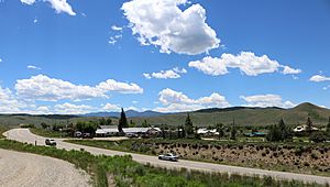
A view of Parshall from across U.S. Highway 40.
|
|

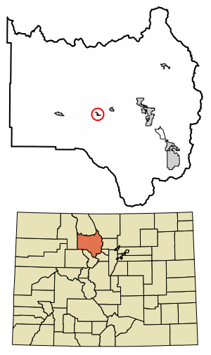
Location of the Parshall CDP in Grand County, Colorado.
|
|
| Country | |
| State | |
| County | Grand County |
| Government | |
| • Type | unincorporated town |
| Area | |
| • Total | 0.299 sq mi (0.774 km2) |
| • Land | 0.299 sq mi (0.774 km2) |
| • Water | 0 sq mi (0.000 km2) |
| Elevation | 7,575 ft (2,309 m) |
| Population
(2010)
|
|
| • Total | 47 |
| • Density | 157/sq mi (61/km2) |
| Time zone | UTC-7 (MST) |
| • Summer (DST) | UTC-6 (MDT) |
| ZIP Code |
80468
|
| Area code(s) | 970 |
| GNIS feature | Parshall CDP |
Parshall is an unincorporated town, a post office, and a census-designated place (CDP) located in and governed by Grand County, Colorado, United States. The Parshall post office has the ZIP Code 80468. At the United States Census 2010, the population of the Parshall CDP was 47, while the population of the 80468 ZIP Code Tabulation Area was 391 including adjacent areas.
Contents
Geography
Parshall is located in central Grand County at 40°03′24″N 106°10′29″W / 40.05667°N 106.17472°W (40.056790,-106.174793).
Climate
This climate type is dominated by the winter season, a long, bitterly cold period with short, clear days, relatively little precipitation mostly in the form of snow, and low humidity. According to the Köppen Climate Classification system, Parshall has a subarctic climate, abbreviated "Dfc" on climate maps.
| Climate data for Parshall, Colorado | |||||||||||||
|---|---|---|---|---|---|---|---|---|---|---|---|---|---|
| Month | Jan | Feb | Mar | Apr | May | Jun | Jul | Aug | Sep | Oct | Nov | Dec | Year |
| Average high °C (°F) | −3 (27) |
0 (32) |
6 (42) |
12 (53) |
17 (63) |
23 (73) |
26 (79) |
25 (77) |
21 (70) |
14 (57) |
5 (41) |
−2 (29) |
12 (54) |
| Average low °C (°F) | −19 (−2) |
−17 (1) |
−11 (12) |
−6 (22) |
−1 (30) |
2 (36) |
6 (43) |
5 (41) |
0 (32) |
−5 (23) |
−11 (13) |
−17 (1) |
−6 (21) |
| Average precipitation mm (inches) | 23 (0.9) |
23 (0.9) |
25 (1) |
36 (1.4) |
36 (1.4) |
30 (1.2) |
46 (1.8) |
38 (1.5) |
41 (1.6) |
30 (1.2) |
28 (1.1) |
20 (0.8) |
370 (14.7) |
| Source: Weatherbase | |||||||||||||
Demographics
The United States Census Bureau initially defined the Parshall CDP for the United States Census 2010.
| Parshall CDP, Colorado | ||
|---|---|---|
| Year | Pop. | ±% |
| 2010 | 47 | — |
| 2020 | — | |
| Source: United States Census Bureau | ||
See also
 In Spanish: Parshall (Colorado) para niños


