
Pennington, Texas facts for kids
Quick facts for kids
Pennington, Texas
|
|
|---|---|

Pennington, Texas
Location in Texas

Pennington, Texas
Location in the United States
|
|
| Country | United States |
| State | Texas |
| County | Houston and Trinity |
| Elevation | 344 ft (105 m) |
| Population
(2000)
|
|
| • Total | 67 |
| Time zone | UTC-6 (Central (CST)) |
| • Summer (DST) | UTC-5 (CDT) |
| ZIP codes |
75856
|
| Area code(s) | 936 |
| GNIS feature ID | 382475 |
Pennington is an unincorporated community in Houston and Trinity Counties in the U.S. state of Texas. Originally known as Tyler or Tyler's Prairie, Pennington is located off U.S. Highway 287 near the Davy Crockett National Forest. Although it is unincorporated, It has a post office with a zip code of 75856.
Education
The Groveton Independent School District serves students on both the Houston and Trinity County sides of the community.
Images for kids
-
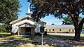
Pennington Baptist Church, 1955


All content from Kiddle encyclopedia articles (including the article images and facts) can be freely used under Attribution-ShareAlike license, unless stated otherwise. Cite this article:
Pennington, Texas Facts for Kids. Kiddle Encyclopedia.