
Petropavlovsk-Kamchatsky facts for kids
Quick facts for kids Petropavlovsk-Kamchatsky (English)Петропавловск-Камчатский (Russian) |
|
|---|---|
| - City - | |
 |
|
 |
|
|
|
|
| City Day | October 17 |
| Administrative status | |
| Country | Russia |
| Federal subject | Kamchatka Krai |
| Administratively subordinated to | Petropavlovsk-Kamchatsky City Under Krai Jurisdiction |
| Municipal status | |
| Urban okrug | Petropavlovsk-Kamchatsky Urban Okrug |
| Head | Sergey Kondrashin |
| Representative body | City Duma |
| Statistics | |
| Area | 362.14 km2 (139.82 sq mi) |
| Population (2010 Census, preliminary) |
179,780 inhabitants |
| - Rank in 2010 | 100th |
| Population (2013 est.) | 181,618 inhabitants |
| Density | 496/km2 (1,285/sq mi) |
| Time zone | MAGT (UTC+12:00) |
| Founded | October 17, 1740 |
| Postal code(s) | 683000 (main) |
| Dialing code(s) | +7 4152 |
| Official website: http://pkgo.ru/ | |
Petropavlovsk-Kamchatsky is a city and the administrative, industrial, scientific, and cultural center of Kamchatka Krai, Russia.
It was previously known as Petropavlovsk (until 1924).
Geography
The city is situated on high hills and surrounded by volcanoes. The surrounding terrain is mountainous enough that the horizon cannot be seen clearly from any point in town. Across Avacha Bay from the city in Vilyuchinsk is Russia's largest submarine base, the Rybachiy Nuclear Submarine Base, established during the Soviet period and still used by the Russian Navy. The city is located 6,766 kilometres (4,204 mi) from Moscow and about 2,220 kilometres (1,380 mi) from Vladivostok.
Images for kids
-
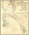
Section of Mikhail Tebenkov's 1872 Petropavlovsk harbor chart
-
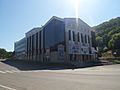
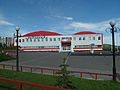
Kamchatka Drama and Comedy Theater
-
Kamchatka Regional United Museum
-

inside of Kamchatka Regional United Museum
-
Football Sports grounds
-
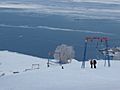
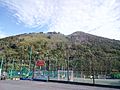
Ski resort "Red Hill" ("Krasnaya Sopka") in Petropavlovsk-Kamchatskiy
-
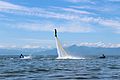
Flyboard
-
View of Petropavlovsk-Kamchatskiy biathlon stadium in Vitaly Fatyanov prize competition.
-
Zvezdny Sports complex
-
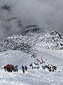
Avachinsky volcano Mountain Climbing during Volcano Day
-
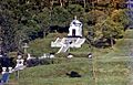
Chapel on Nikolskaya Sopka
-
Kamchatka Panteleimon Monastery
-
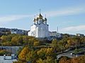
Holy Life-Giving Trinity Cathedral
-
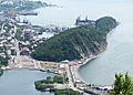
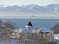
Nikolskaya Sopka
-
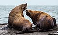
Sea lions in Petropavlovsk-Kamchatskiy
-
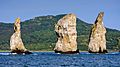
Tri Brata
-
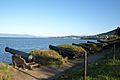
Historical Cannons on Nikolskaya Sopka
-
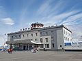
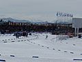
Petropavlovsk-Kamchatsky (Elizovo) Airport
-
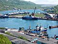
Port of Petropavlovsk-Kamchatsky


.jpg)


.jpg)


See also
 In Spanish: Petropávlovsk-Kamchatski para niños
