
Philipp, Mississippi facts for kids
Quick facts for kids
Philipp, Mississippi
|
|
|---|---|

Highway sign, incorrectly spelled "Phillip"
|
|

Philipp, Mississippi
Location in Mississippi

Philipp, Mississippi
Location in the United States
|
|
| Country | United States |
| State | Mississippi |
| Counties | Tallahatchie |
| Elevation | 157 ft (48 m) |
| Time zone | UTC-6 (Central (CST)) |
| • Summer (DST) | UTC-5 (CDT) |
| ZIP code |
38950
|
| Area code(s) | 662 |
| GNIS feature ID | 675681 |
Philipp is an unincorporated community in southern Tallahatchie County, Mississippi, United States, along Mississippi Highway 8. Philipp is 6 miles (9.7 km) east of Minter City and 14 miles (23 km) west of Holcomb. Although Philipp is an unincorporated community, it has a post office with a ZIP code of 38950.
History
The community was founded by Emanuel L. Philipp who was Governor of Wisconsin when he was the manager of a lumber company from 1894 to 1902 in Mississippi.
-
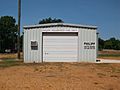
Philipp Volunteer Fire Department
-
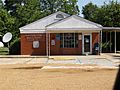
Philipp Post Office


Education
It is zoned to the West Tallahatchie School District. The local schools for West Tallahatchie are R. H. Bearden Elementary School and West Tallahatchie High School.
At one time the Philipp Consolidated School was located in the community. In 1957 the West Tallahatchie district announced that the property was for sale.
At a later point Black Bayou Elementary School in Glendora served southern parts of the West Tallahatchie district. The district decided to close Black Bayou in 1998. Previously West District Middle School (now Bearden) served as a middle school for the West Tallahatchie area.
Coahoma Community College is the designated community college for Tallahatchie County.
