Plasterfield facts for kids
Quick facts for kids Plasterfield
|
|
|---|---|
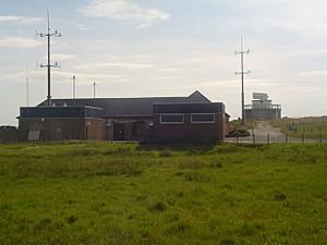
 The Stornoway radar station, which helps controllers at Prestwick monitor transatlantic and other high-level air traffic, is located at the south-eastern corner of Plasterfield |
|
| Language | Scottish Gaelic English |
| OS grid reference | NB440330 |
| Civil parish | |
| Council area | |
| Lieutenancy area | |
| Country | Scotland |
| Sovereign state | United Kingdom |
| Post town | STORNOWAY |
| Postcode district | HS1 |
| Dialling code | 01851 |
| Police | Northern |
| Fire | Highlands and Islands |
| Ambulance | Scottish |
| EU Parliament | Scotland |
| UK Parliament |
|
| Scottish Parliament |
|
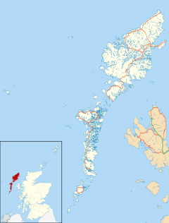
Plasterfield (Scottish Gaelic: Raon na Crèadha) is a hamlet in the Scottish Outer Hebrides, on the Isle of Lewis. Plasterfield is within the parish of Stornoway.
Plasterfield is a suburb of Stornoway and consists of two groups of houses, (built after World War II). The ambulance station for the Isle of Lewis is also located at Plasterfield as well a small industrial estate (Mossend estate). In the 1970s a group of Barratt houses were built adjacent to Plasterfield, this area was originally called Bayview and now has its own separate set of street names and is connected to Constable Road. Plasterfield is also the home of the MacKinnon's Bakery (now The Blackhouse bakery).
Angus Macleod, the former Scottish editor of The Times, was raised in Plasterfield.


