
Porrentruy facts for kids
Quick facts for kids
Porrentruy
|
||
|---|---|---|
|
||
| Country | Switzerland | |
| Canton | Jura | |
| District | Porrentruy | |
| Area | ||
| • Total | 14.76 km2 (5.70 sq mi) | |
| Elevation | 423 m (1,388 ft) | |
| Population
(Dec 2020 )
|
||
| • Total | 6,434 | |
| • Density | 435.91/km2 (1,129.0/sq mi) | |
| Postal code |
2900
|
|
| Surrounded by | Fontenais, Bressaucourt, Courtedoux, Bure, Courchavon, Coeuve, Alle, Courgenay | |

Porrentruy (German: Pruntrut) is a Swiss municipality and seat of the district of the same name found in the canton of Jura.
Contents
Culture
Porrentruy is the site of many important institutions of the canton of Jura, including the cantonal courts, and also of the archives of the former Episcopal See of Basel. It is also the location of the Université Populaire Jurassienne.
In 1988, Porrentruy was awarded the Wakker Prize for the development and preservation of its architectural heritage.
Geography

Porrentruy has an area of 14.76 km2 (5.70 sq mi). Of this area, 5.08 km2 (1.96 sq mi) or 34.4% is used for agricultural purposes, while 5.91 km2 (2.28 sq mi) or 40.1% is forested. Of the rest of the land, 3.64 km2 (1.41 sq mi) or 24.7% is settled (buildings or roads), 0.12 km2 (30 acres) or 0.8% is either rivers or lakes and 0.03 km2 (7.4 acres) or 0.2% is unproductive land.
Of the built up area, industrial buildings made up 1.7% of the total area while housing and buildings made up 10.7% and transportation infrastructure made up 7.3%. Power and water infrastructure as well as other special developed areas made up 3.5% of the area while parks, green belts and sports fields made up 1.5%. Out of the forested land, 38.8% of the total land area is heavily forested and 1.2% is covered with orchards or small clusters of trees. Of the agricultural land, 22.0% is used for growing crops and 12.1% is pastures. Of the water in the municipality, 0.2% is in lakes and 0.6% is in rivers and streams.
The municipality lies on both sides of the Allaine River, in Ajoie (the bulge in the northwest corner of Switzerland that extends into France) at the foot of the Jura Mountains on the north. In addition to the wide valley of the Allaine itself, it includes the watershed of the Creux-Genat River, that flows down from the peaks of La Banné (511 m [1,677 ft]) and La Perche (526 m [1,726 ft]). In the north, the municipality includes the hills and forests of the Petit Fahy (543 m [1,781 ft]) und Grand Fahy (570 m [1,870 ft]). The highest point in the municipality is the ridge that divides it from the municipality of Bure at 580 m (1,900 ft).
Images for kids
-
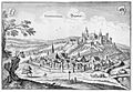
This view of Porrentruy dates from the 17th century.
-
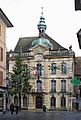
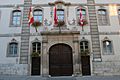
Hôtel de Ville
-
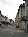
Roads through the historic old town of Porrentruy
-
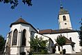
St. Pierre Church
-
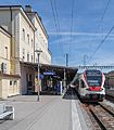
Porrentruy railway station
-
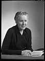
Hélène Rivier, 1952
-
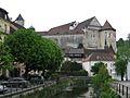
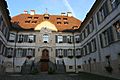
Porrentruy Castle
-
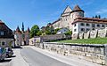
Porrentruy Castle and Porte de France
-
Church and College of the Jesuits
-
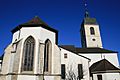
St-Pierre Church
-
Hôtel de Gléresse
-
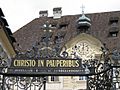
Hôtel-Dieu
-
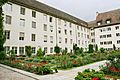
Jura Natural Sciences Museum and Garden


.jpg)


See also
 In Spanish: Porrentruy para niños
