
Preston County, West Virginia facts for kids
Quick facts for kids
Preston County
|
|
|---|---|
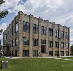
Preston County Courthouse
|
|

Location within the U.S. state of West Virginia
|
|
 West Virginia's location within the U.S. |
|
| Country | |
| State | |
| Founded | January 19, 1818 |
| Named for | James Patton Preston |
| Seat | Kingwood |
| Largest city | Kingwood |
| Area | |
| • Total | 651 sq mi (1,690 km2) |
| • Land | 649 sq mi (1,680 km2) |
| • Water | 2.6 sq mi (7 km2) 0.4%% |
| Population
(2010)
|
|
| • Total | 33,520 |
| • Estimate
(2019)
|
33,432 |
| • Density | 51.49/sq mi (19.880/km2) |
| Time zone | UTC−5 (Eastern) |
| • Summer (DST) | UTC−4 (EDT) |
| Congressional district | 1st |
Preston County is a county located in the U.S. state of West Virginia. As of the 2020 Census, the population was 34,216. Its county seat is Kingwood. The county was formed from Monongalia County in 1818 and named for Virginia Governor James Patton Preston.
Preston County is part of the Morgantown, WV Metropolitan Statistical Area, and is the southernmost county of the Pittsburgh media market. It is the home of The Buckwheat Festival, a county fair known for making buckwheat pancakes.
Contents
Geography
According to the U.S. Census Bureau, the county has a total area of 651 square miles (1,690 km2), of which 649 square miles (1,680 km2) is land and 2.6 square miles (6.7 km2) (0.4%) is water.
Major highways
 Interstate 68
 U.S. Highway 50
 U.S. Route 219
 West Virginia Route 7
 West Virginia Route 24
 West Virginia Route 26
 West Virginia Route 72
 West Virginia Route 92
Adjacent counties
- Fayette County, Pennsylvania (north)
- Garrett County, Maryland (east)
- Grant County (southeast)
- Tucker County (south)
- Barbour County (southwest)
- Taylor County (west)
- Monongalia County (northwest)
National protected area
- Monongahela National Forest (part)
State parks
- Cathedral State Park (also a Registered National Natural Landmark)
- Fairfax Stone State Park
Demographics
| Historical population | |||
|---|---|---|---|
| Census | Pop. | %± | |
| 1820 | 3,422 | — | |
| 1830 | 5,144 | 50.3% | |
| 1840 | 6,866 | 33.5% | |
| 1850 | 11,708 | 70.5% | |
| 1860 | 13,312 | 13.7% | |
| 1870 | 14,555 | 9.3% | |
| 1880 | 19,091 | 31.2% | |
| 1890 | 20,355 | 6.6% | |
| 1900 | 22,727 | 11.7% | |
| 1910 | 26,341 | 15.9% | |
| 1920 | 27,996 | 6.3% | |
| 1930 | 29,043 | 3.7% | |
| 1940 | 30,416 | 4.7% | |
| 1950 | 31,399 | 3.2% | |
| 1960 | 27,233 | −13.3% | |
| 1970 | 25,455 | −6.5% | |
| 1980 | 30,460 | 19.7% | |
| 1990 | 29,037 | −4.7% | |
| 2000 | 29,334 | 1.0% | |
| 2010 | 33,520 | 14.3% | |
| 2019 (est.) | 33,432 | −0.3% | |
| U.S. Decennial Census 1790–1960 1900–1990 1990–2000 2010–2019 |
|||
2010 census
As of the 2010 United States Census, there were 33,520 people, 12,895 households, and 9,038 families residing in the county. The population density was 51.7 inhabitants per square mile (20.0/km2). There were 15,097 housing units at an average density of 23.3 per square mile (9.0/km2). The racial makeup of the county was 97.6% white, 1.1% black or African American, 0.2% American Indian, 0.1% Asian, 0.2% from other races, and 0.8% from two or more races. Those of Hispanic or Latino origin made up 0.7% of the population. In terms of ancestry, 29.4% were German, 14.3% were Irish, 9.5% were American, and 8.9% were English.
Of the 12,895 households, 29.0% had children under the age of 18 living with them, 56.1% were married couples living together, 9.1% had a female householder with no husband present, 29.9% were non-families, and 24.6% of all households were made up of individuals. The average household size was 2.42 and the average family size was 2.84. The median age was 42.0 years.
The age distribution was 19.55% under the age of 18, 7.36% from 18 to 24, 27.58% from 25 to 44, 29.83% from 45 to 64, and 15.68% who were 65 years of age or older. The median age was 42.0 years. For every 100 females, there were 106.63 males. For every 100 females age 18 and over, there were 106.48 males.
The median income for a household in the county was $40,753 and the median income for a family was $46,622. Males had a median income of $38,713 versus $25,808 for females. The per capita income for the county was $19,329. About 10.1% of families and 13.9% of the population were below the poverty line, including 19.0% of those under age 18 and 9.9% of those age 65 or over.
Communities
City
Towns
Census-designated place
Unincorporated communities
- Afton
- Alpine Lake
- Amboy
- Arthurdale
- Austen
- Borgman
- Bretz
- Bull Run
- Cascade
- Clifton Mills
- Colebank
- Corinth
- Cuzzart
- Denver
- Eglon
- Etam
- Evansville
- Fellowsville
- Gladefarms
- Hazelton
- Hopemont
- Hopewell
- Horse Shoe Run
- Howesville
- Independence
- Israel
- Lenox
- Little Sandy
- Manheim
- Macomber
- Manown
- Marquess
- Mount Olivet
- Mount Vernon
- Orr
- Pisgah
- Pleasantdale
- Preston
- Rockville
- Rodemer
- Rohr
- Ruthbelle
- Saint Joe
- Scotch Hill
- Sell
- Silver Lake
- Sinclair
- Snider
- Stevensburg
- Sugar Valley
- Threefork Bridge
- Turner Douglass
- Valley Point
- Victoria
- West End
- White Oak Springs
- Zevely
See also
 In Spanish: Condado de Preston para niños
