
Princes Highway facts for kids
Quick facts for kids Princes HighwayNew South Wales–South Australia |
|
|---|---|
 |
|
| General information | |
| Type | Highway |
| Length | 1,898 km (1,179 mi) |
| Opened | 1920 |
| Route number(s) | See Route allocation |
| Former route number |
See Former routes |
| Major junctions | |
| East end | Ultimo, Sydney |
|
|
| West end | Glen Osmond, Adelaide |
| Location(s) | |
| Major settlements | Wollongong, Nowra, Ulladulla, Batemans Bay, Eden, Orbost, Sale, Melbourne, Geelong, Warrnambool, Mount Gambier, Kingston SE, Tailem Bend, Murray Bridge, Crafers, Adelaide, Port Wakefield |
| Highway system | |
| Highways in Australia National Highway • Freeways in Australia Highways in New South Wales Highways in Victoria Highways in South Australia |
|
The Princes Highway is a major road in Australia, extending from Sydney to Adelaide via the coast through the states of New South Wales, Victoria and South Australia. It has a length of 1,941 kilometres (1,206 mi) (along Highway 1) or 1,898 kilometres (1,179 mi) via the former alignments of the highway, although these routes are slower and connections to the bypassed sections of the original route are poor in many cases.
The highway follows the coastline for most of its length, and thus takes quite an indirect and lengthy route. For example, it is 1,040 kilometres (650 mi) from Sydney to Melbourne on Highway 1 as opposed to 870 kilometres (540 mi) on the more direct Hume Highway (National Highway 31), and 915 kilometres (569 mi) from Melbourne to Adelaide compared to 730 kilometres (450 mi) on the Western and Dukes Highways (National Highway 8). Because of the rural nature and lower traffic volumes over much of its length, the Princes Highway is a more scenic and leisurely route than the main highways between these major cities.
Contents
Route allocation
Sections of the Princes Highway have different route allocations. These allocations, from its northern terminus in Sydney to its western terminus in Port Augusta, are:
| Route allocation |
Road name(s) | Start point | End point | Distance | Cumulative distance |
Notes | ||
|---|---|---|---|---|---|---|---|---|
| km | mi | km | mi | |||||
| City Road; King Street; Princes Highway | Broadway | Junction with President Avenue, Kogarah | 11.3 | 7.0 | 11.3 | 7.0 | ||
| Princes Highway | Junction with President Avenue, Kogarah | South of Waterfall, with exit as the Princes Highway to Helensburgh | 27.8 | 17.3 | 39.1 | 24.3 | ||
| undesignated | Princes Highway (superseded route) | South of Waterfall | Maddens Plains | 20.9 | 13.0 | 60 | 37 | |
| Princes Highway (superseded route) | Junction with Lawrence Hargrave Drive, Thirroul | Junction with Memorial Drive, Bulli | 2.9 | 1.8 | 62.9 | 39.1 | ||
| undesignated | Princes Highway (superseded route) | Junction with Memorial Drive, Bulli | Haywards Bay | 33.6 | 20.9 | 96.5 | 60.0 | |
| Princes Motorway | South of Waterfall | North of Albion Park Rail; junction with the Illawarra Highway | 55.3 | 34.4 | 94.4 | 58.7 | ||
| Princes Highway | North of Albion Park Rail | Black-Allan Line, NSW/Victorian border | 422 | 262 | 516.4 | 320.9 | ||
| Princes Highway | Victorian/NSW border | Traralgon | ||||||
| Princes Freeway | Traralgon | Geelong | ||||||
| Princes Highway | Geelong | Victorian/South Australian border | ||||||
| Princes Highway | South Australian/Victorian border | Mount Gambier | ||||||
| Princes Highway | Mount Gambier | Tailem Bend | ||||||
| Princes Highway | Tailem Bend | Port Augusta | ||||||
Former routes
In 2013, New South Wales introduced a new alphanumeric route numbering system, replacing the former system of national and state routes. The Princes Highway formerly entered Wollongong as State Route 60 down the Bulli Pass and ran a largely separate route from Bulli and Thirroul through to the southern suburbs from the parallel Princes Motorway, the later of which bears the 'M1' route designation. The gazetted route of the Princes Highway differs from the route of State Route 60 (and from that shown on road signs). The gazetted route was designated State Route 60 for its length, but deviated from the road that is signposted as the Princes Highway between Bellambi and North Wollongong (part of Memorial Drive).
History
The section of the Princes Highway between West Helensburgh and Bulli Tops the original coastal route between Sydney and Wollongong, first used in 1843. to Bulli Tops.
The Princes Highway as a named route came into being when pre-existing roads were renamed ‘Prince's Highway’ after the visit to Australia in 1920 of the Prince of Wales (later to become King Edward VIII and, after abdicating, the Duke of Windsor).
The original submissions in January 1920 were in order for the Prince to have the opportunity during his visit to make the trip from Melbourne to Sydney overland along the route. Different routes were considered, including the inland route via Yass. This idea never came to fruition, due partly to the limited amount of time and the cost to construct the road to a suitable standard for him to undertake the trip. The Prince did, however, give his permission for the naming.
The highway had opening ceremonies in both New South Wales and Victoria during 1920. The first section of road from Melbourne was opened on 10 August in Warragul. The road from Sydney was opened on 19 October in Bulli, by the NSW Minister for Local Government, Thomas Mutch.
The approval was given by the Victorian executive to extend the highway west from Melbourne through Geelong, Camperdown, Warrnambool and Portland to the South Australian border in January 1922. The roads were renamed by the South Australian government from Adelaide east to the South Australian border in February 1922. At that time, the route from Adelaide was via Aldgate, Mylor, Macclesfield, Strathalbyn, Langhorne Creek, crossing the Murray River at Wellington, then continuing along the present towns of Meningie, Kingston SE, Robe, Beachport, Millicent and Gambier Town (Mount Gambier). By 1928, the route went through Mount Barker and Wistow to Lanhorne Creek. By 1935, the Princes Highway passed through Nairne and Kanmantoo, Murray Bridge and Tailem Bend (now known as the Old Princes Highway). This road was superseded by the South Eastern Freeway (Crafers-Murray Bridge in stages 1967-1979), Swanport Bridge (1979) and finally the South Eastern Freeway was extended from Crafers to Glen Osmond (2000).
In 1942, as part of wartime defence measures, a road was built from Mount Keira Road to Fairy Meadow. This route forms part of Mount Ousley Road.
In August 2011, the stretch of the highway in South Australia between Port Wakefield and Port Augusta (commonly referred to as "Highway 1") was renamed Augusta Highway as part of a process to standardise the rural property addressing system across the state.
Timeline of significant upgrades and bypasses
| Date | Project | State | Length | Value | Comments | Notes | |
|---|---|---|---|---|---|---|---|
| km | mi | ||||||
| 1959–1963 | North–South Motorway (Pacific Motorway) | NSW | From North Wollongong to West Wollongong, the Motorway was opened in stages, replacing Princes Highway as main north-south route | ||||
| 1961 | Maltby By-pass Road (Werribee bypass) | VIC | 10.5 | 6.5 | A£950,000 | Opened on 16 June 1961 by the Hon. Sir Thomas Maltby ED, MP, Minister of Public Works, the route was named the ‘Maltby By-pass Road’ by then Premier of Victoria, Henry Bolte MP. It was Victoria's first controlled-access highway, or ‘freeway’, as such roads are now generally known in Victoria. ‘It is a 4-lane divided highway, 6.5 miles in route length, with no access from adjoining property or cross roads over its entire length’. | |
| 1964 | Connector road | NSW | The road, from Mount Ousley Road to the North–South Motorway at Gwynneville, was opened to traffic. | ||||
| 1967 | Princes Highway East, near Mount Drummer | VIC | 8.9 | 5.5 | A ceremony, sponsored by Orbost Shire Council, at Genoa, was held on 17 January 1967. | ||
| 1967 | South Eastern Freeway (Stage 1) | SA | Bypassed Crafers and Stirling. | ||||
| 1969 | Moe bypass | VIC | 6.1 | 3.8 | ‘A single 24 ft. Carriageway has been provided, with earthworks and grade separated structures which can accommodate future duplicate pavements’. | ||
| 1972 | Haunted Hills section | VIC | 4.2 | 2.6 | Second carriageway opened between Gunn's Gully and Hernes Oak. | ||
| 1973 | Road duplication | VIC | 6.4 | 4 | Dual carriageway from East Warrnambool to Allansford. | ||
| 1975 | NSW | Princes Highway from Waterfall to Bulli Tops, superseded by the opening of Southern Freeway. | |||||
| 1976 | Snowy River Bridge, Princes Freeway, Orbost | VIC | 8.4 | 5.2 | A$2.4 million | Opened by the Hon. J A Rafferty, Minister for Transport, 25 November 1976. The bridge was the first of four bridges to be built as part of the freeway bypass of Orbost. It's interesting to note the reference to a ‘freeway’, given that the entire bypass is a single two-lane carriageway and is not controlled access. The CRB's own definition of a freeway can be found in most of their annual reports dating back to the 1960s: ‘A freeway is a road having dual carriageways with no direct access from adjoining properties and side roads. All crossings of a freeway are by means of overpass or underpass bridges, and traffic enters or leaves the freeway carriageways by means of carefully designed ramps’. |
|
| 1979 | Swanport Bridge | SA | Completed the South Eastern Freeway to bypass Murray Bridge. | ||||
| 1981 | Drouin bypass | VIC | 7 | 4.3 | A$12 million | From Robin Hood to the ‘existing’ highway east of Drouin, with ‘two lanes each direction, plus emergency stopping lanes’. Opened 12 February 1981, by the Hon. J C M Balfour, MP. | |
| 1983 | Berwick bypass | VIC | 7.3 | 4.5 | A$19.6 million | Opened on 14 December 1983 by the Federal Minister for Transport, the Hon. Peter Morris MP, and the Victorian Assistant Minister of Transport, the Hon. Jack Simpson MP. This road bypass was from the Princes Highway, near Hessle Road, to Pink Hill, Beaconsfield. | |
| 1987 | Road duplication | VIC | 9 | 5.6 | A$16 million | Nar Nar Goon to Garfield duplication opened 10 April 1987. | |
| 1989 | Road duplication | VIC | Garfield to Bunyip River duplication completed in June 1989. | ||||
| 1992 | Morwell bypass | VIC | Bypass opened to traffic in April 1992. | ||||
| 1994 | Longwarry section duplication | VIC | 7.8 | 4.8 | A$25 million | Duplication completed between Bunyip River and Robin Hood in January 1994. | |
| 1995 | Road duplication | VIC | Duplicated section between Trafalgar East to Moe opened in August 1995. | ||||
| 1997 | Road duplication | VIC | 7 | 4.3 | Yarragon to Trafalgar duplication opened to traffic on 2 May 1997, completing a dual carriageway highway from Melbourne to Traralgon. | ||
| 2000 | Heysen Tunnels | SA | The tunnel replaced Mount Barker Road (through Eagle On The Hill), extending the Adelaide end of South Eastern Freeway from Crafers to Glen Osmond. | ||||
| 2002 | Oak Flats Interchange | NSW | The project was opened on 29 October 2001. The interchange was designed to significantly improve traffic flow around the Albion Park/Oak Flats section of the Princes Highway by removing a railway level crossing and nearby traffic signals. ‘The interchange also connects with Shellharbour City Council's East-West Link Road’. | ||||
| 2005 | Kiama bypass | NSW | A$179 million | Opened to traffic on 28 November 2005. The North Kiama Bypass linked the Kiama Bypass in the south and the Princes Highway near Dunmore in the north. | |||
| 2007 | Pakenham bypass | VIC | 20 | 12 | A$242 million | Opened to traffic in December 2007, funded jointly by the state and federal governments. | |
| 2008 | Geelong Ring Road | VIC | Corio to Hamilton Highway, Fyansford opened 14 December 2008. | ||||
| 2009 | Geelong Ring Road | VIC | A$380 million | Hamilton Highway, Fyansford to Waurn Ponds opened 14 June 2009, six months ahead of schedule. The project from Corio to Waurn Ponds was funded jointly by the state and federal governments. | |||
| 2009 | Road duplication | NSW | A$108 million | Oak Flats to Dunmore dual carriageways opened to traffic in October 2009, completing a four-lane route between Sydney and south of Kiama. | |||
| 2013 | Geelong Ring Road | VIC | Anglesea Road to Princes Highway opened to traffic in February 2013. | ||||
| 2013 | Road duplication | VIC | 4 | 2.5 | Wurruk to Sale duplication opened June 2013. | ||
| 2015 | Road duplication | VIC | 30 | 19 | From Waurn Ponds to Winchelsea. | ||
Projects
The NSW Government Roads & Maritime Services have identified the following major projects either completed, in progress or in planning, as of February 2014:
| Project | Length | Construction | Value | Status | Notes | ||
|---|---|---|---|---|---|---|---|
| km | mi | Start | Complete | ||||
| Bulli Pass upgrade | 1.1 | 0.68 | In planning | ||||
| Albion Park bypass | In planning | ||||||
| Oak Flats to Dunmore upgrade | June 2007 | October 2009 | $108 million | Complete | |||
| North Kiama bypass | 7.6 | 4.7 | November 2003 | October 2005 | $141 million | Complete | |
| Kiama On and Off Ramps (Northbound and Southbound) | 2008/2009 | $8 million | Complete | ||||
| Gerringong upgrade | 7.5 | 4.7 | July 2012 | August 2015 | $340 million | Complete | |
| Foxground and Berry bypass | 11.6 | 7.2 | January 2015 | Mid 2018 | $580 million | Under construction | |
| Berry to Bomaderry upgrade | 11.5 | 7.1 | In planning | ||||
| Nowra Bridge study (southbound) | In planning | ||||||
| South Nowra upgrade – Kingorne Street to Forest Road | 6.3 | 3.9 | November 2011 | March 2014 | $62 million | Complete | |
| Forest Road to Jervis Bay Road | 23.5 | 14.6 | December 2008 | $23.5 million | Complete | ||
| Conjola Mountain realignment | 2.3 | 1.4 | September 2008 | April 2010 | $58 million | Complete | |
| Burrill Lake Bridge replacement | Early 2018 | $58 million | Under construction | ||||
| Termeil Creek realignment | 1.6 | 0.99 | February 2015 | Mid 2016 | $21 million | Under construction | |
| Nangudga Bridge replacement | December 2011 | $3.7 million | Complete | ||||
| Victoria Creek upgrade | 3.2 | 2.0 | June 2011 | March 2013 | $35 million | Complete | |
| Dignams Creek upgrade | In planning | ||||||
| Bega bypass | 3.6 | 2.2 | June 2012 | December 2013 | $55 million | Complete | |
| Pambula River Bridge replacement | 3.5 | 2.2 | August 2006 | March 2008 | $17 million | Complete | |
Images for kids
-
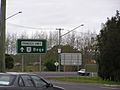
Princes Highway at Moruya.
-
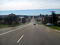
Princes Highway at Eden.
-
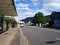
Princes Highway at Woonona
-
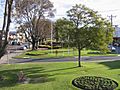
The Princes Highway is picturesque in some towns, such as Bairnsdale, Victoria, where the median strip has been made a garden.


See also
 In Spanish: Carretera Princes para niños
