Princeville, North Carolina facts for kids
Quick facts for kids
Princeville, North Carolina
|
|
|---|---|

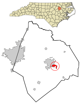
Location in Edgecombe County and the state of North Carolina.
|
|
| Country | United States |
| State | North Carolina |
| County | Edgecombe |
| Area | |
| • Total | 1.52 sq mi (3.95 km2) |
| • Land | 1.51 sq mi (3.92 km2) |
| • Water | 0.01 sq mi (0.03 km2) |
| Elevation | 30 ft (9 m) |
| Population
(2010)
|
|
| • Total | 2,082 |
| • Estimate
(2019)
|
1,926 |
| • Density | 1,272.97/sq mi (491.45/km2) |
| Time zone | UTC-5 (Eastern (EST)) |
| • Summer (DST) | UTC-4 (EDT) |
| ZIP code |
27886
|
| Area code(s) | 252 |
| FIPS code | 37-53840 |
| GNIS feature ID | 1022085 |
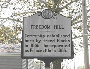
Princeville is a town in Edgecombe County, North Carolina, United States, and is the oldest town incorporated by African Americans in the United States. It was established by freed slaves after the Civil War and incorporated in 1885. It is part of the Rocky Mount, North Carolina Metropolitan Statistical Area. As of the 2010 census, the town population was 2,082. A 2018 special census recount placed the town's population at 1,939 residents. The town is on the opposite bank of the Tar River from Tarboro. The city of Rocky Mount is 16 miles (26 km) to the west.
Contents
History
In July 2012, the State Treasurer's Office took control of the books for financially strapped Princeville, only the fifth time the state has taken over for a local municipality since the 1930s. Princeville has been taken over twice – the state also assumed control of its books in 1997.
Princeville experienced severe flooding in September 1999 by the Cape Verde-type Hurricane Floyd and in October 2016 by the Category 5 Atlantic Hurricane Matthew.
Princeville School was listed on the National Register of Historic Places in 2001.
Geography
Princeville is located at 35°53′13″N 77°31′14″W / 35.88694°N 77.52056°W (35.886974, -77.520584).
According to the United States Census Bureau, the town has a total area of 1.53 square miles (3.95 km2), of which 1.51 square miles (3.92 km2) is land and 0.01 square miles (0.03 km2), or 0.69%, is water.
Demographics
| Historical population | |||
|---|---|---|---|
| Census | Pop. | %± | |
| 1890 | 428 | — | |
| 1900 | 552 | 29.0% | |
| 1910 | 627 | 13.6% | |
| 1920 | 562 | −10.4% | |
| 1930 | 614 | 9.3% | |
| 1940 | 818 | 33.2% | |
| 1950 | 919 | 12.3% | |
| 1960 | 797 | −13.3% | |
| 1970 | 654 | −17.9% | |
| 1980 | 1,508 | 130.6% | |
| 1990 | 1,652 | 9.5% | |
| 2000 | 940 | −43.1% | |
| 2010 | 2,082 | 121.5% | |
| 2019 (est.) | 1,926 | −7.5% | |
| U.S. Decennial Census | |||
2020 census
| Race | Number | Percentage |
|---|---|---|
| White (non-Hispanic) | 37 | 2.95% |
| Black or African American (non-Hispanic) | 1,162 | 92.66% |
| Asian | 1 | 0.08% |
| Other/Mixed | 36 | 2.87% |
| Hispanic or Latino | 18 | 1.44% |
As of the 2020 United States census, there were 1,254 people, 789 households, and 556 families residing in the town.
See also
 In Spanish: Princeville (Carolina del Norte) para niños


