
Punggol facts for kids
Quick facts for kids
Punggol
|
|
|---|---|
|
Planning Area and HDB Town
|
|
| Other transcription(s) | |
| • Chinese | 榜鹅 |
| • Pinyin | Bǎng'é |
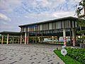
       From top left to right: Punggol Town Centre, Flats at Edgedale Plains, Flats at Punggol Cove, Panoramic view of Greendale Secondary School, Watertown, Punggol Plaza, Punggol Waterway Park
|
|
| Country | |
| Region | North-East Region
|
| CDC |
|
| Town council |
|
| Constituency |
|
| Area | |
| • Total | 9.57 km2 (3.69 sq mi) |
| • Residential | 3.74 km2 (1.44 sq mi) |
| Population
(2018)
|
|
| • Total | 161,570 |
| • Density | 16,883/km2 (43,727/sq mi) |
| Demonym(s) | Official
Colloquial
|
| Postal district |
19
|
| Dwelling units | 43,385 |
| Projected ultimate | 96,000 |
Punggol (in Chinese: 榜鹅, in Tamil: பொங்கோல்), which can also be spelt as Ponggol, is a planning area and town. It was built on the Tanjong Pungool peninsula in the North-Eastern part of Singapore. It is North of Sengkang and has a riverline border with Seletar and Pasir Ris. The Straits of Johor is North of it. Coney Island is part of Pungool.
Images for kids
-
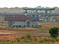
The Punggol West LRT is located in relatively undeveloped surroundings in 2006. As of 2015, one can no longer view the LRT Station directly from this point of view. The plain area with Matilda House shown here, has been developed into new HDB flats and condominiums.
-
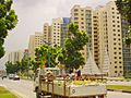
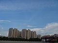
Punggol in 2002, with the first phase of the Punggol 21 plan completed
-
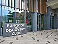
The Punggol Discovery Cube is a visitor's centre for residents and visitors to learn about Punggol's history.
-
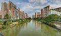
Waterway View is one of the newer waterfront housing estates under the "Punggol 21-plus" project.
-
Punggol Interchange
-
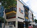
Punggol Plaza in January 2006
-
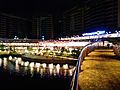
Waterway Point at night in 2016
-
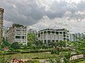
Oasis Terraces as seen from Punggol Waterway in 2018.
-
Punggol Town Square, located in the town centre of Punggol


