Purga, Queensland facts for kids
Quick facts for kids PurgaQueensland |
|||||||||||||||
|---|---|---|---|---|---|---|---|---|---|---|---|---|---|---|---|

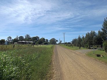
Hughes Road, 2015
|
|||||||||||||||
| Population | 576 (2016 census) | ||||||||||||||
| • Density | 10.177/km2 (26.36/sq mi) | ||||||||||||||
| Postcode(s) | 4306 | ||||||||||||||
| Area | 56.6 km2 (21.9 sq mi) | ||||||||||||||
| Time zone | AEST (UTC+10:00) | ||||||||||||||
| LGA(s) | City of Ipswich | ||||||||||||||
| State electorate(s) |
|
||||||||||||||
| Federal Division(s) | Blair | ||||||||||||||
|
|||||||||||||||
Purga is a rural locality in the City of Ipswich, Queensland, Australia. In the 2016 census, Purga had a population of 576 people.
History
The area was named after the parish which was derived from the Aboriginal word pur-pur, meaning a meeting place. A railway station on the Dugandan railway line was opened in 1882. A primary school was opened in 1871 and closed in 1967.
Heritage listings
Purga has a number of heritage-listed sites, including:
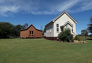
- Boonah Road: Purga United Church
- Carmichaels Road: Purga Aboriginal Cemetery
- South Deebing Creek Road: former Deebing Creek Mission
Road infrastructure
Ipswich – Boonah Road (State Route 93) runs through from north-east to south-east.

All content from Kiddle encyclopedia articles (including the article images and facts) can be freely used under Attribution-ShareAlike license, unless stated otherwise. Cite this article:
Purga, Queensland Facts for Kids. Kiddle Encyclopedia.


