
Quetta facts for kids
Quick facts for kids
Quetta
|
||
|---|---|---|
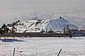
    Clockwise from top: Mount Chiltan, Quetta railway station, a view of Quetta City at night, Bolan Mosque
|
||
|
||
| Etymology: Pashto: Kwaṭa (fortress) | ||
| Nickname(s):
Little London
|
||

Quetta
Location in Balochistan, Pakistan

Quetta
Location in Pakistan
|
||
| Country | ||
| Region | ||
| District | Quetta | |
| Incorporated | 1876 | |
| Government | ||
| • Type | Municipal Corporation | |
| Area | ||
| • Total | 3,501 km2 (1,352 sq mi) | |
| Elevation | 1,680 m (5,510 ft) | |
| Population
(2017)
|
||
| • Total | 1,001,205 | |
| • Demonym | Quettan | |
| Time zone | UTC+05:00 (PST) | |
| ZIP code format |
87xxx
|
|
| Area code(s) | 081 | |

Quetta is the provincial capital and largest city of Balochistan, Pakistan. It was largely destroyed in the 1935 Quetta earthquake, but was rebuilt and has a population of 1,001,205 according to the census of 2017 while the Quetta District has a population of 2,275,699. Quetta is at an average elevation of 1,680 metres (5,510 feet) above sea level, making it Pakistan's only high-altitude major city. The city is known as the "Fruit Garden of Pakistan," due to the numerous fruit orchards in and around it, and the large variety of fruits and dried fruit products produced there.
Located in northern Balochistan near the Pakistan-Afghanistan border, Quetta is a trade and communication centre between the two countries. The city is near the Bolan Pass route which was once one of the major gateways from Central Asia to South Asia. Quetta played an important role militarily for the Pakistani Armed Forces in the intermittent Afghanistan conflict.
Images for kids
-
Quetta Fort Mirri
-
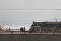
Passengers boarding a Chaman bound train at Baleli, Quetta
-
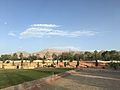
Musa Sports Complex


See also
 In Spanish: Quetta para niños
