
Raceview, Queensland facts for kids
Quick facts for kids RaceviewIpswich, Queensland |
|||||||||||||||
|---|---|---|---|---|---|---|---|---|---|---|---|---|---|---|---|

Edwards Street, 2016
|
|||||||||||||||

Raceview
Location in Queensland
|
|||||||||||||||
| Population | 9,721 (2016 census) | ||||||||||||||
| • Density | 1,648/km2 (4,270/sq mi) | ||||||||||||||
| Postcode(s) | 4305 | ||||||||||||||
| Area | 5.9 km2 (2.3 sq mi) | ||||||||||||||
| Time zone | AEST (UTC+10:00) | ||||||||||||||
| Location |
|
||||||||||||||
| LGA(s) | City of Ipswich | ||||||||||||||
| State electorate(s) | Ipswich | ||||||||||||||
| Federal Division(s) | Blair | ||||||||||||||
|
|||||||||||||||
Raceview is a suburb of Ipswich in the City of Ipswich, Queensland, Australia. In the 2016 census, Raceview had a population of 9,721 people.
Education
Raceview State School is a government primary (Prep-6) school for boys and girls at 96 Wildey Street (27°38′26″S 152°46′56″E / 27.6406°S 152.7823°E). In 2018, the school had an enrolment of 996 students with 69 teachers (63 full-time equivalent) and 45 non-teaching staff (29 full-time equivalent). It includes a special education program.
Bethany Lutheran Primary School is a private primary (Prep-6) school for boys and girls at 126 Cascade Street (27°38′14″S 152°46′35″E / 27.6373°S 152.7764°E). In 2018, the school had an enrolment of 278 students with 22 teachers (19 full-time equivalent) and 21 non-teaching staff (11 full-time equivalent).
There are no secondary schools in Raceview. The nearest government secondary school is Bremer State High School in neighbouring Ipswich CBD to the west.
Images for kids
-
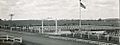
USAF Military Cemetery
-
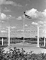
American Military Cemetery, 1946

