
Ridgecrest, California facts for kids
Quick facts for kids
Ridgecrest, California
|
||
|---|---|---|

College Heights Blvd., Ridgecrest
|
||
|
||

Location in Kern County and the state of California
|
||

Ridgecrest, California
Location in southern California

Ridgecrest, California
Location in California

Ridgecrest, California
Location in the United States
|
||
| Country | ||
| State | ||
| County | Kern | |
| Incorporated | November 29, 1963 | |
| Area | ||
| • Total | 21.53 sq mi (55.76 km2) | |
| • Land | 20.88 sq mi (54.08 km2) | |
| • Water | 0.65 sq mi (1.69 km2) 3.04% | |
| Elevation | 2,290 ft (698 m) | |
| Population | ||
| • Total | 27,959 | |
| • Density | 1,298.6/sq mi (501.42/km2) | |
| Time zone | UTC−08:00 (Pacific) | |
| • Summer (DST) | UTC−07:00 (PDT) | |
| ZIP Codes |
93555–93556
|
|
| Area codes | 442 and 760 | |
| FIPS code | 06-60704 | |
| GNIS feature IDs | 1652783, 2410944 | |

Ridgecrest is a city in Kern County, California, United States, along U.S. Route 395 in the Indian Wells Valley in northeastern Kern County, adjacent to the Naval Air Weapons Station China Lake (NAWS, or China Lake). It was incorporated as a city in 1963. The population was 27,959 at the 2020 census, up slightly from 27,616 at the 2010 census.
Ridgecrest is surrounded by four mountain ranges; the Sierra Nevada on the west, the Cosos on the north, the Argus Range on the east, and the El Paso Mountains on the south. It is approximately 82 miles (132 km) from the Lancaster/Palmdale area, 110 miles (177 km) from Bakersfield, and 120 miles (193 km) from San Bernardino, the three nearest major urban centers. Private air travel in and out of the city is provided through the Inyokern Airport. There are currently no scheduled commercial flights.
The city has been near the epicenter of major earthquakes, including one in 1995 and a series of quakes in July 2019.
Contents
History
The settlement began as a farming community called Crumville in 1912, honoring James and Robert Crum, local dairymen. The first post office opened in 1941. By 1943, Ridgecrest had grown to 115 homes and 196 residents. NOTS (Naval Ordnance Test Station) was established in November 1943, providing a strong job base for the years to come.
Ridgecrest incorporated in 1963. During this era the growth of Ridgecrest was governed by the continuing needs of the high tech industries coupled to the Naval Station's programs for testing arms and guidance systems.
Geography

According to the United States Census Bureau, the city has a total area of 21.4 square miles (55.4 km2), of which 20.8 sq mi (53.9 km2) is land and 0.7 sq mi (1.8 km2) of it (3.04%) is water. Ridgecrest is located in Indian Wells Valley, which is a southern extension of Owens Valley, broken up by the volcanic Coso Range.
1995 Ridgecrest earthquake
The area, associated with the Eastern California Shear Zone, has experienced numerous earthquake swarms in the past (groups of several thousand quakes under magnitude 6.0 or so) often with no obvious mainshock. The 1995 Ridgecrest earthquake sequence started on August 17, when a magnitude 5.4 quake, centered 18 kilometers (11 mi) north of the town of Ridgecrest, shook the area and spawned over 2,500 aftershocks over the course of the following five weeks. Then, on September 20, 1995, the second large quake struck the area: it measured magnitude 5.8, and was at that time the largest earthquake to hit southern California since the January 17, 1994 Northridge earthquake.
Climate

The weather in the Indian Wells Valley (Ridgecrest, CA) is predominantly influenced by its high desert location. The climate is characterized by hot days and cool nights with extremely arid conditions prevailing throughout the summer months. The mean annual maximum temperature for the Ridgecrest area is 75 °F (24 °C) while the mean annual minimum temperature is 48 °F (9 °C). There are wide annual temperature fluctuations that occur from a high of 119 °F (48 °C) to a low of 1 °F (−17 °C). The area is known to have wind as high as 75 mph (121 km/h) on a sunny day. Whenever winds exceed 30 mph (48 km/h) dust devils and dust clouds form in the area. December is the coolest month with an average maximum temperature of 60 °F (16 °C) and an average minimum temperature of 30 °F (−1 °C). The all-time minimum temperature of 1 °F (−17 °C) was recorded on December 23, 1963, and January 7, 1973. Ridgecrest is a desert, with an average of less than 5 inches (130 mm) "equivalent rainfall" per year, which includes less than 2 inches (51 mm) of snow.
July is the hottest month with an average maximum temperature of 103 °F (39 °C) and an average minimum temperature of 66 °F (19 °C). The all-time maximum temperature of 119 °F (48 °C) was recorded on July 31, 1971.
| Climate data for Naval Air Weapons Station China Lake | |||||||||||||
|---|---|---|---|---|---|---|---|---|---|---|---|---|---|
| Month | Jan | Feb | Mar | Apr | May | Jun | Jul | Aug | Sep | Oct | Nov | Dec | Year |
| Record high °F (°C) | 78 (26) |
89 (32) |
92 (33) |
104 (40) |
108 (42) |
118 (48) |
119 (48) |
114 (46) |
109 (43) |
103 (39) |
89 (32) |
77 (25) |
119 (48) |
| Average high °F (°C) | 61.3 (16.3) |
63.7 (17.6) |
74.4 (23.6) |
76.1 (24.5) |
85.9 (29.9) |
98.2 (36.8) |
101.8 (38.8) |
101.9 (38.8) |
94.3 (34.6) |
81.2 (27.3) |
64.3 (17.9) |
58.5 (14.7) |
80.1 (26.7) |
| Average low °F (°C) | 30.6 (−0.8) |
34.6 (1.4) |
40.1 (4.5) |
45.6 (7.6) |
52.8 (11.6) |
63.1 (17.3) |
68.4 (20.2) |
67.4 (19.7) |
59.4 (15.2) |
48.3 (9.1) |
33.8 (1.0) |
26.1 (−3.3) |
47.5 (8.6) |
| Record low °F (°C) | 6 (−14) |
12 (−11) |
21 (−6) |
27 (−3) |
38 (3) |
42 (6) |
50 (10) |
51 (11) |
39 (4) |
24 (−4) |
18 (−8) |
8 (−13) |
6 (−14) |
| Average precipitation inches (mm) | 0.88 (22) |
0.79 (20) |
0.78 (20) |
0.13 (3.3) |
0.11 (2.8) |
0.02 (0.51) |
0.09 (2.3) |
0.31 (7.9) |
0.24 (6.1) |
0.18 (4.6) |
0.27 (6.9) |
0.47 (12) |
4.27 (108.41) |
| Average snowfall inches (cm) | 0.8 (2.0) |
0.0 (0.0) |
0.0 (0.0) |
0.0 (0.0) |
0.0 (0.0) |
0.0 (0.0) |
0.0 (0.0) |
0.0 (0.0) |
0.0 (0.0) |
0.0 (0.0) |
0.0 (0.0) |
0.5 (1.3) |
1.3 (3.3) |
| Climate data for Inyokern, California | |||||||||||||
|---|---|---|---|---|---|---|---|---|---|---|---|---|---|
| Month | Jan | Feb | Mar | Apr | May | Jun | Jul | Aug | Sep | Oct | Nov | Dec | Year |
| Record high °F (°C) | 27 (80) |
30 (86) |
34 (93) |
38 (100) |
44 (112) |
46 (114) |
48 (119) |
46 (114) |
43 (110) |
41 (105) |
31 (88) |
29 (84) |
48 (119) |
| Average high °F (°C) | 15.3 (59.6) |
18.2 (64.8) |
21.3 (70.3) |
25.4 (77.7) |
30.6 (87.0) |
35.9 (96.7) |
39.3 (102.7) |
38.4 (101.2) |
34.6 (94.2) |
28.4 (83.2) |
20.6 (69.0) |
15.4 (59.7) |
27.0 (80.5) |
| Average low °F (°C) | −0.7 (30.8) |
1.4 (34.6) |
3.7 (38.7) |
6.8 (44.3) |
11.6 (52.9) |
15.8 (60.5) |
19.0 (66.2) |
18.1 (64.6) |
14.5 (58.1) |
9.0 (48.2) |
2.9 (37.3) |
−1.0 (30.2) |
8.4 (47.2) |
| Record low °F (°C) | −17 (1) |
−13 (9) |
−9 (15) |
−6 (21) |
−3 (26) |
3 (38) |
8 (46) |
7 (45) |
2 (35) |
−7 (20) |
−10 (14) |
−15 (5) |
−17 (1) |
| Average precipitation inches (mm) | 19 (0.74) |
24 (0.95) |
14 (0.55) |
4.3 (0.17) |
1.8 (0.07) |
0.51 (0.02) |
4.1 (0.16) |
5.6 (0.22) |
5.1 (0.20) |
2.5 (0.10) |
9.7 (0.38) |
15 (0.59) |
105.61 (4.15) |
| Average snowfall inches (cm) | 0.76 (0.3) |
0.0 (0.0) |
0.25 (0.1) |
0.0 (0.0) |
0.0 (0.0) |
0.0 (0.0) |
0.0 (0.0) |
0.0 (0.0) |
0.0 (0.0) |
0.0 (0.0) |
0.0 (0.0) |
0.51 (0.2) |
1.52 (0.6) |
Demographics
| Historical population | |||
|---|---|---|---|
| Census | Pop. | %± | |
| 1950 | 2,028 | — | |
| 1960 | 5,099 | 151.4% | |
| 1970 | 7,629 | 49.6% | |
| 1980 | 15,929 | 108.8% | |
| 1990 | 27,725 | 74.1% | |
| 2000 | 24,927 | −10.1% | |
| 2010 | 27,616 | 10.8% | |
| 2019 (est.) | 28,973 | 4.9% | |
| U.S. Decennial Census | |||
2010
The 2010 United States Census reported that Ridgecrest had a population of 27,616. The population density was 1,289.5 people per square mile (497.9/km2). The racial makeup of Ridgecrest was 21,387 (77.4%) White, 1,113 (4.0%) African American, 341 (1.2%) Native American, 1,209 (4.4%) Asian, 143 (0.5%) Pacific Islander, 1,836 (6.6%) from other races, and 1,587 (5.7%) from two or more races. Hispanic or Latino of any race were 4,941 persons (17.9%).
The Census reported that 27,420 people (99.3% of the population) lived in households, 109 (0.4%) lived in non-institutionalized group quarters, and 87 (0.3%) were institutionalized.
There were 10,781 households, out of which 3,901 (36.2%) had children under the age of 18 living in them, 5,211 (48.3%) were opposite-sex married couples living together, 1,352 (12.5%) had a female householder with no husband present, 609 (5.6%) had a male householder with no wife present. There were 681 (6.3%) unmarried opposite-sex partnerships, and 64 (0.6%) same-sex married couples or partnerships. 2,978 households (27.6%) were made up of individuals, and 1,001 (9.3%) had someone living alone who was 65 years of age or older. The average household size was 2.54. There were 7,172 families (66.5% of all households); the average family size was 3.10.
The population was spread out, with 7,544 people (27.3%) under the age of 18, 2,654 people (9.6%) aged 18 to 24, 7,157 people (25.9%) aged 25 to 44, 6,844 people (24.8%) aged 45 to 64, and 3,417 people (12.4%) who were 65 years of age or older. The median age was 33.8 years. For every 100 females, there were 100.3 males. For every 100 females age 18 and over, there were 99.9 males.
There were 11,915 housing units at an average density of 556.3 per square mile (214.8/km2), of which 6,525 (60.5%) were owner-occupied, and 4,256 (39.5%) were occupied by renters. The homeowner vacancy rate was 2.9%; the rental vacancy rate was 9.2%. 16,520 people (59.8% of the population) lived in owner-occupied housing units and 10,900 people (39.5%) lived in rental housing units.
2000

According to the census of 2000, there were 24,927 people, 9,826 households, and 6,691 families residing in the city. The population density was 1,179.9 inhabitants per square mile (455.6/km2). There were 11,309 housing units at an average density of 535.3/sq mi (206.7/km2). The racial makeup of the city was 82.02% White, 3.53% Black or African American, 1.08% Native American, 3.88% Asian, 0.58% Pacific Islander, 4.93% from other races, and 3.98% from two or more races. 12.04% of the population were Hispanic or Latino of any race.
There were 9,826 households, out of which 35.0% had children under the age of 18 living with them, 52.2% were married couples living together, 11.5% had a female householder with no husband present, and 31.9% were non-families. 27.6% of all households were made up of individuals, and 8.6% had someone living alone who was 65 years of age or older. The average household size was 2.51 and the average family size was 3.06.
In the city, the population was spread out, with 29.1% under the age of 18, 8.5% from 18 to 24, 28.1% from 25 to 44, 23.0% from 45 to 64, and 11.3% who were 65 years of age or older. The median age was 36 years. For every 100 females, there were 99.6 males. For every 100 females age 18 and over, there were 97.9 males.
The median income for a household in the city was $44,971, and the median income for a family was $52,725. Males had a median income of $46,993 versus $29,558 for females. The per capita income for the city was $21,312. About 10.2% of families and 12.3% of the population were below the poverty line, including 17.5% of those under age 18 and 5.1% of those age 65 or over.
- High school or higher: 87.4%
- Bachelor's degree or higher: 24.4%
- Graduate or professional degree: 8.5%
- Unemployed: 6.8%
- Mean travel time to work: 14.9 minutes
- Never married: 22.1%
- Now married: 56.7%
- Separated: 2.6%
- Widowed: 6.6%
- Divorced: 12.1%
- Males: 12,924 – (49.9%)
- Females: 12,971 – (50.1%)
- Median resident age: 35.5 years
- California median age: 33.3 years
People in group quarters:
- 987 people in military barracks, etc.
- 87 people in nursing homes
- 33 people in other non-institutional group quarters
- 22 people in state prisons
Local features and activities

The most notable feature in the nearby area is the Coso People rock art in Big and Little Petroglyph Canyons. The Coso People were prolific artists and traded with distant tribes using tools crafted of stone. Archeological recovery at coastal Chumash sites in California indicates considerable trade with the Coso People.
Other traditional activities present are:
|
Maturango Museum

The Maturango Museum is located in Ridgecrest. The museum is best known for the guided tours to Little Petroglyph Canyon on China Lake Naval Weapons Station (NAWS). The Museum offers exhibits and displays featuring both the natural and the cultural history and diversity of the Northern Mojave Desert with exhibits of plants, animals, Native American artifacts, geology and contemporary arts and crafts.
Naval Air Weapons Station China Lake or NAWS China Lake is an airborne weapons testing and training range located adjacent to Ridgecrest and operated by the United States Navy and its contractors. The officer's family housing on base is noted for their monthly 'pig parties' where a lawn ornament in the shape of a pig placed by the previous host on another's lawn signaled who the next host would be and the next location for the neighborhood gathering. Each family would bring their meat to burn and a dish to share. At some point during the party, a decision was made to deposit the pig at another home for the location of next month's pig party.
Coso Rock Art District

Coso Rock Art District, sometimes equated with the Big and Little Petroglyph Canyons is a site containing over 20,000 Native American petroglyphs now located within Naval Air Weapons Station China Lake, near China Lake and Ridgecrest, California. In fact, there are several other distinct canyons to the Coso Rock Art District besides the Big and Little Petroglyph Canyons. The most popular subjects are bighorn sheep, deer, and antelope. Big and Little Petroglyph Canyons were declared a National Historic Landmark in 1964. In 2001, they were incorporated into a larger National Historic Landmark District, called Coso Rock Art District. In 2014, the Ridgecrest Petroglyph Festival, a celebration of the petroglyphs, native culture, and Ridgecrest as a California tourist destination was created as an annual event. It was named as one of Groupon's "10 Most Unique Autumn Festivals in the Country"
Walker Pass
Walker Pass (el. 5,250 ft (1.60 km)) is a mountain pass by Lake Isabella in the southern Sierra Nevada mountains. It is located in northeastern Kern County, approximately 53 mi (85 km) ENE of Bakersfield and 10 mi (16 km) WSW of Ridgecrest. The pass provides a route between the San Joaquin Valley on the west and the Mojave Desert on the east.
Events calendar
- Annually in September: Parade of 1,000 flags for Sept. 11, 2001 terrorist attacks. (memorial service)
- Annually in November: Ridgecrest Petroglyph Festival
- Annually in spring: Wildflower Tours
- Annually in spring & fall: Petroglyph Tours
- Annually in September: Desert Empire Fair
- Annually in November: Gem & Mineral Show
- Annually in December: Santa's Art Shop
Economy
Naval Air Weapons Station China Lake (NAWS China Lake) is an airborne weapons testing and training range located adjacent to Ridgecrest and operated by the United States Navy and its contractors. Naval Air Weapons Station China Lake provides the majority of employment in the city at just under 8,000 jobs in 2018. This includes the government civilian workforce, active duty military personnel and private contractors.
AltaOne Federal Credit Union has its corporate headquarters in Ridgecrest.
The Searles Valley Minerals plant is located adjacent to the Searles Dry Lake near the town of Trona, California, about thirty miles east of Ridgecrest.
Top employers
The principal employers in Ridgecrest in 2020 were:
| Rank | Employer | Employees |
|---|---|---|
| 1 | NAWS China Lake | 7995 |
| 2 | Ridgecrest Regional Hospital | 840 |
| 3 | Searles Valley Minerals | 700 |
| 4 | Sierra Sands Unified School District | 527 |
| 5 | Walmart | 333 |
| 6 | Albertsons | 173 |
| 7 | Cerro Coso Community College | 152 |
| 8 | Alta One Federal Credit Union | 123 |
| 9 | City of Ridgecrest | 116 |
| 10 | Home Depot | 116 |
Education

Sierra Sands Unified School District, which serves the city of Ridgecrest, Inyokern, and the surrounding communities, includes the following elementary schools: Las Flores Elementary, Faller Elementary, Richmond Elementary currently displaced to Vieweg Elementary due to damage in recent earthquakes, Gateway Elementary, Pierce Elementary, and Inyokern Elementary. For middle-schoolers the school district includes James Monroe Middle School, and Murray Middle School. The district's primary high school, Sherman E Burroughs High School, serves Ridgecrest, China Lake NAWC, Inyokern, Buttermilk Acres, Red Mountain, and Randsburg. There is also an alternative high school, Mesquite High School. Ridgecrest Elementary Academy for Language, Music, and Science (REALMS)is a public charter school sponsored by the Kern County Office of Education. Opened in 2019, the school educates children from Transitional K to the 6th grade. The school campus was formerly a Transitional K to 8th grade school which operated from 2001 to 2018 under the name Ridgecrest Charter School.
| Grades | School | City |
|---|---|---|
| K-5 | Faller Elementary School | Ridgecrest |
| Gateway Elementary School | ||
| Inyokern Elementary School | Inyokern | |
| Las Flores Elementary School | Ridgecrest | |
| Pierce Elementary School | ||
| Richmond Elementary School | ||
| Rand Elementary School | Johannesburg | |
| 6-8 | James Monroe Middle School | Ridgecrest |
| Murray Middle School | ||
| 9-12 | Sherman E. Burroughs High School | |
| Mesquite High School (alternative) |
College
Cerro Coso Community College, a part of the Kern Community College District, was established in 1973 and has a full-time enrollment of 2,347. The 420 acres (1.7 km2) Indian Wells Valley Campus (IWV) is located in the upper Mojave Desert near Ridgecrest. The IWV Campus is the largest of the Cerro Coso campuses. It serves a population of about 50,000. The college serves the communities of Ridgecrest, China Lake, Inyokern, and Trona.
Public library
Ridgecrest Branch Library, a branch of the Kern County Library, serves Ridgecrest, Inyokern, China Lake, Trona and surrounding communities.
Transportation
Ridgecrest is located at the junction of highways California State Route 178 and U.S. Route 395 (business route).
The City of Ridgecrest provides the Ridgecrest Transit shuttle bus service to and from Inyokern, connecting with the Eastern Sierra Transit Authority bus that serves Bishop and Mammoth Lakes to the north, and Lancaster (Metrolink station), with connections for Los Angeles, to the south. Kern Transit connects Ridgecrest to Lake Isabella and Mojave.
Notable people
Notable natives include:
- Ted Bachman, former American football defensive end, attended Burroughs High.
- Lacy Barnes-Mileham, (b. 1964), graduated Burroughs High (1983) and Fresno State (1988). Won U.S.A. Track and Field discus championships in 1999 and 1991, and competed in the 1996 Atlanta Olympics.
- Jerome Davis (sprinter), sprinter
- Mark Hoppus, co-lead singer and bassist of the rock band Blink-182
- Jason Monks, politician and member of the Idaho House of Representatives
- Sabaa Tahir, author
Images for kids
-
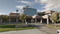
Ridgecrest City Hall and Police Headquarters
-
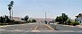
Looking south in Ridgecrest


See also
 In Spanish: Ridgecrest (California) para niños
