
Rileyville, New Jersey facts for kids
Quick facts for kids
Rileyville, New Jersey
|
|
|---|---|

Corner of Rileyville Road (CR 607) and Ridge Road
|
|

Rileyville, New Jersey
Location in Hunterdon County, New Jersey

Rileyville, New Jersey
Location in New Jersey

Rileyville, New Jersey
Location in the United States
|
|
| Country | |
| State | |
| County | Hunterdon |
| Township | East Amwell |
| Elevation | 469 ft (143 m) |
| GNIS feature ID | 879694 |
Rileyville is an unincorporated community located within East Amwell Township in Hunterdon County, New Jersey, United States. Located on the ridge line of Sourland Mountain, it is located along Rileyville Road (County Route 607) near its intersections with Ridge Road and Mountain Road. Most of the area is forested though some single-family houses are located along the aforementioned roads, and some farmland (agricultural and horse farms) sits on the north face of the mountain.
Images for kids
-
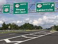
US 202 northbound at Route 179 in East Amwell
_in_East_Amwell_Township,_Hunterdon_County,_New_Jersey.jpg)
See also
 In Spanish: Municipio de East Amwell (Nueva Jersey) para niños

All content from Kiddle encyclopedia articles (including the article images and facts) can be freely used under Attribution-ShareAlike license, unless stated otherwise. Cite this article:
Rileyville, New Jersey Facts for Kids. Kiddle Encyclopedia.