
River Ure facts for kids
Quick facts for kids River Ure |
|
|---|---|
.jpg)
|
|
.png)
Location of the Ure within North Yorkshire
|
|
| Country | England |
| State | North Yorkshire |
| Physical characteristics | |
| Main source | Ure Head 640 m (2,100 ft) 54°21′59.967″N 2°18′0.033″W / 54.36665750°N 2.30000917°W |
| River mouth | River Ouse Cuddy Shaw Reach (near Linton-on-Ouse), North Yorkshire, England 10 m (33 ft) 54°2′4″N 1°16′30″W / 54.03444°N 1.27500°W |
| Length | 119 km (74 mi) |
The River Ure in North Yorkshire, England is approximately 74 miles (119 km) long from its source to the point where it becomes the River Ouse. It is the principal river of Wensleydale, which is the only major dale now named after a village rather than its river. The old name for the valley was Yoredale after the river that runs through it.
The Ure is one of many rivers and waterways that drain the Dales into the River Ouse. Tributaries of the Ure include the River Swale and the River Skell.
Contents
Name
The earliest recorded name of the river is Earp in about 1025, probably an error for Ear ƿ, where ƿ represents the Old English letter wynn or 'w', standing for ƿæter ("water"). By 1140 it is recorded as Jor, hence Jervaulx (Jorvale) Abbey, and a little later as Yore. In Tudor times the antiquarians John Leland and William Camden used the modern form of the name.
The name probably means "the strong or swift river". This is on the assumption that the Brittonic name of the river was Isurā, because the Roman name for Aldborough was Isurium; intervocalic s is known to have been lost in Brittonic at an early date. This explanation connects the river name with an Indo-European root is- meaning "strong" and the names of the Isar in Germany and the Isère in France.
Course
The source of the river is Ure Head on Abbotside Common where it flows west south-west to the valley floor and then turns south. Where it reaches the A684 it turns east along Wensleydale as far as Wensley. From here it flows south-east to Jervaulx Abbey and shortly after south to Mickley. Here it returns east and then south to Ripon. A little way after Ripon it flows east again to Boroughbridge.
To the east of Boroughbridge, the Ure is joined by the River Swale. About 6 miles (9.7 km) downstream of this confluence, at Cuddy Shaw Reach near Linton-on-Ouse, the river changes its name to the River Ouse.
Water levels
| Monitoring station | Station elevation | Low water level | High water level | Record high level |
|---|---|---|---|---|
| Bainbridge | 208 m (682 ft) | 0.06 m (0.20 ft) | 2.5 m (8.2 ft) | 3.66 m (12.0 ft) |
| Kilgram | 94 m (308 ft) | 0.27 m (0.89 ft) | 1.5 m (4.9 ft) | 5.64 m (18.5 ft) |
| Masham | 76 m (249 ft) | 0.14 m (0.46 ft) | 2.3 m (7.5 ft) | 3.53 m (11.6 ft) |
| Ripon Ure Bank | 24 m (79 ft) | 0.03 m (0.098 ft) | 0.89 m (2.9 ft) | 3.73 m (12.2 ft) |
| Westwick Lock | 22 m (72 ft) | 0.11 m (0.36 ft) | 2.5 m (8.2 ft) | 3.35 m (11.0 ft) |
| Boroughbridge | 15 m (49 ft) | 9.62 m (31.6 ft) | 13 m (43 ft) | 15.59 m (51.1 ft) |
- Low and high water levels are average figures.
Geology
Upper Wensleydale is high, open and remote U-shaped valley overlying Yoredale Beds. The gradient is gentle to the north end of the valley, becoming steeper further south. Glacial drumlins lie either side of the river, which is shallow but fast flowing. The river is fed from many gills cutting through woodland and predominantly sheep farmsteads. The Settle to Carlisle railway runs along the western side of the valley here.
Mid Wensleydale is made of Great Scar limestone under Yoredale beds that make up the valley sides, which are marked with stepped limestone scars. The valley floor is made from glacial drift tails and moraine. The river here is broad and gently flowing in meanders in a stony channel. There are four tributary valleys that contribute to several waterfalls in this area.
Lower Wensleydale is a broader version of mid Wensleydale with the river gently meandering until it drops significantly at Aysgarth over the platformed waterfalls. The valley sides become increasingly wooded.
From Middleham onwards the river is a typical mid-age river and meanders in wider arcs as it flows south-east.
History
The valley has been inhabited since prehistoric times. Examples of earthworks and other artifacts from the Bronze and Iron Ages can be seen in the Dales Countryside Museum in Hawes and the Romans built a fort at Bainbridge. Place-names in the valley denote the different types of settlers, such as Angles and Norse with typical suffixes like 'ton' and "sett".
During medieval times, much of the upper dale was sheep country belonging to Middleham Castle and Jervaulx Abbey. In 1751, the Richmond to Lancaster Turnpike was created and originally followed the Roman road from Bainbridge. In 1795 it was diverted along the valley to Hawes and took the Widdale route, now the B6255 to Ingleton.
More recently in 1990, Aysgarth Falls was used as a location in Robin Hood, Prince of Thieves, in the scene where Robin Hood fights Little John. It also featured in the 1992 film of Wuthering Heights and the 1984 TV miniseries, A Woman of Substance.
Economy
Farming, lead mining, dairying and quarrying are the mainstays of the modern economy of the valley, along with tourism. The dairy at Hawes produces Wensleydale cheese. Brewing takes place in Masham at the Black Sheep and Theakston Breweries.
There are many waymarked footpaths and open countryside. The Pennine Way passes through Hawes.
The River Ure is navigable upstream as far as its junction with the Ripon Canal, 2 miles (3 km) south east of Ripon, a distance of 13.6 miles (21.9 km). There are locks at Milby, where a short cut bypasses the weir at Boroughbridge, and at Westwick.
Navigation to Swale Nab, at the confluence with the River Swale, was opened in January 1769 as part of the River Ouse Navigation. Navigation to the Ripon Canal was opened in January 1772.
The Leeds and Thirsk Railway bought the navigation in January 1846. The navigation was neglected, and the lack of dredging resulted in boats having to be loaded with less cargo. There was a brief upturn in trade in the 1860s, but the decline continued after that. By 1892, no traffic proceeded past Boroughbridge, and the North Eastern Railway took action to prevent the waterway above Boroughbridge being used.
Until 1999 the navigation authority to Swale Nab was the Linton Lock Navigation Commissioners. The Commissioners had insufficient income to maintain the navigation, and in 1999 it was transferred to British Waterways. The navigation authority for the whole navigation is now the Canal & River Trust.
Natural history
The differing habitats of the area have their own populations of flora such as cranesbill, bistort, pignut and buttercup. Other species that can be seen in the area are wood anemones, violets, primroses, purple orchids, cowslips and herb paris. Some plants, such as spring sandwort, have managed to grow where the lead mining took place. There are large populations of badgers, roe deer, red foxes and rabbits in the valley. Among the variety of birds that can be seen in the valley are golden plovers, curlews and oystercatchers. Fish populations along the river include: Brown Trout, Grayling, Barbel, Chub, Roach and Perch.
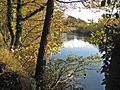
Gallery
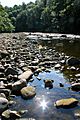
-
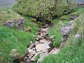
The River Ure near its source
-
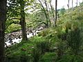
River Ure west of Hawes
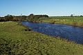
-
The River Ure near Worton Bridge
-
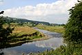
River Ure near Aysgarth with Batt Island in view
-
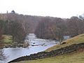
The River Ure at Hackfall Gorge near Mickley
-
River Ure near West Tanfield
-
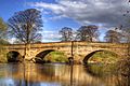
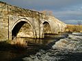
Bridge over River Ure near Ripon
-
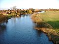
River Ure, Roecliffe
-
B6265 Hewick Bridge over River Ure
-
River Ure taken from Arrows Bridge


Lists
TributariesFrom the source of the river:
|
SettlementsFrom the source of the river:
|
CrossingsFrom the source of the river:
|
See also
 In Spanish: Río Ure para niños
